Imagine wading through a knee-deep river surrounded on both sides by the towering cliffs of a narrow slot canyon. Or strolling by the Virgin River, admiring lush overhanging fern gardens. Or taking in a breathtaking 270-degree canyon view. Or seeing beautiful waterfalls cascading over cliff tops into emerald-colored pools. Or clambering over boulders and down short drop offs into a tube-shaped slot canyon.
You can see and experience these – and more – in the incredible Zion National Park.
The park is a hiker’s paradise. From easy, paved strolls to technical trails with breathtaking views, here is a hand-picked compilation of the best hiking Zion National Park has to offer. Many of them also feature on my guide to the best photo spots in Zion National Park.
If you’re planning to visit Zion National Park by yourself, make your planning easy and stress free with a detailed itinerary. I have 1-, 2- and 3-day itineraries for Zion National Park that include all the park highlights, give you choices based on your preferred activity level, and take all the stress out of planning your trip.
Watch the best hikes in Zion National Park on video:
🔔 You can also watch this video on YouTube directly (opens in new tab).
🎙️ Or listen as a podcast:
🛏️TOP HOTEL PICK: Check availability now
🚘FIND THE CHEAPEST CAR RENTAL: Search Discover Cars for the best deals
✈️FIND THE CHEAPEST FLIGHTS: Search Skyscanner for the best deals
🧳GET TRAVEL INSURANCE: Get insured with Travelex before you go
📱TAKE AN AUDIO TOUR: Buy an audio tour now
Table of Contents
The 10 Best Hikes in Zion National Park
The Narrows
Hike Length: 10 miles roundtrip (Bottom Up, but you can turn back sooner) | 16 miles one way (Top Down)
Trail Difficulty: Difficult/ strenuous
Trailhead Location: The Gateway to The Narrows / End of Riverside Walk (Bottom Up)
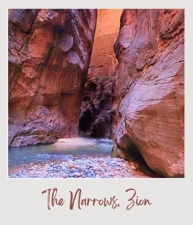
If you plan to go hiking at Zion National Park and are up for a bit of an adventure, then this hike is for you. It is not only one of the most popular Zion National Park hikes, but is also one of the most unique hikes in the entire country because you actually hike IN a river through a narrow slot canyon.
There are two ways to do the hike. The Bottom Up hike is the in-and-out day hike that most people do and goes through the most spectacular parts of the canyon. The Top Down hike requires a permit and a drop off at one end of the slot canyon, then you hike the entire length of the canyon, most often camping overnight along the way.
The main bottom-up hike starts at the end of the Riverside Walk. The canyon is fairly wide and the river shallow to start, but as you progress past Mystery Falls, the canyon walls close in. The most dramatic section is Wall Street where the canyon is hundreds of feet high and just a few yards wide.
Typically, you crisscross from side to side, seeking small sections where there is land on the side which makes it easier to walk. There are occasional small beaches where you can rest and have a snack or lunch.
There is a side canyon, Orderville Canyon, that is also worth exploring.
➡️ Read my full Guide to Hiking The Narrows for more details and information about this epic hike.
Tips:
‼️ I recommend taking a stick with you to help stabilize you, as the surface is a rocky river bed and there is a current to the river, which combine to create some instability.
‼️ The water can be very cold, so I recommend wearing water proof pants and river/ water shoes, especially in early spring and the fall. You can rent them from outfitters in Springdale. It might be better to buy shoes if you plan to do any other river hiking, so you are more comfortable.
The best shoes for The Narrows have a sturdy sole, but are still comfortable wet. Recommended waterproof hiking shoes/ boots for men are the Salomon Men’s X Ultra 3 Mid GTX Hiking Boots and for women are the Salomon Women’s X Ultra 3 MID GTX W Hiking Boots.
➡️ Read my detailed guide to the Best Hiking Boots/ Shoes for reviews, what to look for and more options.
‼️ The Narrows is closed when the river level is too high (typically March-April) and when there is danger of flash flooding. Always check the weather and possibility of flash floods before you head out.
‼️ Head out as early as you can to avoid the crowds.
Highlights:
✳️ The experience of hiking in a river
✳️ Wall Street (super narrow and tall section of the slot canyon)
Subscribe to daily national parks planning tips, travel inspiration and trip ideas and get instant access to the free PDF of this
Guide to the Best Hikes in Zion National Park
Observation Point
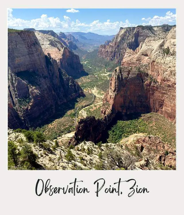
Angels’ Landing gets all the attention as the most famous Zion National Park hike, but Observation Point is 700 feet higher and looks down on Angel’s Landing far below. For the absolute best views in Zion, this is the hike to do.
There are actually two ways to hike to Observation Point, and you can combine into an epic one-way hike. (There’s a third, but that’s currently closed).
OPTION 1: Hike up and back from Weeping Rock Trail via the Lower East Rim Trail
⚠️ This trail is currently closed due to a rock slide.
Trail Length: 8 miles roundtrip
Trail Difficulty: Difficult/ strenuous
Trailhead Location: The Weeping Rock Trailhead
This is a strenuous hike with an elevation gain of over 2,100 feet. It starts uphill immediately and soon goes through a series of switchbacks. The trail passes the junction to Hidden Canyon (which is worth a trip in and of itself to fully explore, but you can go the head of the canyon as part of this hike).
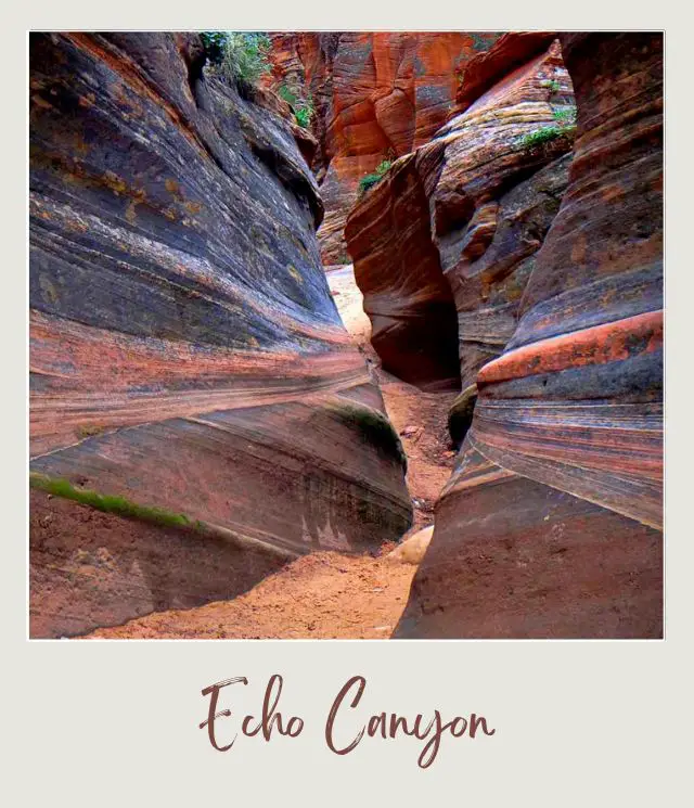
A highlight is Echo Canyon, a slot canyon with layers of dark rock. The trail crosses a dry river bed and then climbs up out of the canyon. About a mile after Echo Canyon the trail joins the East Rim Trail. Here there is another series of steep switchbacks before you get to the top of the plateau. The last mile is fairly flat. Where the trail meets the East Mesa Trail (see below), turn left and head out to Observation Point.
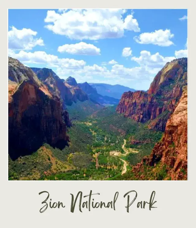
With 270-degree views of the west rim, Angel’s Landing (far below) and the length of the canyon (with the lodge clearly visible), Observation Point has arguably the best view in the entire park!
OPTION 2: The East Mesa Trail
Trail Length: 6.4 miles roundtrip
Trail Difficulty: Easy
Trailhead Location: The East Mesa Trailhead is reached by road. You need to drive out of the East Gate and head towards the Zion Ponderosa Resort. Note that the final section is on dirt roads that may be difficult in a regular car in mud or snow.
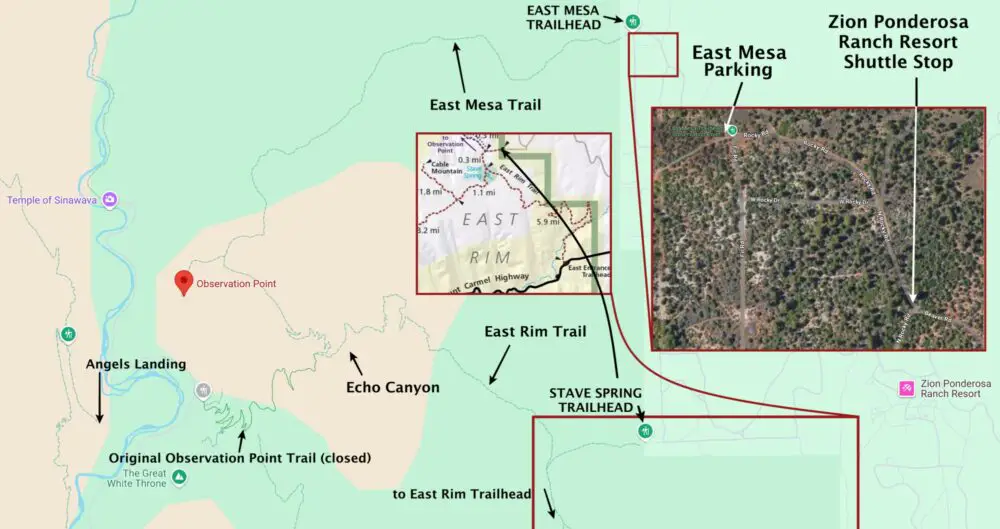
‼️ Tip: There is parking for several cars at the trailhead. However, the last section of the dirt road just before the trailhead is quite steep, so you may prefer to take a (paid) shuttle from Zion Ponderosa Ranch Resort.
➡️ Book the Zion Ponderosa Ranch Resort hiker shuttle online here

The trail is mostly along an old jeep trail on flat ground that is easy to follow. There are no dramatic views for most of the trail, which passes through meadows of sage brush, grasses and wildflowers and thinly forested areas. It’s a pretty walk that ends, however, at one of the most dramatic views in the park.
➡️ Read my East Mesa Trail to Observation Point Guide
OPTION 3: The East Rim Trail
Trail Length: 4.7 miles each way from the Zion Ponderosa Ranch drop-off/ Stave Spring Trailhead. 10.6 miles each way from the East Rim Trailhead.
Trail Difficulty: Challenging
Trailhead Location: Either the main East Rim Trailhead (on the Zion-Mount Carmel Highway, 100 feet west of the East Entrance fee booths) or the Stave Spring Trailhead.
➡️ Book the Zion Ponderosa Ranch Resort hiker shuttle online here
I recommend starting at the Stave Spring Trailhead. After starting flat through sage brush and along the rim of a side canyon, the trail soon descends into Echo Canyon. It then climbs up the other side, over sliprock, with only small stone cairns to guide the way, before joining the original trail from Zion Canyon to Observation Point.
It climbs up some switchbacks, skirts along just below the rim, and then ends in a short sandy side trail to Observation Point.
‼️ Tip: If you use Zion Ponderosa Ranch Resort’s shuttle, you can get dropped off at Stave Spring Trailhead, hike the East Rim Trail to Observation Point, then hike the East Mesa Trail back and get picked up from there back to your vehicle at the resort, making an epic loop.
➡️ Read my East Rim Trail to Observation Point Guide
➡️ Read my East Mesa Trail to Observation Point Guide
Highlights:
✳️ Views of the canyon from Observation Point
✳️ Echo Canyon
The Subway
Hike Length: 9.1 miles (one way)
Trail Difficulty: Moderate
Trailhead Location: Wildcat Trailhead, on the Kolob Reservoir Road about 15.3 miles above the town of Virgin
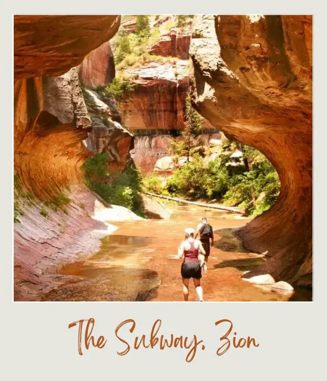
One of the best hikes at Zion National Park isn’t actually in the main park at all! The Subway otherwise called the Left fork of the North Creek is accessed on the Kolob reservoir road. The Subway is a 9-mile, one-way hike. This means you need a shuttle or a second car to take you back to your vehicle. Several of the outfitters in Springdale provide shuttle services.
The next barrier to hiking the Subway is that it requires a permit that is limited to only a few visitors per day. You can apply for the Advance Lottery up to 2 months early. A few spaces are left that can be reserved through the Canyoneering Reservation System. Then there is a last minute drawing 7-2 days in advance for a few remaining spaces. Finally, in the unlikely event that there are still some spaces available, you can try to get a permit the day before. Book/ enter all of these things on the national park website.
The difficulties of getting on the Subway hike only make it that much more majestic and amazing.
The hike starts out on a smooth and wide trail. Soon it turns into rocky slabs. Don’t lose the trail. After a few miles on mostly flat land, you scramble down steep boulders a drop into a slot canyon. Once you drop in via a rappel holding onto a rope, the Left Fork Canyon, the subway feels similar to the Narrows in the main canyon of Zion.
You will be bouldering, rappelling (technical equipment not necessary, but be careful!), and climbing. You cannot lose the trail here as you just follow the stream down a narrow canyon for miles. You will soon discover exactly why this hike got its name as the slot canyon walls are carved out looking like a subway tube.
At first, you may try to save yourself from getting wet while you make your way through the very narrow spaces with deep water holes. But eventually, there will be sections when you must swim through freezing cold water (wetsuits required in the winter) for a short distance. Slide down rough rocks and crawl your way through the rest of the hike, with wet shoes and socks.
Without a doubt one of the best Zion National Park hikes, hiking in the Subway is an experience of a lifetime; one you will remember forever.
Tips:
‼️ In order to exit the hike, you must climb 2 miles up a very steep and exposed (ie. HOT) trail to the top. The trail is mostly gravel. Save energy for this last climb out!
Highlights:
✳️ The amazing slot canyon formations
✳️ The interactive experience (swimming, wading, bouldering, rappelling and climbing)
Explored by Jamie Harper from Fly by the Seat of our Pants
Angels Landing
Hike Length: 2.4 miles one way / 4.8 miles return
Hike difficulty: Strenuous and very exposed
Trailhead location: The Grotto Trailhead
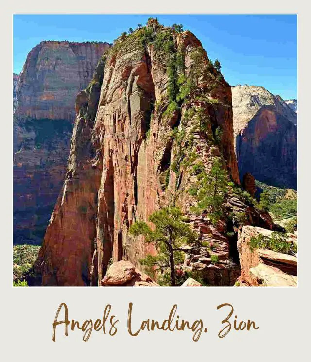
Not only one of the best Zion hikes but also the park’s most popular hike, Angel’s Landing offers a spectacular view of Utah’s red rock country from above 1,500 feet.
The hike starts flat and easy along the river before heading up a series of switchbacks up to Refrigerator Canyon. The views of Zion Canyon from the top of these first set of switchbacks is already amazing. Then there is an easy flat section through the appropriately cool canyon.
Another very steep series of 21 short switchbacks called Walter’s Wiggles ends up at a ridge called Scout Lookout. There are great views down the back end of the canyon from here and if you are afraid of heights, you could turn back here.
Heading onwards, the final half mile is along a steep and incredibly narrow ridge (the Hogsback), where you need to use chains that are bolted into the stone cliff so you don’t fall off.
From there, it is a short final push to the summit of Angels Landing, where you can enjoy sensational views of the canyon.
Tips:
‼️ This hike is not for the faint of heart as it has plenty of steep ledges with no guard rails. If you are scared of the heights, and have little to no experience mountaineering or doing strenuous hikes that require scrambling, you should not do this hike alone.
‼️ While Angel’s Landing is open year-round, the best time for hiking it is from late spring though early fall. During summer, however, temperatures can soar into 100 degrees Fahrenheit, so it’s paramount to bring enough water on your hike. Winter is the least busy time at Zion, however, during this time the trail is often covered by ice and snow which makes for hazardous conditions.
➡️ Read more Tips for Angels Landing
‼️ In recent years, however, because it’s the most famous Zion hike, the trail has been getting more crowded. This is especially true for the summer season and holidays when scores of travelers come to Angel’s Landing. In addition, Zion National Park has become one of the most popular day trips from Las Vegas, so plan your trip accordingly.
➡️ If you only have a day to visit Zion from Las Vegas, book a day trip here.
‼️ In fact, you need a permit to hike Angel’s Landing. Permits are issued through a lottery system.
➡️ For the full low-down, read my guide: How to Get Angel’s Landing Permits.
Early morning and late afternoon are best times to hike Angel’s Landing as it will allow you to avoid the crowds and have the best light for your photos. Conversely, the worst time for photos at Angel’s Landing is mid-afternoon.
➡️ Read my full Angels Landing Guide
Highlights:
✳️ Refrigerator Canyon – a deep canyon where temperatures always stay cool
✳️ A set of switchbacks (called Walter’s Wiggles) that lead to to the top of the ridge
✳️ The final part of the hike – a narrow ledge on the side of the mountain that climbs more than 500 feet
✳️ Views from the top of the first set of switchbacks, from Scouts Lookout and from Angels Landing
Explored by Daria Bachmann from The Discovery Nut
Weeping Rock
Hike Length: 0.4 miles roundtrip
Hike difficulty: Easy
Trailhead location: Weeping Rock shuttle stop
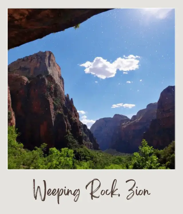
If you’re looking to do one of the short hikes in Zion National Park, then this one is for you. In fact, it is the shortest trail in the park. The short trail takes you to Weeping Rock, which is an overhang covered in ferns and moss with water trickling down along the entire length.
You can sit under the overhang in the shade and look out at Great White Throne through a curtain of dripping water. It’s a lovely cool spot to sit and relax and enjoy the views.
Tip:
‼️ Although the trail is short, it’s uphill, so it’s not suitable for wheelchairs.
Highlights:
✳️ Lush hanging gardens
✳️ Looking out from behind a curtain of dripping water
Riverside Walk
Hike Length: 2.2 miles roundtrip
Trail Difficulty: Easy
Trailhead Location: Temple of Sinawava
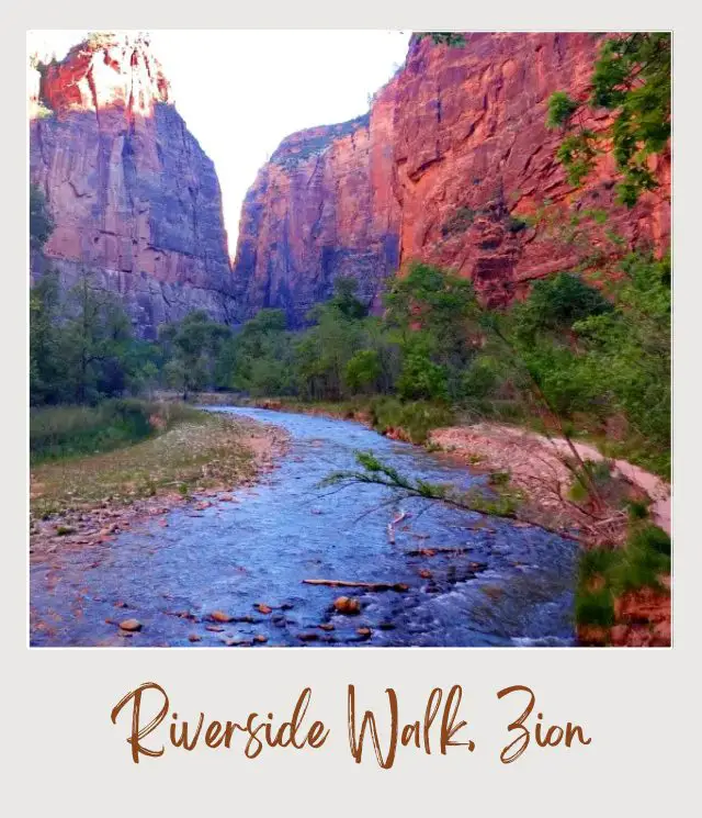
This is one the most easy hikes in Zion National Park. It is a wheelchair accessible, paved and flat trail that runs alongside the Virgin River, passing hanging gardens along the way. It is the starting point for the Narrows, but is worth hiking in and of itself.
It starts from the last shuttle stop and the canyon narrows, so, although it’s not a super narrow slot canyon, you are surrounding by tall canyon walls on both sides. There are ferns, moss and trees all around you. It is a lovely, relaxing walk.
The hike ends where the canyon is so narrow that there is just the river and the canyon cliffs (See The Narrows).
Highlights:
✳️ River views
✳️ Hanging gardens
Canyon Overlook
Hike Length: 1.0 mile roundtrip
Trail Difficulty: Moderate
Trailhead Location: Near the east entrance of the Zion-Mount Carmel Tunnel
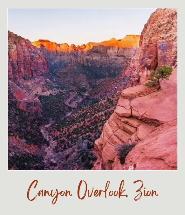
The Canyon Overlook trail is a short one mile roundtrip hike where the reward is a stunning view! You’ll find the trailhead on the east side of the tunnel, right before the tunnel entrance.
The Canyon Overlook trail starts with a short elevation gain of 163 feet. After that you’ll be steadily making your way up into the canyon and to the final overlook.
At the halfway mark, the trail goes through a little shaded alcove with a seep and lush ferns growing out of the sandstone walls. This is a nice cool spot during the hot summer months. At the end of the trail you have a fabulous view overlooking Echo Canyon. You can see Highway 9 and the window holes from the tunnel off to the left. Return the way you came.
This would be rated as one of the Zion National Park easy hikes but the trail is considered moderate due to a few sections with steep drop offs where there are no railings.
Tips:
‼️ If you’re hiking with kids, be careful around these exposed spots where a fall could be dangerous.
‼️ The parking lot is small so get there early or you’ll be driving around in circles waiting for a spot. Better yet, hike this before sunrise so you can take amazing photos as the sun rises and shines on the distant mountain peaks.
Highlights:
✳️ Amazing view, especially at sunrise
✳️ Short family-friendly hike
Explored by Jamie Joyner from Photo Jeepers
If you’re planning to visit Zion National Park by yourself, make your planning easy and stress free with a detailed itinerary. I have 1-, 2- and 3-day itineraries for Zion National Park that include all the park highlights, give you choices based on your preferred activity level, and take all the stress out of planning your trip.
Emerald Pools
Hike Length: 3.2 Miles roundtrip to the furthest pool
Trail Difficulty: 1st pool is easy | 2nd and 3rd pool are difficult
Trailhead Location: At Zion Lodge (Stop 5)
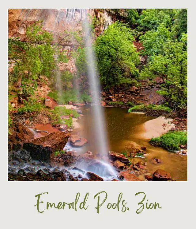
Emerald Pools Trail is one of the most unique and interesting trails in Zion National Park. This is some of the best hiking in Zion National Park.
The trail starts at the Zion Lodge located on shuttle stop #5 inside the park. Once you get to Zion Lodge exit the shuttle to your right and follow the signs to the Emerald Pools Trailhead.
This hike is super unique because along the way you will follow a stream while you’re hiking to get to the pools. Because Zion is a dry climate, the stream can be dried up in the summer and fall time so this hike is especially interesting and beautiful in the spring when there is lots of water flowing!
Only 0.6 miles into the trail you will reach the first pool, Lower Emerald Pool. You will make your way along with a tall alcove where two waterfalls flow from the top.
The second pool is only 0.2 miles further and actually used to be closed for more than a decade due to a rockslide. The second pool is now open and a gorgeous look at the pools that form the waterfalls you see at the Lower Emerald Pools.
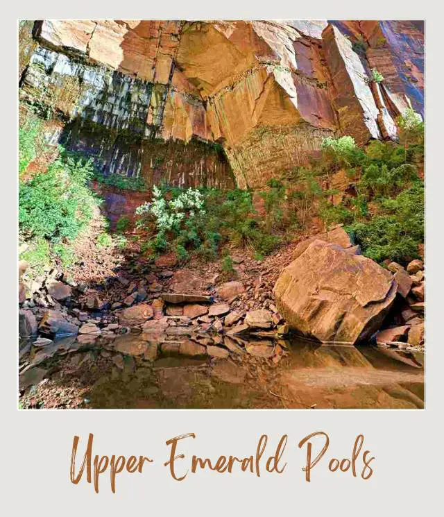
The 3rd pool, Upper Emerald Pool is a bit more difficult to get to but definitely worth it. Upper Emerald Pool is a great place to stop and have a picnic before finishing up your hike.
After a long day of hiking be sure to have picked an awesome Zion National Park Airbnb where you can relax, maybe have a soak in a hot tub, or drinks around your very own fire pit.
Tips:
‼️ To make the trail even longer you can add the Kayenta Trail or the Grotto Trail and make a loop that begins and ends at the Zion Lodge.
Highlights:
✳️ A desert oasis hike with lush vegetation and magnificent rock faces
✳️ Waterfalls
Explored by Jessica from Unearth The Voyage
Watchman Trail
Length: 3.1 miles roundtrip
Difficulty: Easy
Trailhead Location: North of Watchman Campground, accessible from Visitor Center Parking Lot
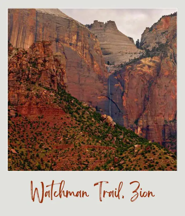
The Watchman Trail is one of the best day hikes in Zion National Park, but is perhaps also one of the most underrated. We decided it was necessary for us to hike this trail, as we stayed at the Watchman Campground during our two days in Zion. The Watchman trail begins with a walk along the Virgin River before crossing the road and beginning the hike up the canyon, ending at the Watchman Viewpoint.
This trail is perfect for wildflower lovers and nature photographers! There are so many wildflowers that grow along this trail and out of the canyon walls, making this a memorable hike. This path is well maintained and while the incline varies, the total elevation gain is less than 700 feet, so it never becomes too tiring. The trail also has switchbacks to keep it from becoming too difficult.
The end of the trail is composed of a small loop with a lookout over the town of Springdale, perfect for watching the sunset.
Tips:
‼️ The later sections of the trail are exposed to a steep drop off, so watch your step and be aware if conditions are less than favorable. In the rain the soil can become very muddy, making the trail more difficult and dangerous.
Highlights:
✳️ Variety of desert wildflowers
✳️ Viewpoint over Springdale
Explored by Val Pope from Voyages With Val
Pa’rus Trail
Length: 3.5 miles roundtrip
Difficulty: Easy
Trailhead Location: Visitor Center or Canyon Junction Shuttle Stops
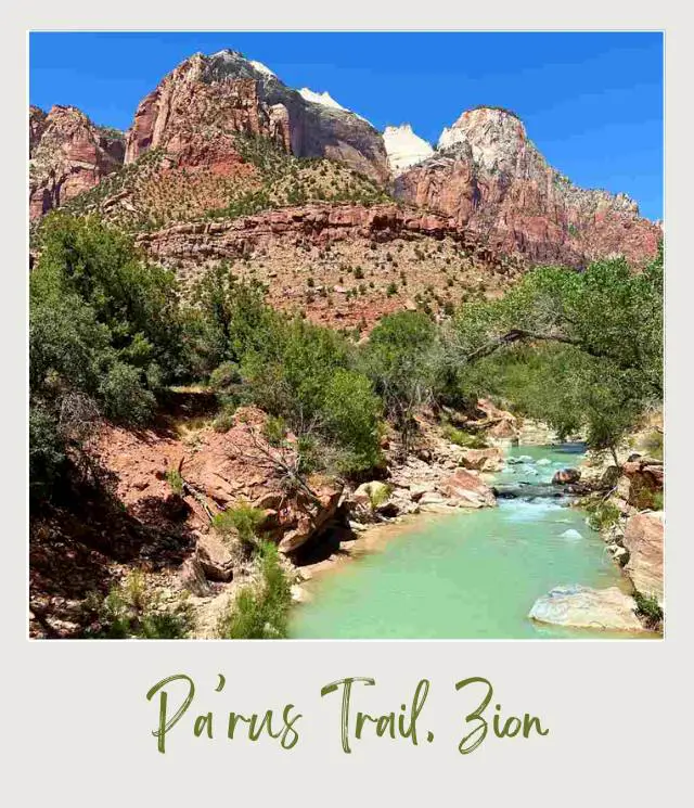
The Pa’rus trail in Zion National Park is another of the most underrated Zion National Park trails, and is absolutely stunning.
Beginning at the Visitor Center, this paved trail takes you on an easy hike past the South Campground, ending in a majestic view of the Virgin river as it meanders through Zion Canyon.
This hike is super easy, but will give you great views along the way. Right off the bat, you’ll notice the gorgeous meadows bursting with flowers that flank the trail.
Beyond that, you’ll see red rock formations towering above you. One of the most famous of these is the Watchman, which photographs beautifully.
There are nature exhibits along the trail where you can learn about the formation of Zion, and you’ll also have spots with direct access to the Virgin river.
It doesn’t take very long to hike the Pa’rus trail, only about two hours. The trail ends near the Canyon Junction bridge, from where you can get that famous photo of the Watchman and the Virgin river. From there you can hike back or catch the shuttle. You can also do the hike in reverse.
Finally, this trail is pet-friendly, making it perfect for your furry friends! This is a multi-use trail, and bikes are common. The Pa’rus trail is a must-do, even if you only have two days in Zion.
Highlights & Tips:
‼️ There’s almost no shade on this trail, so avoid hiking it in the heat of the day if possible.
‼️ ✳️ Sunset is a particularly splendid time, the light is perfect for photos, the weather is cooler, and you might spot wildlife.
‼️ ✳️ When the sun starts going down, keep your eyes out for deer in the meadows that flank this trail
‼️ ✳️ Stop at the Canyon Junction bridge to get stunning photos of Zion, but be careful – cars go by here all the time. This view is one of the most photographed in the park!
➡️ Read More: Best Photo Spots in Zion National Park
Explored by Ale Leon from Sea Salt & Fog
Map of the Best Hikes Zion National Park, Utah
Essential Hiking Gear
Before you set out on these hikes, you’ll want to make sure you have the right gear.
➡️ Day Hike Essentials (Packing List)
➡️ Best Hiking Shoes / Boots (Reviews and Recommendations)
➡️ Best Hiking Sandals (Reviews and Recommendations)
➡️ Best Baby Hiking Backpack Carrier (Reviews and Recommendations)
➡️ Best Backpack Carrier to Take Your Dog Hiking (Reviews and Recommendations)
➡️ Best Handheld GPS for Hiking (Reviews and Recommendations)
➡️ Best Winter Hiking Boots for Men (Reviews and Recommendations)
➡️ Best Winter Hiking Boots for Women (Reviews and Recommendations)
➡️ Best Microspikes for Winter Hiking (Reviews and Recommendations)
➡️ Best Snowshoes for Beginners (Reviews and Recommendations)
Happy hiking!
More Planning Resources for Zion National Park
⭐ Zion National Park Guide
⭐ Zion Itineraries
⭐ Planning a Trip to Zion National Park
⭐ 7 Mistakes to Avoid
⭐ How Many Days in Zion National Park?
⭐ 12 Tips For Visiting Zion National Park
⭐ How To Get Angels Landing Permits
⭐ Hiking The Narrows In Zion National Park
⭐ Best Things To Do In Zion National Park
⭐ Canyoneering In Zion National Park
⭐ Best Photo Spots in Zion National Park
⭐ How To Get To Zion National Park
⭐ Zion Shuttle Service Guide
⭐ How to visit Zion Without Using the Shuttle
⭐ The Airports closest to Zion National Park
⭐ The Closest Airport to Zion National Park
⭐ The Best Time of Year to Visit Zion National Park
⭐ Visiting Zion Throughout the Year
⭐ 12 Fun Facts About Zion National Park
⭐ Best Books About Zion National Park
⭐ Best Vacation Rentals Near Zion National Park
⭐ The 5 Best Easy Hikes in Zion National Park
⭐ 12 Best Things to Do in Zion National Park for Non Hikers
What’s your favorite Zion hiking spot (or which of these Zion trails can you not wait to try)? Join my private Facebook group National Parks Collectors and comment and let me know.
➡️ If you’re also going to Bryce Canyon, read my Bryce Canyon National Park Guide.
Subscribe to daily national parks planning tips, travel inspiration and trip ideas and get instant access to the free PDF of this
Guide to the Best Hikes in Zion National Park
If you liked this article, Pin It to your Zion National Park board!


💡 Are you just starting to think about taking a national parks trip? Get Inspiration
‼️ Are you looking for helpful tips for visiting US national parks? Read articles that share useful tips on a range of national-park related issues
💻 Are you starting to plan a trip to Zion National Park? Read my Guide to Zion National Park
📋 Do you want a ready-made super detailed plan for your trip to Zion? Get a detailed 1 – 3-day Zion National Park Itinerary
🛏️ Are you looking for a place to stay near Zion National Park? Find a vacation rental near Zion National Park
💲 Are you ready to book your trip? Use these Planning and Booking Resources
📖 Do you want to read a book about Zion National Park? Check out my Recommended Reading List for Zion National Park
About the Author
James Ian is a national park, camping and hiking expert.
He has dedicated his life to travel, visiting more than 80 countries, all 7 continents and most of the national parks in the United States. With over 35 years experience in the travel industry, James has worked on cruise ships, at resorts and hotels, and as a travel planner who’s helped hundreds of people plan successful trips to US national parks.
Based on his experience visiting our national parks multiple times, in-depth research and expertise as a travel planner, James has published detailed itineraries for many of the major national parks in the US. These itineraries, as well as in-depth park guides, and other resources will help you have your own incredible trip to US national parks without stress and hassle.
As a national park expert, James has contributed to many publications, including USA Today, Newsweek, Time Business News, Savoteur, Best Trip, and Wired.
I’m a member of the Amazon Services LLC Associates Program. As an Amazon Associate I earn from qualifying purchases.
