Driving through spectacular scenery, stopping off at viewpoints to take photos and soaking in the scenery is a classic national parks experience. Endless wooded hills and arid desert; snowy white sand dunes and glowing red rocks; towering peaks and yawning canyons … You can see – and drive through them – all in the national parks of the US.
I have, together with other travel experts, hand-picked the 21 best scenic drives in US national parks to inspire you and help you plan your next national parks adventure.
No time to read about the most scenic drives in America now? Pin It and save it for later:

If you plan to visit more than a couple of parks in a year (or the same park more than twice), then look at getting the America the Beautiful Pass. It gives you unlimited access for a year (from date of purchase) to over 2,000 federal recreation sites including all U.S. national parks plus national forest and BLM lands. It includes admission for one vehicle or four people (for places that charge per person).
Buy the America the Beautiful Pass here
Table of Contents
Map of the Best Scenic Drives in USA
Subscribe to monthly updates with tips for planning, travel inspiration and trip ideas and get instant access to the free PDF of the
Most Scenic Drives in US National Parks
The Most Scenic Drives In America’s National Parks
Badlands Loop State Scenic Byway | Badlands National Park
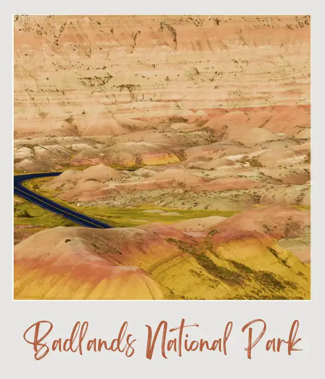
Officially called SD Highway 240, the Badlands scenic drive is without a doubt one of the best scenic drives in South Dakota. The road winds its way across the northern section of the park, crossing passes through the Badlands “wall” and passing a diverse range of incredible rock formations along the way. From traditional badlands to yellow mounds, pinnacles and eroded buttes, there are so many stunning formations to admire.
There are also good chances of seeing wildlife such as mule deer, pronghorn antelope, prairie dogs and even, possibly, black-footed ferrets or bison. There are 16 designated overlooks along the Badlands scenic byway.
Length: 39 miles | 62.5 km
Best Views: Pinnacles Overlook, Yellow Mounds Overlook, Burns Basin Overlook, Panorama Point
Road Closures: The road is open year round
Insider Tip: Cell service in the park is not great, so pick up a park map at the entrance rather than relying on GPS. You won’t get lost without a map, but it will help you identify key features along the way.
Park Loop Road | Acadia National Park
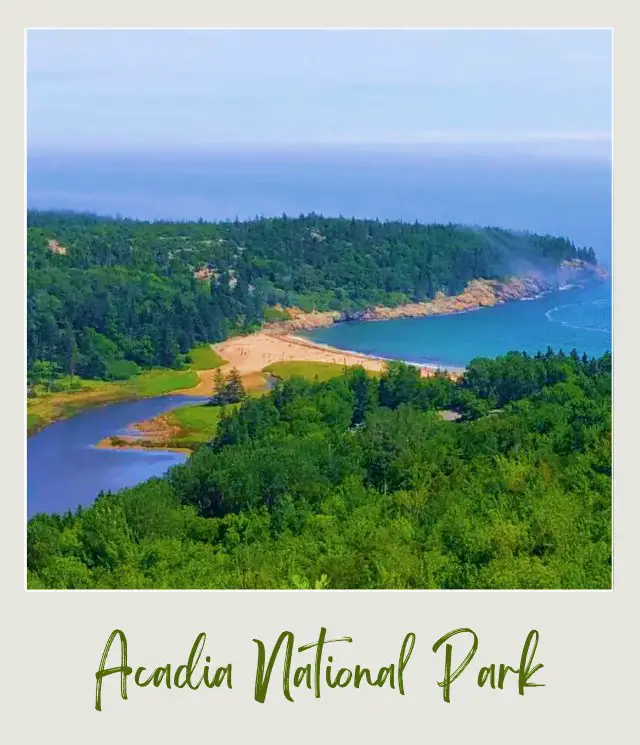
One of the best scenic drives in New England, the Park Loop Road circles around and through Acadia National Park on Mount Desert Island.
The drive starts at the Hulls Cove Visitor Center and heads south past Bar Harbor. Just after crossing Route 233, the 20-mile one-way section of the loop starts off to the left. It passes Sieur de Monts Spring and Beaver Dam Pond before heading up Champlin Mountain and Egg Rock Overlook before descending down past Sand Beach.
There’s a reason this is one of the best scenic drives in Maine. Here the drive goes along the stunning shoreline past Thunder Hole, Monument Cove, Otter Cliffs and Otter Cove. The road then heads north alongside Hunters Brook. The one-way section ends just before Jordan Pond House, where you have to stop and have tea and popovers smothered in jam and butter while enjoying the views of the Jordan Pond and The Bubbles.
Back on the road, now two-way again, you will come to the turnoff for the 3.5-mile road up Cadillac Mountain, the highest peak in Acadia. Note that for summer 2021, you will need to make a vehicle reservation to drive up Cadillac Mountain (read all about it here).
The main road continues back to the Visitor Center. The drive typically takes 3-4 hours, though you could easily take longer if you stop a lot.
You can get a self-drive guided audio tour for the Park Loop drive. It provides commentary about the history, nature and other features along the loop that you access at all of the major points of interest along the way. This is a great way to maximize your experience on the drive.
Length: 27 miles/ 43 km
Best Views: Frenchman Bay Overlook, Egg Rock Overlook, Otter Point
Road Closures: Most of the road is often closed in winter other than the Sand Beach Entrance Station to Otter Cliff Road section, which is usually kept open.
Insider Tip: You can park in the right-hand lane of the Park Loop Road (unless there are signs indicating that this is not the case) in addition to many designated parking areas.
Read More: If you are planning a trip to Acadia, read my Acadia National Park Guide
California Highway 190 | Death Valley National Park
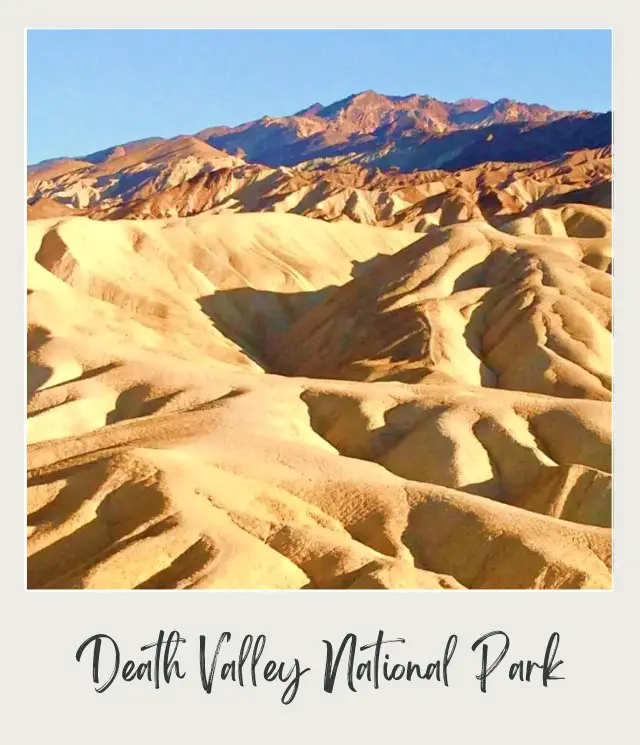
California Highway 190 is the main road that cross Death Valley from east to west. If you come from the west, there are panoramic views of the arid valley from above before you descend down into the valley and past salt flats.
One of the main features in the park that is right on the drive is the Mesquite Flats Sand Dune. This is the largest sand dunes area in Death Valley and is an absolute must-visit destination (especially at sunrise and sunset). You will also pass near the Keane Wonder Mine, which was an active mine from 1907 to 1942. Today, there are interesting ruins of mine buildings and equipment.
The main visitor area in the park, Furnace Creek, is right off the highway. Here there are stores, campgrounds, accommodations and the park’s Visitor Center.
A short drive down a side road towards Badwater Basin, you will find the Golden Canyon trailhead and Artists Drive. Perhaps the most photographed spot in the entire park, Zabriskie Point, where there is a small section of scenic badlands, is on the route too.
Length: 80 miles | 129 km
Best Views: Zabriskie Point, Mesquite Flats Sand Dune
Road Closures: The road is open year-round.
Insider Tip: Death Valley is the lowest and hottest place in the United States. Summer temperatures often exceed 120°F / 49°C in the shade! For a more pleasant visit, go there between October and May.
Read More: If you are planning a trip to Death Valley, read my Death Valley National Park Guide
Generals Highway | Sequoia and Kings Canyon National Parks
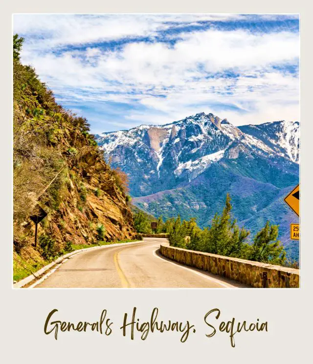
One of the most scenic drives in California, the Generals Highways winds its way through the heavily wooded Sierra Nevada hills from the General Sherman Tree in the Giant Forest section of Sequoia National Park to the General Grant Tree/ Grove in Kings Canyon and beyond (hence the name Generals Highway). The General Sherman tree is the largest tree on our planet (and about 2,500 years old!) and the General Grant tree follows closely behind as the third biggest tree.
There are plenty of trailheads along the route, and it is definitely worth getting out of your vehicle and hitting the trails, which give you the best chance of seeing most of the enormous sequoia trees. Easy walks to see sequoias include the Grant Grove, Big Trees Trail, General Sherman Tree trail and the Congress Trail. If you go early in the morning or late afternoon, there are good chances of seeing wildlife such as black bears.
Length: 75 miles | 120 km between Foothills Visitor Center (Sequoia National Park) and Cedar Grove (Kings Canyon National Park).
Best Views: The Indian Head River Trail is a short and easy walk for beautiful river views. The southern section of the highway has especially great views, but is also very winding. Moro Rock is a short but steep hike, but has sensational views from the top.
Road Closures: The main section between Lodgepole in Sequoia National Park (where the General Sherman Tree is) and the Grant Grove (where the General Grant Tree is) in Kings Canyon National Park is open year-round unless there are temporary closures to clear snow in winter. Tire chains are usually required from fall to spring though. The section through Kings Canyon National Park between Grand Grove and Cedar Grove is generally closed in winter until late April.
Insider Tips:
This is a narrow, winding road that can be hairy in an RV. Vehicles longer than 40 feet/ 12m are prohibited for much of it. Even then, the road between the Foothills Visitor Center near the south entrance to the park and Potwisha Campground is not advised for vehicles longer than 24 feet / 7.3 m because the road is so narrow and winding. The next section north from Potwisha Campground to the main Lodgepole section of the park (where the Giant Forest Museum is) is not recommended for vehicles longer than 22 feet (6.7m). So, if you have an RV, check your vehicle length and use the main Kings Canyon entrance as an alternative.
There are no gas stations in either park, so full up before you head out on this drive.
Read More: If you are planning a trip to Sequoia/ Kings Canyon, read my Sequoia National Park Guide
Lamar Valley | Yellowstone National Park
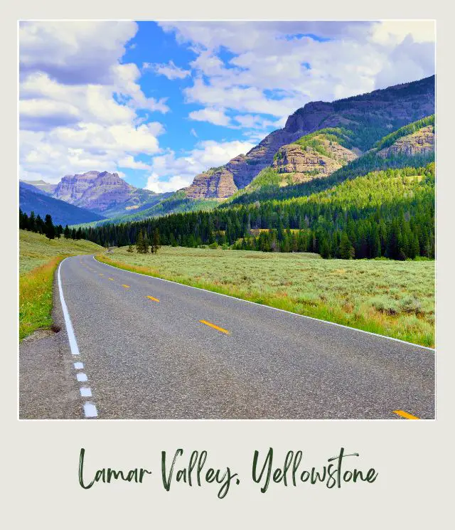
Located in the northern section of the park, Lamar Valley is not only one of the best scenic drives in Yellowstone National Park, it is also the best place to see wildlife. In fact, it is often called “America’s Serengeti”.
The valley is famous for packs of wolves (the Junction Butte pack and the Lamar Canyon pack) that were released back into the park a while ago. However, there are is much more wildlife to see. Here, you will also have a really good chance of seeing large herds of bison grazing on the valley floor. Seeing them strewn along the grassy valley with towering hills behind is a truly awe-inspiring sight. You may also see grizzly bears and black bears; pronghorn antelope, bighorn sheep and elk; and bald eagles and ospreys.
Length: 29 miles | 46.5 km from Tower Junction to the Northeast Gate
Best Views: Soda Butte; anywhere you see wildlife!
Road Closures: The road between the park’s north entrance and northeast gate (continuing on to Cooke City – Silver Gate), which passes through Lamar Valley, is the only road in Yellowstone that is open year-round. Keep in mind, though, that Beartooth Pass, a little further past Cooke City on 212 usually closes in October and doesn’t open until May.
Insider Tip: Wildlife viewing is generally best early in the morning and late in the afternoon. For the best chances of seeing as much wildlife as possible, get to Lamar Valley before sunrise.
Read More: Detailed Guide to Driving Lamar Valley
If you are planning a trip to Yellowstone, read my Yellowstone National Park Guide
Desert View Drive | Grand Canyon National Park
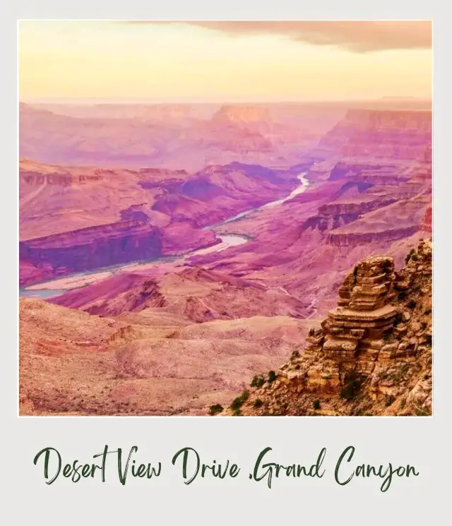
The Desert View Drive between the East Entrance to Grand Canyon National Park and Grand Canyon Village is one of the most scenic drives, USA and provides multiple opportunities to see the canyon and to step back in history. It is also the only scenic road on the south rim that is open to private vehicles. There are six designated viewpoints, as well as many un-named pullouts where you can see the canyon.
At Yaki Point, there is also a fascinating geological museum that gives a great overview of the formation of the canyon. Also worth visiting is the Tusayan Museum and ruins of a small Ancestral Puebloan village. At the far end of the drive is the historic Desert View Watchtower where you can climb its 180 steps (70 feet height) for 360-degree view of the canyon and surrounding plateau.
Length: 25 miles | 40 km from Grand Canyon Village to Desert View Watchtower
Best Views: Yaki Point, Grandview Point, Moran Point, Lipan Point, Navajo Point, Desert View
Road Closures: The road is open year-round, though the park’s East Gate is currently closed due to COVID.
Insider Tip: Take binoculars with you. Seeing expansive views of the canyon is awesome, but seeing the bottom of the canyon and opposite walls up close gives a whole other perspective. If you don’t have any, buy a great pair of binoculars here (or read my detailed Guide to the Best Binoculars For the Money for detailed reviews and more recommendations).
Read More: If you are planning a trip to Grand Canyon, read my Grand Canyon National Park Guide
Arches Scenic Drive | Arches National Park
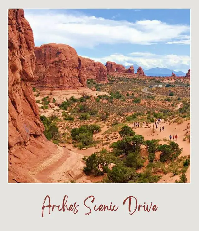
Arches Scenic Drive, another of the best drives in the US, is an in-and-out road that goes from the park entrance to the Devil’s Garden campground. There are short offshoots to the Windows Section of the park and to the Delicate Arch trailhead.
Soon after you pass the Visitor Center, the road climbs up into the park proper. The first main section encountered is Park Avenue, a short but incredibly beautiful canyon that you can see from the parking area or hike down into.
The road then passes the Petrified Dunes before reaching Balanced Rock. Soon after, a right turn takes you down the short road the Windows Section, where you can see Double Arch and the North and South Windows. Back on the main Scenic Drive, the road dips down into a salt valley before climbing to the Fiery Furnace section, which is named after the fiery colors it turns in the late afternoon sun.
There are more dramatic red fins and several arches, including Skyline Arch, before arriving at the Devil’s garden section, where there is the only campground inside the park and the longest hiking trail in Arches National Park.
Length: 36 miles | 58 km
Best Views: Park Avenue, Balanced Rock, Windows Section, Fiery Furnace, Skyline Arch
Road Closures: The road is generally open year-round, but is occasionally temporarily closed after heavy snow for clearing.
Insider Tip: This is the main artery through Arches National Park and gets very crowded in summer. The parking areas also fill up quickly. I strongly recommend getting an early start to beat the crowds. You can stay in Moab, just 5 miles away.
Read More: If you are planning a trip to Arches, read my Arches National Park Guide
Scenic Loop Drive | Grand Teton National Park
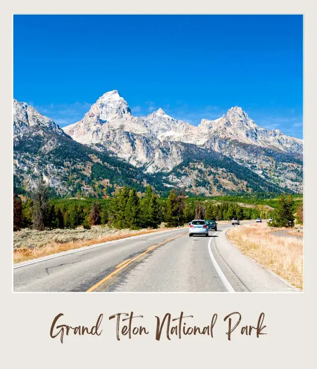
The best of the scenic drives in Grand Teton National Park, this loop takes in virtually all the park highlights. The drive takes you in a long loop along both the inner road that hugs close to the lakes and where you see the mountains close up, and the outer road, which passes some of the most famous views of the mountains, as well as giving you a great chance to see bison and moose.
Along the way, you can take a shuttle boat trip on the beautiful Jenny Lake, stop off at various pullovers for ever-changing views of the stunning Grand Teton mountain range, pass the Jackson Lake Dam, visit the historic Mormon Row and the most photographed barns in the country, and perhaps even see bison grazing in nearby fields.
Length: 42 miles / 68 km
Best Views: The major viewpoints are Jackson Lake Overlook (from the top of Signal Mountain, which is a short side trip off the main loop); Oxbow Bend; Snake River Overlook; the Moulton Barns on Mormon Row; and Schwabacher Landing.
Road Closures: The inner Teton Park Road is closed November 1 to April 30 from Taggart Lake Trailhead to Signal Mountain Lodge. The outer road, highway 191, is open year-round
Insider Tip: The afternoon is the worst time for photography because the sun is behind the mountains.
Read More: For a full description and more details, read my Complete Guide to the Grand Teton Scenic Drive.
If you are planning a trip to Grand Teton, read my Grand Teton National Park Guide
Dunes Drive | White Sands National Park
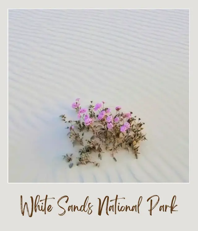
White Sands National Park is one of the most starkly beautiful National Parks destinations! Its alien landscape of rolling ivory dunes framed by the purple San Andres Mountains is a breathtaking sight! There’s a wealth of opportunities for exploring White Sands, and one of the best ways is the scenic Dunes Drive!
Dunes Drive is the main park road that runs the entirety of White Sands National Park! Not only is it brimming with views, but it’s welcomingly uncomplicated, easy to navigate, and rarely overly congested! Dunes Drive is a 16 mile long roundtrip loop road. It traverses 8 miles from the park entrance to the back of the park, before looping back around towards the entrance. During these 8 miles, guests witness the transformation from the shrub laden desert of the park’s entrance, to the glistening ivory dunes that extend for miles in its backcountry!
Dunes Drive contains all the park’s hiking trailheads, picnic areas, viewpoints, tour meeting locations, facilities, and, a visitor favorite, sand sledding opportunities! There’s several trails located along Dunes Drive, from easy nature trails a half mile long, to the grueling five-mile long Alkali Flat Trail!
White Sands National Park and Dunes Drive are located closest to the small town of Alamogordo, New Mexico, and less than an hour away from the larger city of Las Cruces.
Length: 16 miles | 25.7 km loop
Best Views: There’s multiple pullout spots and ample parking for both sightseeing and sand sledding. Anywhere you stop along Dunes Drive, you’re guaranteed exhilarating views and an imaginative and whimsical environment!
Road Closures: White Sands is occasionally closed due to nearby missile range testing, so it’s important to check the park’s website for information on closures.
Insider Tip: Bring your own sled or rent one from the Visitor’s Center, then make your way to the end of Dunes Drive to discover larger dunes perfect for sledding.
Driven by Kristen Czudak from Yonderlust Ramblings
Wheeler Peak Scenic Drive | Great Basin National Park
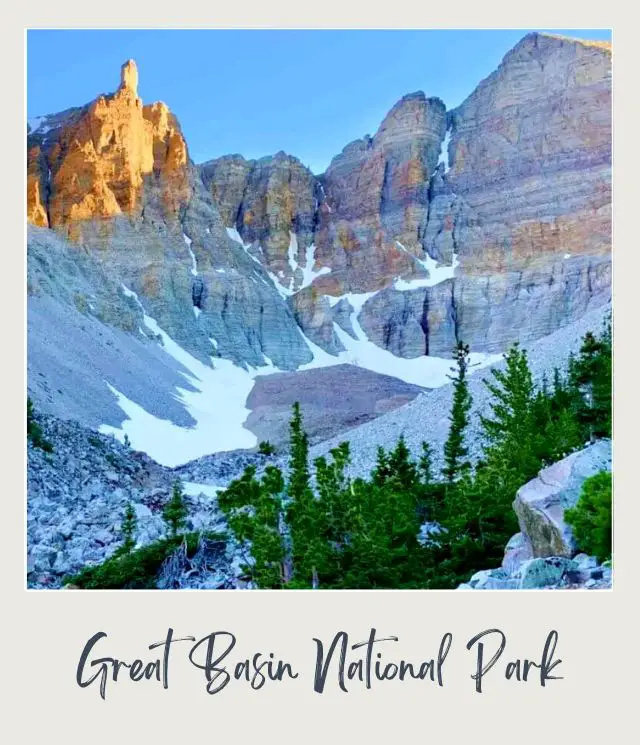
Wheeler Peak Scenic Drive showcases the vast rugged beauty of Great Basin National Park in eastern Nevada. Another of the most scenic drives in USA, this drive offers incredible views of Wheeler Peak (Nevada’s second highest mountain at 13,065 feet), as well as the rest of the Snake Range.
The road begins near the entrance of the park at the Lehman Caves Visitor Center, and begins to steadily ascend. As you head up Wheeler Peak Scenic Drive, you will gain around 4,000 feet of elevation, and you will notice the weather and landscape change from desert to alpine. The flora ranges from sagebrush and shrubs at the start of the drive to pinyon pines, mountain mahogany, conifer forest, and eventually alpine groves.
Length: 12 miles | 19 km (one way)
Best Views: You’ll definitely want to stop along the way at Mather Overlook early on the drive for your first view of Wheeler Peak. Farther up the road, you can get an even better view of this magnificent peak from Wheeler Overlook. The scenic drive also gives you access to some of the best hikes in Great Basin, including the Wheeler Peak Summit Trail and the Bristlecone-Glacier Trail.
Road Closures: Wheeler Peak Scenic Drive closes due to winter weather conditions, usually sometime in November, and typically reopens by Memorial Day, so summer and early fall are the best times to do this amazing drive.
Insider Tip: Though the road is paved, it is also narrow and features many twists and turns, so go slowly, both to appreciate the views and for safety.
Driven by Allison from She Dreams of Alpine
Going to The Sun Road | Glacier National Park
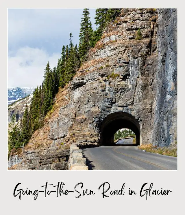
Going-to-the-Sun Road is the best of the best scenic drives in Glacier National Park. This 50-mile drive takes you through the heart of the park, with endless views, hikes, lodges, and vantage points along the route.
The road connects the towns of West Glacier and St. Mary. While only 50-miles, it takes at least 3 hours to drive due to the winding, narrow nature of the road. Plus, you’ll want to take plenty of time to pull over, get out and take in the sights!
Going-to-the-Sun Road is not just one of the best drives in Glacier National Park – some of the park’s best hikes are off the route too. Popular hikes like Avalanche Creek, Hidden Lake, and St. Mary Falls are perfect to break up the drive. For a longer hike, take the day to explore the Highline Trail, starting and ending along Going-to-the-Sun Road.
Length: 50 miles | 80 km
Best Views: For the best views, don’t miss Lake McDonald, The Loop, Big Bend, and St. Mary Lake. Going-to-the-Sun also passes 3 of Glacier National Park’s visitor centers: Apgar, Logan Pass, and St. Mary.
Road Closures: Going-to-the-Sun Road is only open in the summer due to heavy snowfall, typically opening for the year in late June.
Insider Tip: Since the drive is only open a few months out of the year, expect crowds. Avoid the busiest part of the day by starting your drive early, before 8 am! In 2021, there is a timed registration system to enter the road (read all about the timed entry system for the Going to the Sun Road here).
Read More: If you are planning a trip to Glacier, read my Glacier National Park Guide
Driven by Julia Jennings from Well Planned Journey
Tioga Pass Road | Yosemite National Park
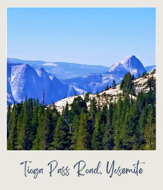
One of the most scenic drives in US national parks – and arguably the best of the scenic drives in Yosemite National Park – can be found along the famous Tioga Pass.
The Tioga Pass, also known as Tioga Pass Road, winds through the park’s high sierras from Crane Flat just outside Yosemite Valley, all the way out to Tuolumne Meadows in the eastern section of the park.
Tioga Pass is a windy mountain road that reaches an elevation of 9,943 feet, making it the highest mountain pass in the state of California. Along with this elevation comes some of the best views in Yosemite.
Length: 39 miles | 62.5 km
Best Views: The best viewpoints along the Tioga Pass are Olmsted Point, Tenaya Lake, Lembert Dome and Tuolumne Meadows. The most popular of these is Olmsted Point where you’ll find breathtaking views of the Sierras. This is a great spot to take a break from the road, have lunch, and enjoy the view.
Road Closures: The best time to visit Yosemite to enjoy driving the Tioga Pass is from June to August. Due to heavy snowfall in the Sierra Nevadas, the Tioga Pass is typically closed from mid fall to late spring.
Insider Tip: When heading out to drive the Tioga Pass, be sure to bring plenty of water and snacks. There will not be anywhere to stop along the way.
Read More: If you are planning a trip to Yosemite, read my Yosemite National Park Guide
Driven by Eden from Rock a Little Travel
Haleakala Highway | Haleakala National Park
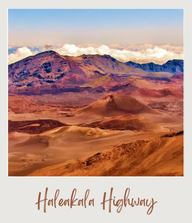
Haleakala Highway, also known as Crater Road, in Haleakala National Park on the island of Maui offers breathtaking views for 20 miles as you ascend to the summit of Haleakala Crater at 10,023 feet.
This scenic drive is famous for its switchbacks and steep incline. Keep an eye out for daredevil bicyclists coming down as you head up. Along the way, you’re also likely to see the Hawaii state bird, the nene goose. Nene are endemic to Hawaii, once an endangered species, they are now considered “vulnerable”. One of the greatest risks for the nene goose is vehicle collisions, so be sure to take the drive slowly and carefully!
About 10 miles into the drive, you will arrive at the entrance booth. Shortly after the booth, take a left on Hosmer Grove Access Road to Hosmer Grove Loop Trail, a quick ½ mile hike where you can see native honeycreeper birds found nowhere else on earth.
As you continue up towards the summit, you will reach Leleiwi Overlook between mile markers 17 & 18. This is a short ⅓ mile roundtrip hike to a crater viewpoint. A bit further up, at mile marker 20, you will reach the upper visitor center. One of the most popular activities that takes place here is watching the sunrise. However, there is nothing like sunset at Haleakala, particularly on a night with a full moon. With an elevation of 10,000 feet you can imagine yourself reaching out and touching the moon, it’s quite magical!
Length: 20 miles | 32 km
Best Views: Leleiwi Overlook; the summit
Road Closures: The road is open year-round, but is occasionally closed die to inclement weather, so always check with the National Park Service before heading out.
Insider Tips:
The key to enjoying a trip to Halekala is ensuring you are prepared. The temperature surprises many tourists who leave the beach in their shorts to do this scenic drive. It’s very common for the daytime high to be no more than 60° F /15° C and for the lows to be 30° F / -1° C. Seasonally there isn’t much variation due to being on the equator, but in the winter months you may get to see some snow on the volcano!
Reservations are required for driving to the summit at sunrise. Read all about reservation system at Haleakala National Park
Driven by Amber West at Wandering Wests
Cathedral Valley Loop | Capitol Reef National Park
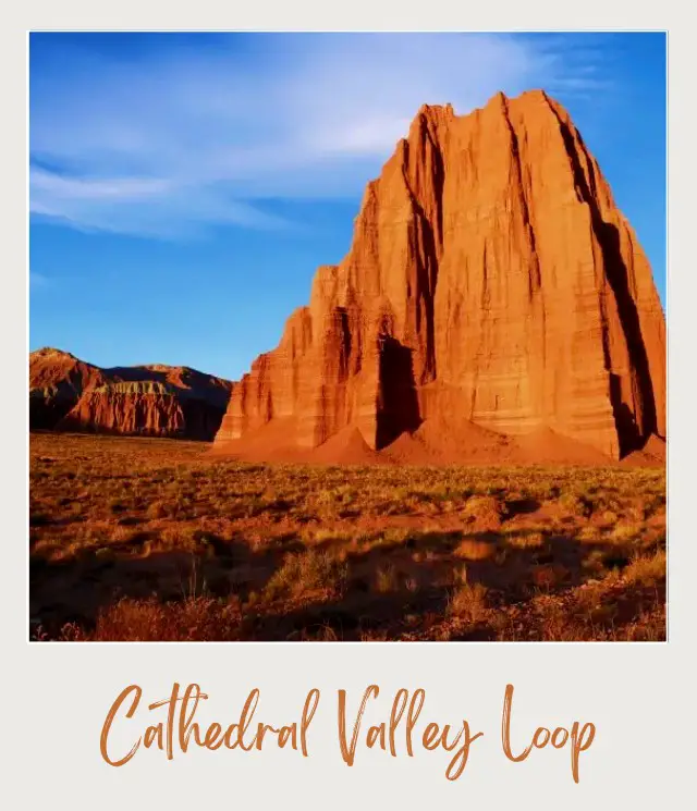
Southern Utah’s Cathedral Valley boasts colorful hillsides, towering monoliths, and sweeping desert vistas. Though it is among the most photogenic areas in Capitol Reef National Park, the area’s relative inaccessibility makes it a solitude-seeker’s paradise.
An unpaved 57.6-mile road highlights the best of the Cathedral Valley. The road weaves in and out of the national park boundaries and showcases awe-inspiring desert scenery at every bend.
The iconic Temples of the Sun and Moon are the most noteworthy attractions along the Cathedral Valley Loop. The twin monoliths erupt from the ground like buildings on fire. In the early morning hours, their deep red glow is particularly striking.
The Cathedral Valley Loop is not for the faint of heart. It is a treacherous backcountry road that requires fording a river and negotiating deep potholes. Pockets of sand and washed-out roads create the perfect recipe for getting stuck if you’re traveling unprepared. The loop drive is only suitable for 4WD vehicles.
Length: 57.6 miles | 92.7 km
Best Views: In addition to the famous cathedrals, the scenic road features three must-see panoramic points: The Cathedral Valley Overlook, and the Upper and Lower South Desert overlooks.
Road Closures: Though the loop is open year-round, the area can be particularly dangerous during flash floods. Before beginning your journey, make sure you stop by the visitor center to check on road and weather conditions.
Insider Tip: You can camp for free on the BLM land adjacent to the cathedrals. Doing so will enable you to visit the rock monoliths at sunrise.
Driven by Erika Bisbocci from Erika’s Travels
Newfound Gap Road | Great Smoky Mountains National Park
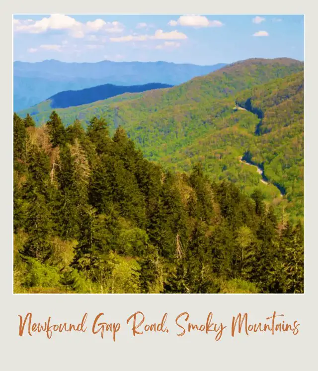
At 5,046 feet, Newfound Gap is the lowest drivable pass through the Great Smoky Mountains National Park. The drive over the pass between Cherokee, North Carolina and Gatlinburg, Tennessee is one of the best scenic drives in Smoky Mountains.
The drive climbs over 3,000 feet and passes through several different mountain landscapes including cove hardwoods, pine-oak forests, northern hardwood trees and wonderfully fragrant spruce-firs. Highlights along the way include the Smokemont Nature Trail, the Oconaluftee Visitor Center and Mountain Farm Museum, Mingus Mill, and, of course, Newfound Gap. Straight through, the drive takes just over an hour, but you should leave much more time to enjoy the views along the way.
Length: 35.5 miles | 57 km
Best Views: Web Overlook, Morton Overlook, Campbell Overlook
Road Closures: The road is open year-round, but is closed for inclement weather in winter. Check with the National Park Service if the weather is looking iffy when you are planning to head out.
Insider Tip: For a truly spectacular side trip, head to Clingman’s Dome. The turnoff is just south of Newfound Gap. In summer, there is a hike to the top with jaw-dropping 360° views of the Smoky Mountains. In winter, the road is closed to vehicular traffic, but open for winter hiking and cross-country skiing.
Read More: If you are planning a trip to the Smokies, read my Great Smoky Mountains National Park Guide
Skyline Drive | Shenandoah National Park

Another top pick for the most scenic drives in the US, Skyline Drive is the scenic roadway that spans Shenandoah National Park. This winding road measures 105 miles in length. With a 35 mile per hour speed limit, you’ll have plenty of time to enjoy the scenic view. It typically takes three hours on a typically day to drive from end to end, but if the park is busy (or you stop frequently to admire the views), it can take much longer.
In addition to the northern entrance in Front Royal and the southern entrance (Rockfish Gap) in Waynesboro, there are two other entrances if you’d like to break up the drive. The park has two full service restaurants: Skyland (MM 41.7) and Big Meadows (MM 51), in addition to three wayside grab & go food service options: Elkwallow (MM 24.1), Big Meadows (MM 51), and Loft Mountain (79.5).
The best part of traversing Skyline Drive are the park’s more than 500 miles of trails. There is truly something for everyone from the fully accessible 1.3-mile Limberlost Trail to the strenuous 9.4-mile Old Rag circuit with an adventurous rock scramble and a 360-degree view that makes you feel like you’re on top of the world.
Length: 105 miles | 169 km
Best Views: There are 75 scenic overlooks to take in the breathtaking views along the way.
Road Closures: Although the road is open year round, it is closed during winter if snow and ice conditions make it dangerous. Check ahead with the National Park Service if in doubt.
Insider Tips:
My strongest recommendation is to not try to take it all in during one day. The park hosts four campgrounds and lodging at three locations (Skyland (MM 41.7), Big Meadows (MM 51), and Lewis Mountain (MM 57.5). If you are more adventurous you can do some backcountry camping in the woods or rent one of six primitive cabin from the Potomac Appalachian Trail Club (PATC).
If you’re bringing a recreational vehicle, the Mary’s Rock Tunnel (mile 32.2) has a maximum clearance of 12’8″.
There’s only one (expensive) gas station inside the park, so it is best to fill your tank before entering the park.
Read More: If you are planning a trip to Shenandoah, read my Shenandoah National Park Guide
25 Best Overlooks on Skyline Drive
Driven by Julie Chickery of Chickery’s Travels
North Cascades Highway | North Cascades National Park

One of the best scenic drives in Washington State is the North Cascades highway. This gorgeous road goes through North Cascades National Park, giving you plenty of places to stop along the way. This drive is the perfect way to experience the park whether you are there for a long stay or just have one day in North Cascades National Park.
If you feel like being active, there are many hikes along the drive. Blue Lake is an easy two-mile hike to a lake, or you can take on the more challenging seven-mile Maple Loop Pass to hike above and around a lake at the bottom of a valley.
Length: The entire highway is over 400 miles long, but the North Cascades Scenic Byway, which passes through the national park , is 140 miles / 225 km
Best Views: The most popular viewpoint is Diablo Lake, where you’ll be able to get amazing pictures of a bright blue lake below. You can also stop at the Gorge Overlook to view a waterfall down below and learn about the history of the area.
Road Closures: The North Cascades Highway is typically closed from November until May depending on how much snow they get each year, so you’ll want to be aware of this when planning your trip.
Insider Tip: The best time of year to go is from June until October, as you’ll get warm, sunny days that allow you to enjoy hiking and swimming in the lakes. The North Cascade region is one of the few places in the state that get the rare larches, and they typically come out for only a few weeks at the end of September or beginning of October.
Driven by Marissa Pedersen from Postcards to Seattle
Read More: If you are planning a trip to North Cascades, read my North Cascades National Park Guide
Pinto Basin Road | Joshua Tree National Park
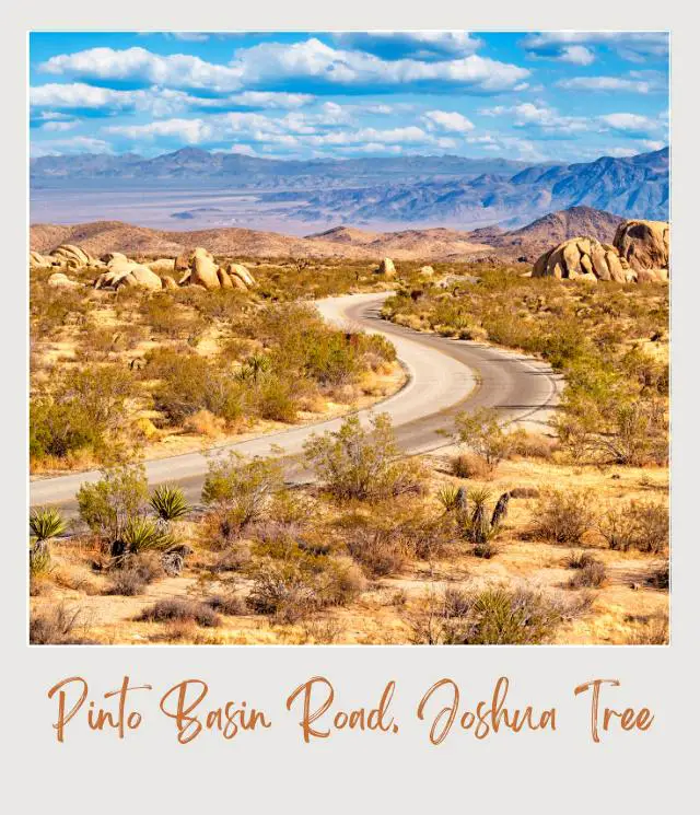
The Pinto Basin Road, which crosses from one end of Joshua Tree National Park to the other, is the main Joshua Tree National Park scenic drive. Located around an hour from the Indio/Palm Springs area, the Pinto Basin Road can be accessed by either the northern or southern entrances to the park. Entering from the south is highly advised as it provides perspective to the size and changing landscape of the desert.
Upon entering the park at Cottonwood Springs you will be able to pull over at many places for scenic views or hikes. The first stop of interest will be Cholla Cactus Garden. Take a stroll through a short, but well-maintained trail that shows off this species of native cactus. It is at this point where the Colorado and Mojave Deserts meet and the rest of your time will be spent exploring the surprisingly different Mojave Desert.
Further north along Pinto Basin Road the road will split. While there is beauty to the right as you head north toward Twenty Nine Palms, most of the great scenery is to the left. Here you’ll find all sorts of hiking and rock climbing opportunities.
Be sure to stop at Skull Rock, which is easy to see how it was named. Hike the Skull Rock Nature Trail or continue on to other popular and accessible trails such as Ryan Mountain Trail, Hall of Horrors and the Hidden Valley Nature Trail. The desert scenery doesn’t end until you exit the park in the town of Joshua Tree.
Length: 62.5 miles / 100 km
Best Views: Ocotillo Patch, Cholla Cactus Garden, Skull Rock
Road Closures: The road is generally open year round
Insider Tip: You can make this drive and see the highlights of Joshua Tree in one day. Unequivocally, the best time of year to visit is during the spring. Depending on the precipitation in winter, the desert comes alive with all sorts of colors as the vegetation blooms. This is the main draw to the park during a time when temperatures are also reasonable.
Read More: If you are planning a trip to Joshua Tree, read my Joshua Tree National Park Guide
Driven by Chris Harvey from Called To Wander
Rim Drive | Crater Lake National Park
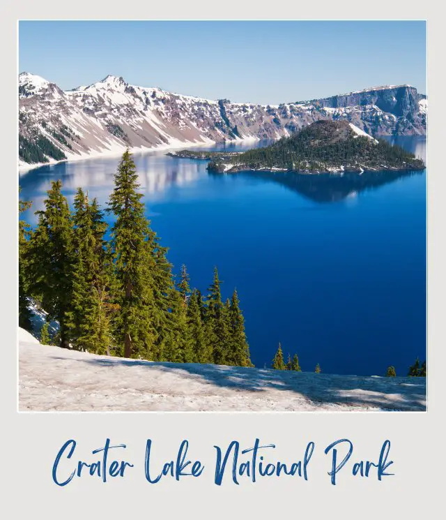
The Rim Drive in Crater Lake National Park is a stunning drive that’s one of the most scenic drives in US national parks. It’s hard to keep your eyes on the road when the lake sparkles in a deep blue. Photos don’t do this place justice.
Crater Lake was formed when a volcano collapsed into itself and formed a crater. This lake is special because it’s entirely created by melting snow, there are no outlets that feed this lake. This is how it gets the sparkling and clear deep blue color. It’s also the deepest lake in the US!
In the summer the entire drive is open! In the summer months, the park will be the most crowded, but you’ll have lush evergreen trees surrounding this beautiful lake. You can also hike around the lake to get an even deeper experience inside this park. A section of the Pacific Crest Trail thru-hike also runs through the park.
Length: 33 miles | 53 km
Best Views: There are 30 official viewpoints along this drive. Each one offering a stunning view of the lake below and the little island in the middle which is called Wizard Island and is the volcanic cinder cone.
Road Closures: In the winter, the park receives an average of 42 feet of snow per year. The park is beautiful, but the north entrance road and Rim Drive are closed to wheeled vehicles from the first big snowstorm (usually sometime in October). The West Rime Drive typically opens sometime between mid-May and the end of June and the East Rim Drive usually remains closed until mid-June to late July (depending on snow).
Insider Tip: The road is narrow and winding. If you’d prefer not to drive it yourself, from July to mid-September, you can take a trolley tour around the entire drive.
Driven by Jenny from Limitless Hiker
Trail Ridge Road | Rocky Mountain National Park
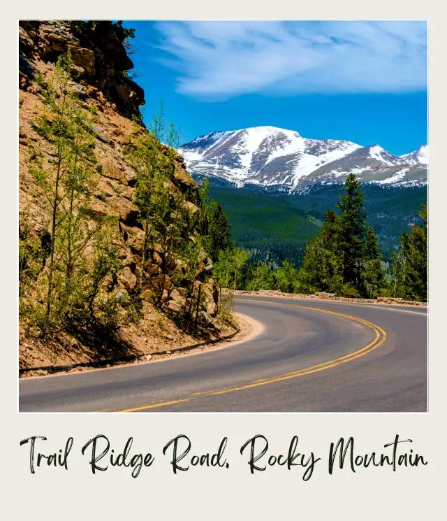
Trail Ridge Road in Colorado’s Rocky Mountain National Park is definitely one of the best scenic drives in Rocky Mountain National Park – you have to see it to believe it! Photos just don’t do it justice.
Crossing the Continental Divide, it links Estes Park in the east with Lake Grandby in the west. Not for the faint of heart, at 12,183 feet, it’s the highest scenic drive in the National Park System. Every twist and turn offer endless views of alpine forests, snowcapped peaks and distant valleys.
Trail Ridge Road also has not one but two visitor centers. Kawuneeche Visitor Center on the west side of the park is open all year. The Alpine Visitor Center, located at a higher elevation, is seasonal. Because of its location, it’s also the highest elevation visitor center in the National Park System.
Length: 48 miles/ 77 km
Best Views: You’ll have plenty of opportunity for a better look at those stunning Rocky Mountain views by stopping at some (or all) of the many turnouts on Trail Ridge Road. A few favorites for the best photo ops are Forest Canyon, Gore Range Overlook and Medicine Bow Curve.
Road Closures: To drive the entire length of this paved scenic drive, you should plan on traveling to Rocky Mountain National Park in the warmer months. Because of snow, Trail Ridge Road closes to through traffic in the early fall, usually in October and doesn’t open again until late May. At this high altitude, closures can occur in June. Guests should always be prepared for rapidly changing weather, even in early summer.
Insider Tip: While driving Trail Ridge Road, keep your eyes peeled for wildlife. It’s common to spot moose, elk and big horn sheep just going about their business. In summer 2021, there is timed entry to the park. Read all about the timed entry tickets system for Rocky Mountain National Park here.
Read More: If you are planning a trip to the Rockies, read my Rocky Mountain National Park Guide
Driven by Lori Blalock from Southerner Says
Denali Park Road | Denali National Park
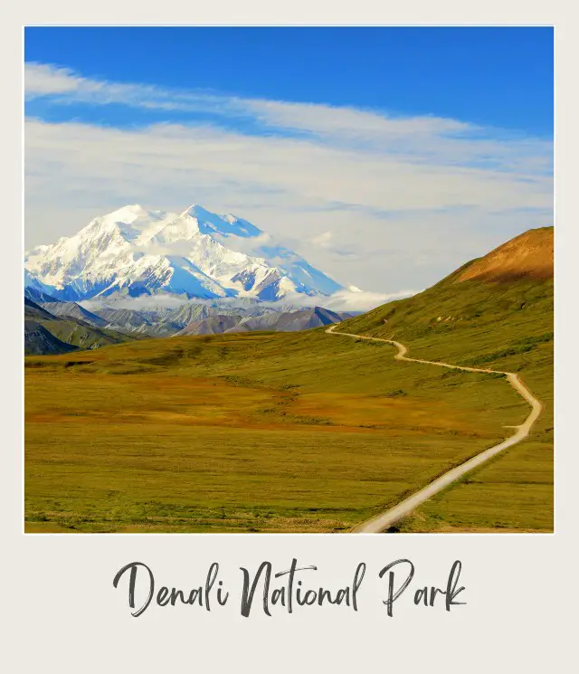
The Denali Park Road is not only the best of the Alaska scenic drives, it is one of the most scenic drives in the country. Plus, you’re likely to see lots of wildlife along this route too. The National Park road is 92 miles long but will take you all day. Along the Denali Park Road you’ll pass prime bear, moose, lynx and wolf habitat with mountains on either side of you.
The road is closed to private vehicles for most of the season (and fully closed for winter – see below) and most visitors need to take a bus that plies the route. However, once per year (typically in June), there is a Denali Park road lottery that lets park goers drive the entire 92 miles out to Kantishna for one of four designated days in September.
Length: 92 miles | 148 km
Best Viewpoints: Views of Denali itself come sporadically on the first half of the drive but come out in full force the further you go. Eielson Visitor Center and Polychrome Pass are great places to stop along the way to stretch and get a nice view but you will find yourself stopping countless times to enjoy the wildlife.
Road Closures: If you want to drive the road yourself you’ll need to wait for the fall road lottery but you can enjoy the road by bus all season long, from mid-May till mid-September. The road is closed completely mid-September to mid-May.
Insider Tip: Having driven the whole thing I would recommend skipping the final few miles past Wonder Lake since you lose the scenic views and the only thing to see is the “end of the road” sign.
Driven by Mike Still from LiveTravelTeach.com
Wherever you go, enjoy the drive!
Do you have any other favorite top scenic drives in USA? I’d love to hear about it. Join my private Facebook group National Parks Collectors and comment and let me know.
Get more national parks inspiration:
- The 12 Best US National Parks
- The Best US National Parks to Visit in Winter
- The Best US National Parks to Visit in Spring
- The Best US National Parks to Visit in Summer
- The Best US National Parks to Visit in Fall
- The Best Lodges in US National Parks
- The Best National Parks Beaches
- The Best Parks to See Fall Foliage
- The Complete List of all 63 US National Parks
And if you are starting to plan your trip, check out my National Parks Guides and use these Resources.
Subscribe to monthly updates with tips for planning, travel inspiration and trip ideas and get instant access to the free PDF of the
Most Scenic Drives in US National Parks
If you liked this post, please share the love and Pin It to your National Parks board!


About the Author

James Ian has traveled to 82 countries and all 7 continents. He has visited all of the main national parks in the United States, as well as many national monuments and state parks.
He has rafted through the Grand Canyon; rappelled down slot canyons near Zion and Arches; hiked among the hoodoos in Bryce and the enormous trees in Sequoia; admired the waterfalls in Yosemite and the colored hot springs in Yellowstone; seen moose in Grand Tetons and seals in the Channel Islands, and much more.
I’m a member of the Amazon Services LLC Associates Program. As an Amazon Associate I earn from qualifying purchases.
