Thinking about doing the Devil’s Garden Hike but not sure if it’s too hard, too crowded, or even worth your time? You’re in the right place.
This trail can be confusing to plan for – there are multiple routes, lots of side trails, and a few tricky sections people don’t always expect.
I’ve hiked the full loop, explored all the spurs, and even got caught in a sudden storm. I’ll tell you what I loved (spoiler: Double O Arch is a true surprise), what parts are more challenging than they look on a map, and what to skip if you’re short on time.
This is best for hikers who want a real adventure – not just a quick viewpoint – and are comfortable with a little scrambling, navigation, and exposure. If you’re looking to see more than just the basics of Arches, this is one of the best trails in the park.
Here’s a quick preview: Most people stop at Landscape Arch – but the real magic happens if you keep going to Double O Arch and beyond.
In this guide, I’ll break down everything you need to know about the Devil’s Garden Hike – routes, distances, difficulty, and tips based on real experience – so you know exactly what to expect.
Let’s walk through the trail and make sure your adventure in Devil’s Garden is unforgettable for all the right reasons.
🛏️ TOP HOTEL PICK: Check availability now
🚘 FIND THE CHEAPEST CAR RENTAL: Search Discover Cars for the best deals
✈️ FIND THE CHEAPEST FLIGHTS: Search Skyscanner for the best deals
🧳 GET TRAVEL INSURANCE: Get insured with Travelex before you go
📱 TAKE AN AUDIO TOUR: Buy an audio tour now
Table of Contents
Devil’s Garden
What is the Devil’s Garden?
Devil’s Garden, Arches National Park is an area of the park filled with sandstone fins and arches. It is also the site of my favorite hike in the park. Arches National Park is famous for the arches (of courses) – and there are actually eight on this hike – but there is surprisingly much more to the park than just the arches, and this hike has highlights of many aspects of the park such as dramatic sandstone fins, soaring spires and dramatic rocky landscapes.
Why is it called Devils Garden?
Devil’s Garden was actually the name given by a prospector Alexander Ringhoffer to the nearby Klondike Bluffs but then was used for this section when Arches became a national monument in 1929.
Subscribe to daily national parks planning tips, travel inspiration and trip ideas and get instant access to the free PDF of this
Guide to the Devil’s Garden Hike
Devil’s Garden Hike (Arches National Park) Overview
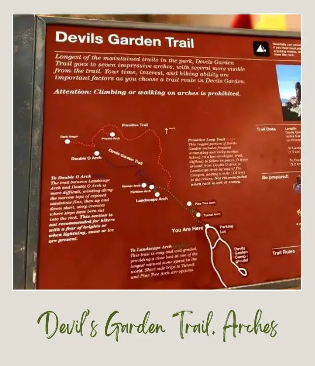
The Devil’s Garden hike is the longest of the trails in Arches National Park, and the most difficult, but there are easier, partial options. There are actually three trails in, each with a different difficulty level.
1. An easy hike to Landscape Arch via Pine Tree and Tunnel Arches
2. A moderate Trail continues on to Double O Arch via Partition Arch, Navajo Arch and Black Arch viewpoint.
3. You can return the same way or return to the main trail near Landscape Arch via a primitive trail, with a side spur to Private Arch. This is a challenging hike and should only be taken if you are fit and prepared.
What is the distance of the Devil’s Garden Trail?
To Landscape Arch: 0.95 miles/ 1.55 km one way (from trailhead)
To Double O Arch: 2.1 miles/ 3.4 km one way (from trailhead)
Primitive Trail: 2.1 miles/ 3.5 km one way (to/ from Double O Arch and main trail near Landscape Arch). Adds an extra mile (1.6 km) to the return trip from Double O Arch.
Full Trail: 7.9 miles/ 11.5 km (loop including primitive trail and all spurs)
Side Spurs to Pine Tree and Tunnel Arches: 0.5 miles/ 0.8km
Side Spur from Double O Arch to Dark Angel: 0.42 miles/ 0.67 km round trip
Side Spur from primitive trail to Private Arch: 0.26 miles/ 0.41 km round trip
How long does it take to hike Devils Garden?
The time it takes to hike any trail depends on your fitness level, weather conditions, how much you stop along the way, etc. The times it took me (stopping off for a lot of photos and a few breathers, but otherwise walking pretty consistently are:
To Landscape Arch: From the Devil’s Garden Trailhead, including the spur trails to Pine Tree and Tunnel Arches took me 35 minutes one way.
To Double O Arch: From Landscape Arch to Double O Arch, including the spur trails to Navajo Arch and Partition Arch took me one hour and forty minutes one way.
Full Trail: The full Devil’s Garden primitive trail loop, including all spurs, lunch, etc. took me 6 hours.
What is the elevation change on the Devil’s Garden Trail?
The hike doesn’t ascend to an end point and then return down, but nonetheless, there is considerable up and down, which adds up to an overall significant elevation change.
Where does the Devil’s Garden Trail start?
The trail starts at the Devil’s Garden parking areas. There are quite a few parking spaces here, but in the bust times, it can fill up. If you are doing the full hike, you will want to set out early anyway, so I recommend getting there are early as possible. I started at 8:00am and in early September there were plenty of parking spaces left, but in the summer months, this may not be the case.
How do you get to the Devil’s Garden trailhead, Arches National Park?
If you are staying in the nearby campground, it is possible to walk to the trailhead, but given how long the hike is, you may prefer to skip this and drive to the trailhead (which is what I did).
If you are staying in Moab and driving into the park for the day, note that the Devil’s Garden Trailhead is at the far end of the paved road in Arches National Park. It takes about 35 minutes to drive from the Arches National Park Visitor’s Center (near the park entrance) to the Devil’s Garden Trailhead. It’s about a 10-minute drive from the center of Moab to the Visitors Center, assuming you don’t need to line up to enter the park (which you often do, but won’t if you go early enough). So allow an absolute minimum of 45 minutes form Moab to Devil’s Garden.
How Difficult is the Devil’s Garden hike?
To Landscape Arch
Easy: This first part of the trail is easy and well-graded. You could easily do this with kids and a lowish level of fitness.
To Double O Arch
Moderate-Strenuous: The main trail from Landscape Arch to Double O Arch is more difficult. There are several points at which is crosses the narrow tops of exposed sandstone fins, and there are steep crevices where steps have been cut into the rocks. This trail is not recommended if you have a fear of heights or when there is lightening, snow or ice.
Primitive Loop Trail between Double O Arch and Landscape Arch
Difficult: This trail includes frequent scrambling and rocky surface hiking on a less developed trail, which is difficult to follow in places. There is one section that goes along the side of a fairly steep slope, with a very narrow foothold.
The trail also goes through a pool that may have water in it (it was dry when I did it, though). It is not recommended when the rock is wet or snowy or if you have a fear of heights.
What are the Highlights of the Devil’s Garden Hike?
There are eight arches (including a distant view of Black Arch). There were nine until Wall Arch collapsed in 2008.
The arches in Devil’s Garden that you can see on the hike are:
✴️ Pine Tree Arch
✴️ Tunnel Arch
✴️ Landscape Arch
✴️ Partition Arch
✴️ Navajo Arch
✴️ Black Cave Arch
✴️ Double O Arch
✴️ Private Arch
Other highlights of the Devil’s Garden hike are Dark Angel and Fin Canyon.
What is the Best Time to Hike Devil’s Garden?
Mornings are cooler and better for photography.
What should I take with me on the Devil’s Garden Hike?
Check out my day hike essential packing list for everything you need. Make sure to take extra water, as this hike is in the desert.
If you are looking to buy new gear, I have written a detailed guide to the Best Hiking Shoes & Boots and the Best Hiking Sandals . If you’ll be hiking in the winter, you will need my Guide to the Best Winter Men’s Boots and Best Winter Women’s Boots.
The best of the best for comfort, durability and fit are:
Best Hiking Shoes:
➡️ Salomon Men’s X Ultra 3 GTX Hiking Shoes
➡️Salomon Women’s X Ultra 3 GTX Hiking Shoes
Best Hiking Boots:
➡️ Salomon Men’s X Ultra Mid GTX Hiking Boots
➡️ Salomon Women’s X Ultra Mid GTX Hiking Boots
Best Hiking Sandals:
➡️Keen’s Targhee III Men’s Hiking Sandals
➡️Chaco Women’s Mega Z Cloud Sandals
Best Winter Hiking Boots:
➡️Salomon Men’s X Ultra Mid Winter CS Waterproof Hiking Boots
➡️Merrell Women’s Thermo Chill Sneakers
Map of Devil’s Garden Trail, Arches National Park
‼️ Click on each icon to see photos
➡️ You can also get a detailed National Geographic map of the trails in Arches National Park on Amazon.
Subscribe to daily national parks planning tips, travel inspiration and trip ideas and get instant access to the free PDF of this
Guide to the Devil’s Garden Hike
Devil’s Garden Trail Arches National Park Description
Let’s break the hike and trail down into the three main sections.
Landscape Arch Hike
The first section of the trail is easy and mostly flat. The hike starts at the trailhead, where there are restrooms and a sign warning you to bring lots of water. Don’t underestimate this. It is the desert and while there are people around for the most part, if you get lost, you may need more water than you think.
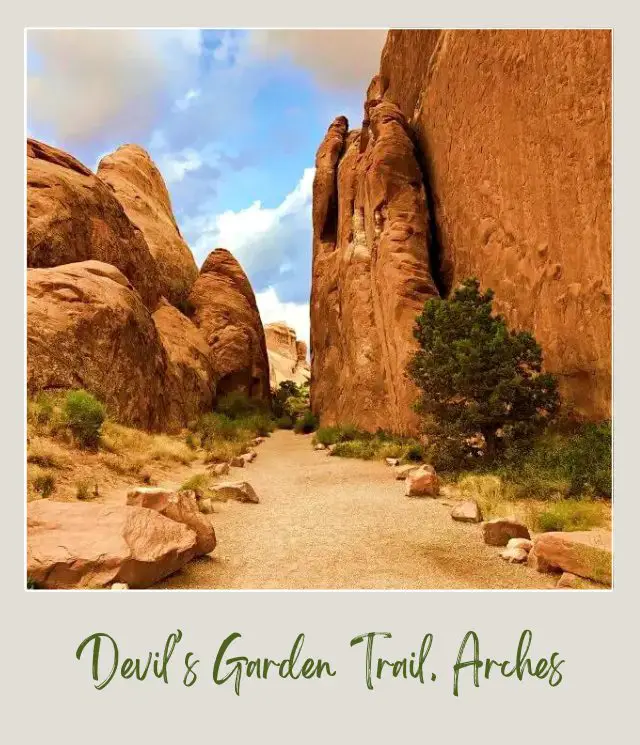
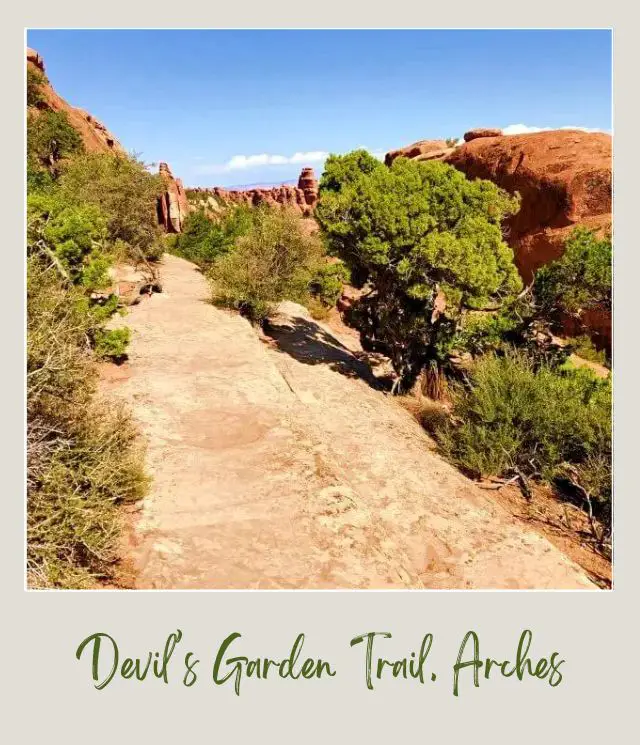
The trail starts through a gap in horizontal fins and then widens.
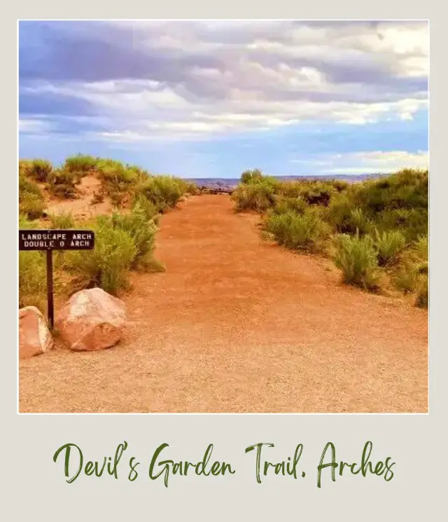
The path is flat and wide and the surrounding area is mostly sage brush.
✴️ Pine Tree Arch and ✴️ Tunnel Arch
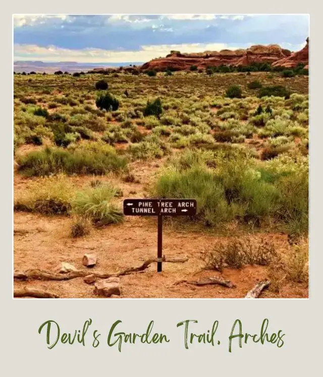
After about ten minutes, you will come to a small sign indicating the side spur trail to Pine Tree and Tunnel Arches. It’s a short, easy diversion and both arches are worth a visit.
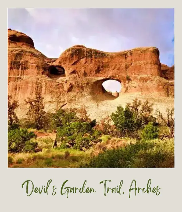
Tunnel Arch looks like a tunnel.
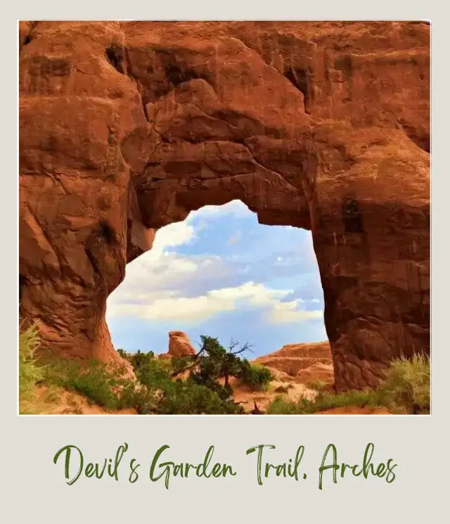
Pine Tree Arch has a pine tree in the middle of it.
✴️ Landscape Arch
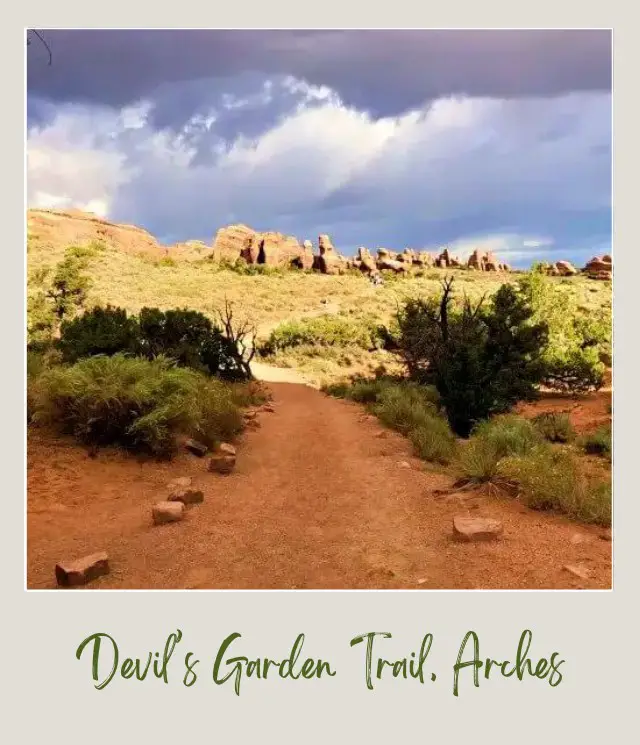
About 35 minutes into the hike, you will get your first view of Landscape Arch. Arches National Park is home to the longest natural occurring arch in the United States. It is the fourth longest arch in the world – there are longer arches in China, but none as narrow and ephemeral as Landscape Arch.
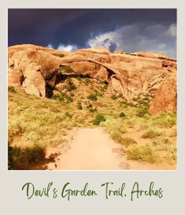
Keep going to the end of the easy trail. The view of Landscape Arch gets better.
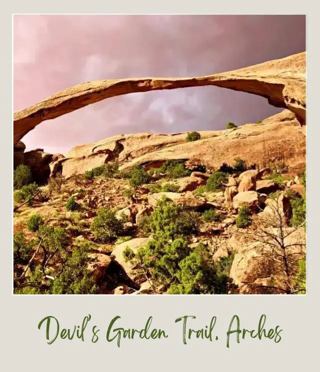
If you look up and to the right, you can see an arch near the top of the cliff. You may see people in the middle of the arch. That is Partition Arch.
This is the end of the easy trail. If it is raining or snowy or if you are not at least moderately fit or if you have a strong fear of heights, or if you don’t have any water with you, you should turn back here.
Double O Arch Trail
The start of the trail to Double O Arch, Arches National Park gives you a pretty good indication of what the trail is like. If you look ahead to the right, you will see a steep sandstone fin. You may see people walking up the fin along the ridge to the top. This is the trail. The ridge is not actually that narrow, but with steep drops on both sides, your fear of heights will get triggered if you have one. If not, this is a fun start to the Double O Arch trail.
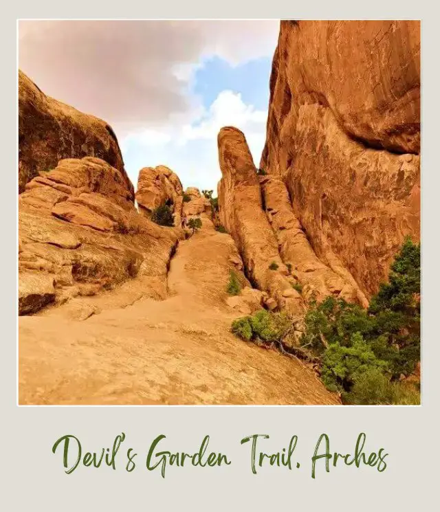
The trail continues uphill. For the Double “O” trail, you will want to make sure you follow trail proper trail etiquette (read about it here if you aren’t sure).
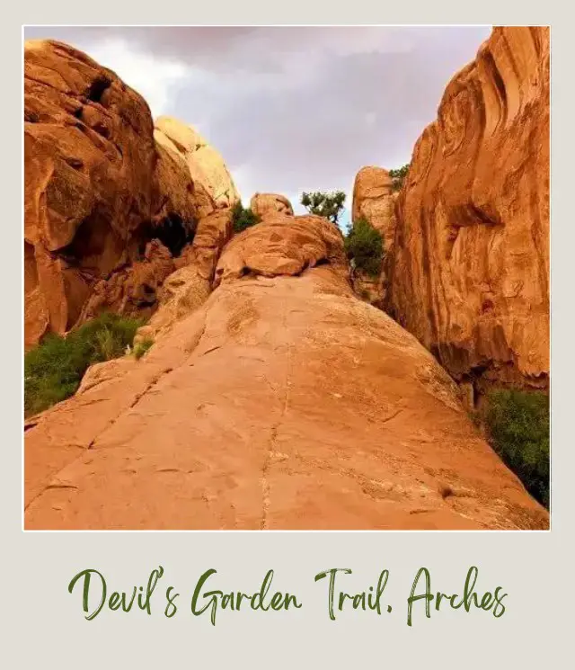
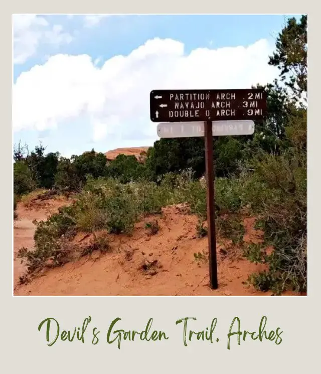
After about fifteen minutes, you will come to a small sign indicating the side spur to Navajo and Partition Arches.
The trail is over sliprock and on a clear sandy path.
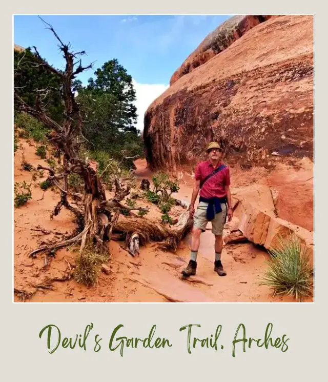
It’s only about a minute until you come to where the path splits between Partition Arch off to the left and Navajo arch to the right. Both are short out-and-back spur trails.
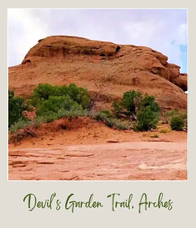
✴️ Partition Arch
The trail to Partition Arch mostly hugs the side of a fin. It’s flat and easy.
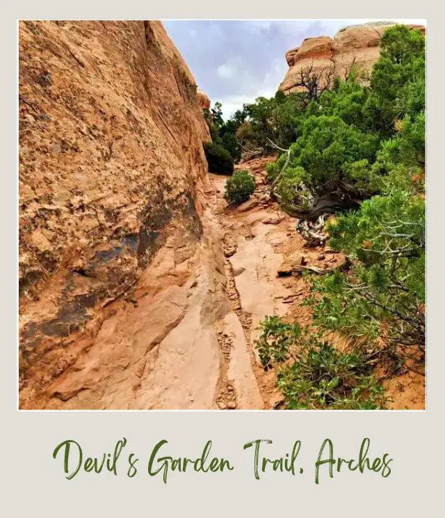
Partition Arch is a double arch with nice views of the landscape beyond. This is the arch that can be seen from the end of the Landscape Arch trail below.
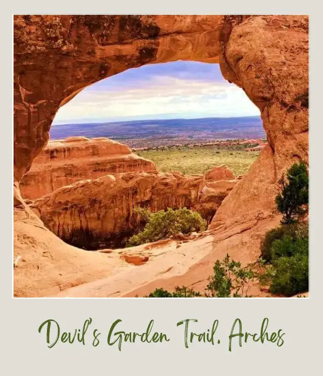
✴️ Navajo Arch
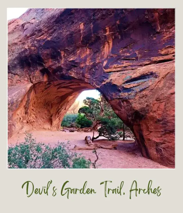
When you are done enjoying the view from Partition Arch, go back to where the trail divides and take the other spur to Navajo Arch, also a flat, easy trail.
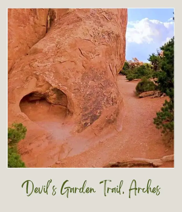
It’s only about five minutes from the divider to Navajo Arch. The Arch is pretty cool. There are no expansive views, but you can walk through the cave-like arch and look back through it.
Back at the main trail, it is about 35 minutes from the side spurs to Partition and Navajo Trails to Double O Arch. Most of the trail is easy to follow, but there is one part that it is easy to get lost.
Look for the cairns! Cairns are piles of rocks that are used to indicate the trail. They are mostly used when the trail goes over rocks so evidence of a path disappears. If you are new to trail markers, read about them here – definitely helpful for this hike!
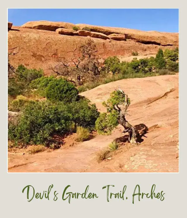
We wandered around a little before we found the sign indicating where the trail went over another fin (about ten minutes after getting back on the main trail).
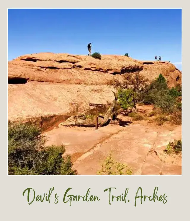
This part of also hairy if you are afraid of heights. The trail goes along the top of a fairly long fin, with drops on both sides.
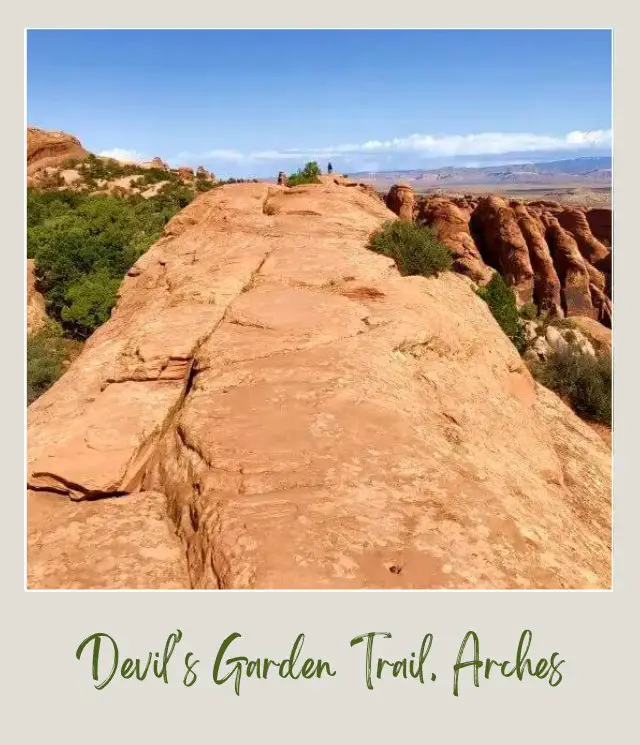
It’s actually fairly wide – but can also be windy.
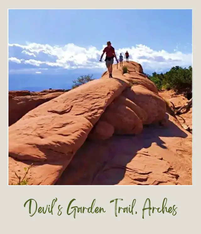
I was happy to get to the other side.
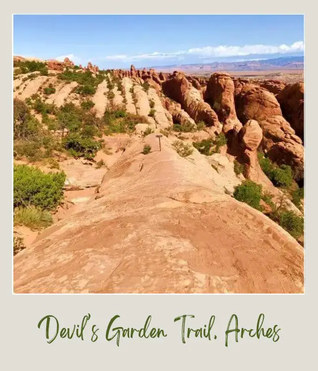
If you’re coming from the opposite direction, this is the sign to look for.
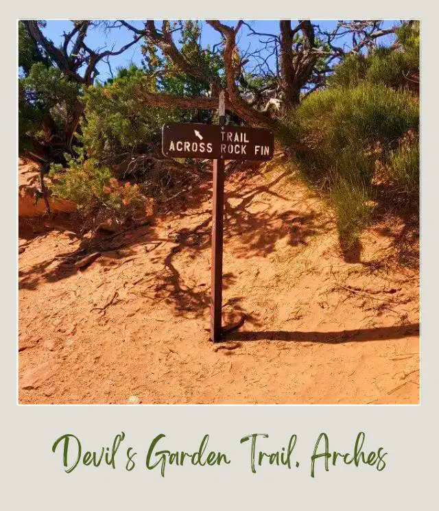
There’s a trail sign indicating the direction to Double O Arch.
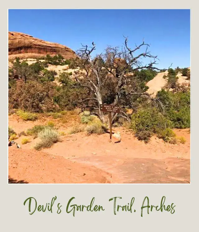
✴️ Black Arch (Black Cave Arch)
Soon after is a VERY short spur to a lookout of Black Arch (or Black Cave Arch, depending on who you talk to).
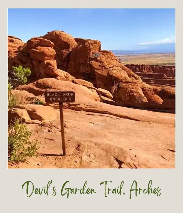
It’s a distant view.
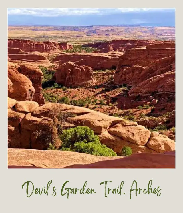
At this point, you’re about fifteen minutes from Double O Arch. There are spectacular views of Devil’s Garden and Fin Canyon.
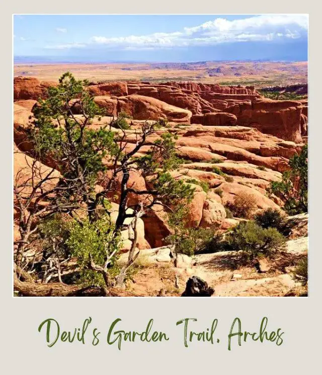
If you do the primitive trail, you’ll be hiking down into there later in the day. The trail skirts along the side of a fin at one point.
✴️ Double O Arch
When you first get to Double O Arch, you can only see the larger arch.
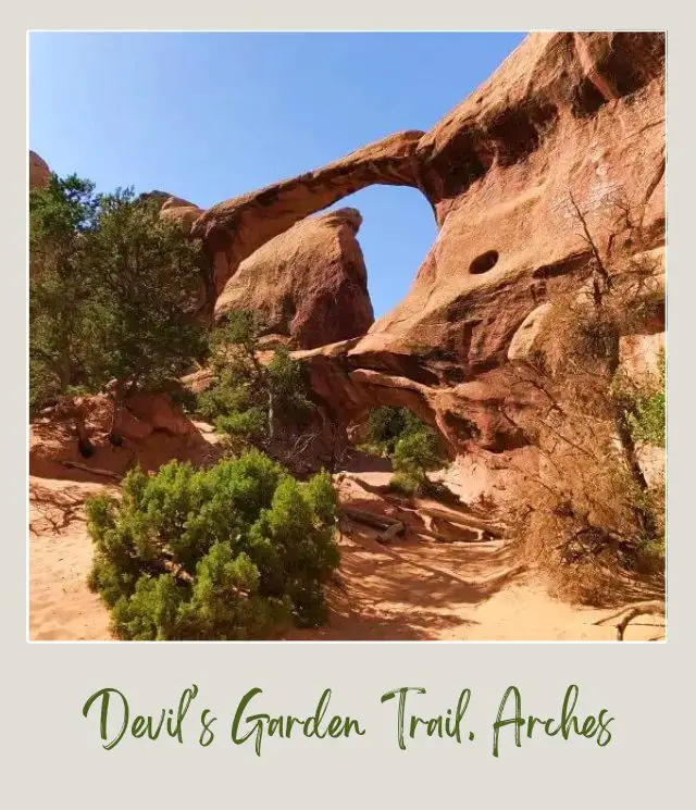
Keep going. Then climb up and through the lower arch (it’s a bit of a scramble, but worth it). Then climb the oath up a little for a stunning view of Double Arch and views through and beyond the arch.
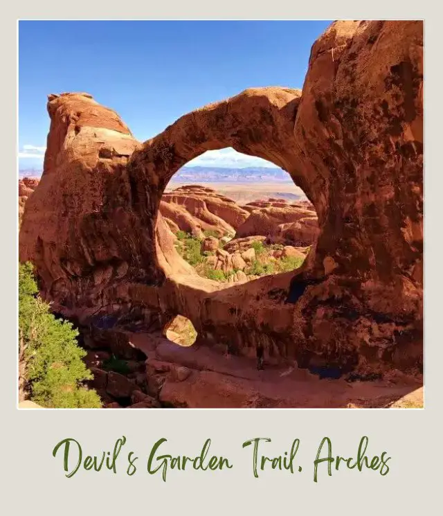
This is one of my favorite views in the entire park. It makes a good spot to relax, drink water and have a snack.
✴️ Dark Angel, Arches National Park
When you’re ready, go back through the arch and find the path continuing along.
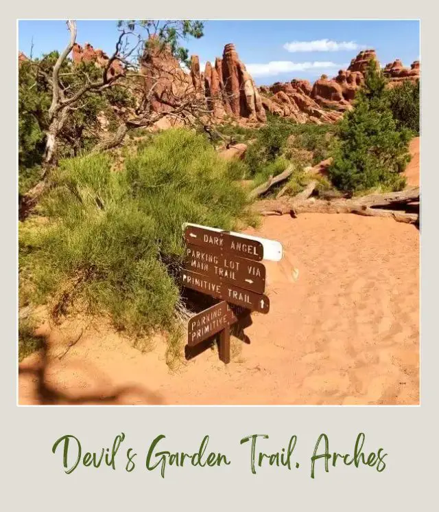
A side trail off the left and ahead goes to Dark Angel. In the distance you can see a tall dark rock spire. That is Dark Angel.
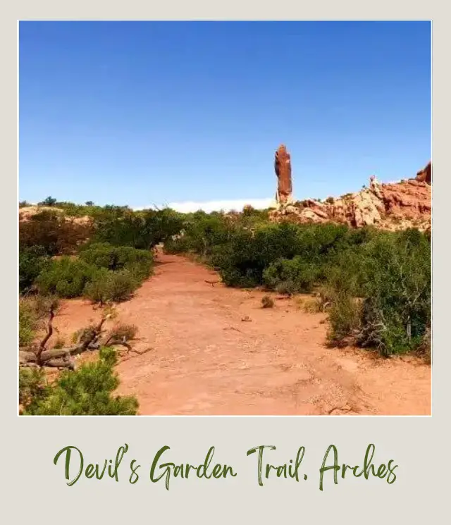
The trail is fairly easy, but if you are feeling a little sore or tired, you could skip this.
If you do it, you will get to the spire, which you can walk around.
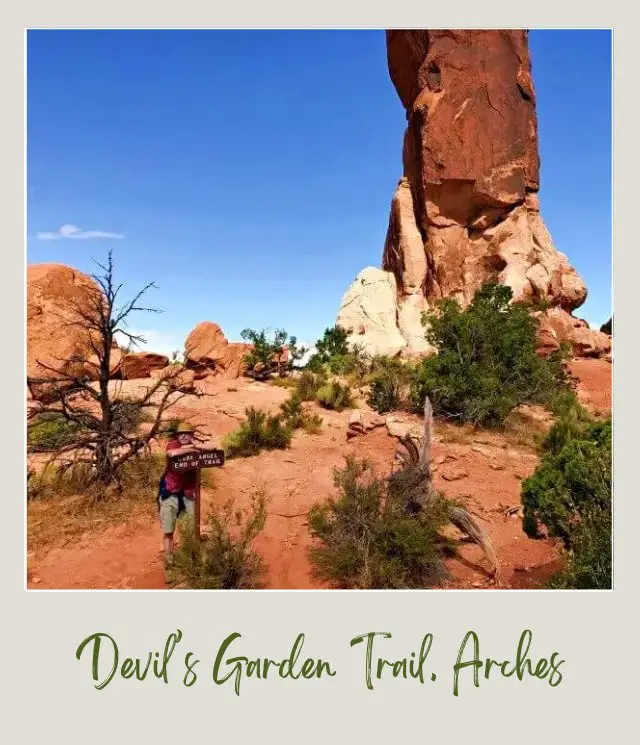
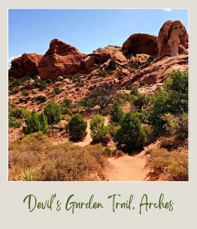
Then it is back to Double O Arch.
Primitive Trail, Devil’s Garden
From Double O Arch, you have to make a choice – go back the way you came or continue on the primitive trail.
Should you take the primitive loop trail? If it isn’t raining or snowy, if you have plenty of water and if you’re reasonably fit, then yes, do it. I loved this trail and it was not as daunting as I expected.
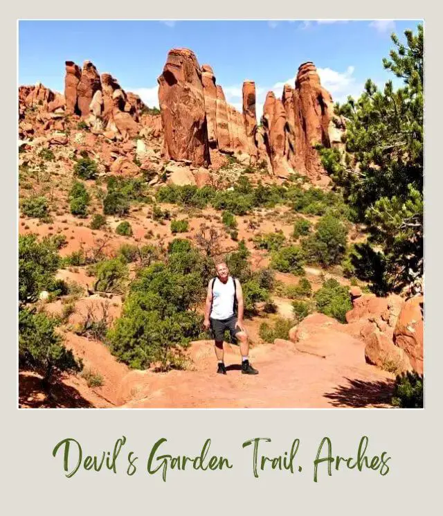
However, I did encounter a couple of young women coming from the opposite direction who had got lost and had wandered around for ages before they found the trail again, so if you’re a novice hiker, that is something to keep in mind.
How to find and follow the primitive trail in Devil’s Garden
I found the trail pretty easy to follow. There are cairns marking the trail when it goes over rocks, and parts have logs laid along the side of the trial. Don’t walk across a log – use it as a guide for the side of the trail!
✴️ Fin Canyon
The trail goes down into Fin Canyon. Part of the trail is in a sandy wash – which is hard walking, but easy to follow, at least.
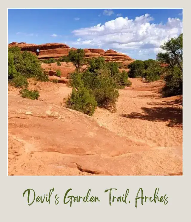
The views of the canyon are really amazing.
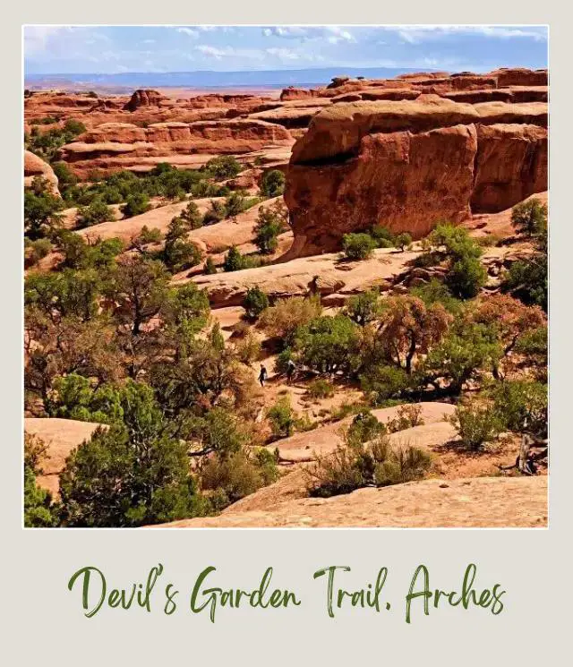
Keep an eye for the spur trail to Private Canyon (about twenty minutes from the start of the primitive trail).
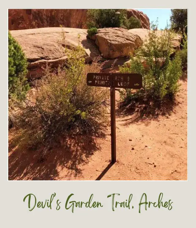
✴️ Private Arch
Private Arch is only about eight minutes away.
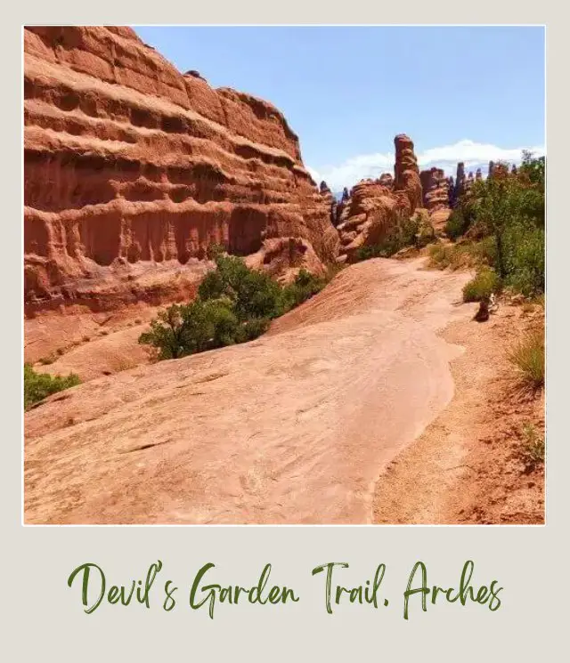
The arch is down and to the left, which is why it is called ‘private’, I guess. There was a group of hikers there when I visited, so it wasn’t as ‘private’ as I was hoping. The Devil’s Garden trail is a well-traveled trail, so the chances of having it also to yourself are not that small.
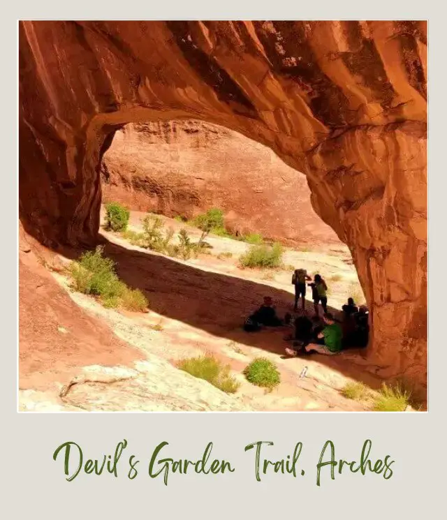
Look for the logs and cairns to follow the trail.
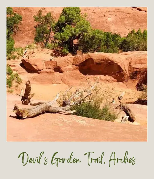
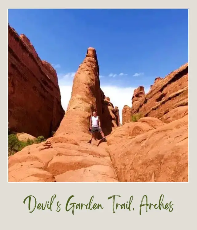
About 25 minutes after being back on the main trail after visiting Private Arch is the hairiest part for me.
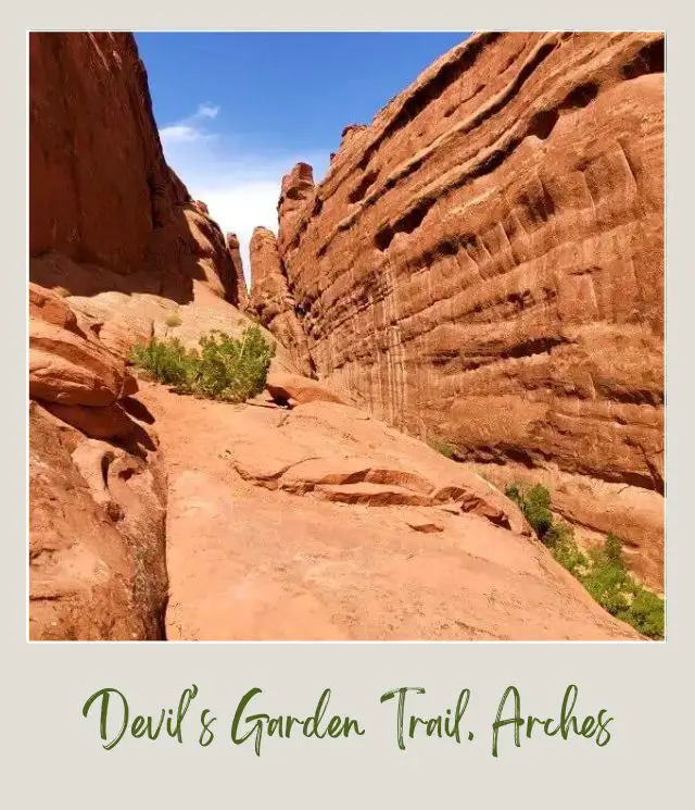
You need to skirt along the edge of a fin. The cliff was fairly steep and the footholds fairly narrow. I’m afraid of heights, so this was unnerving for me, but my shoes were sticky enough and plenty of other people navigated it successfully as well. I wouldn’t want to do this part if the rock was wet or icy though.
There were other parts that went alongside cliffs, but the path was much wider.
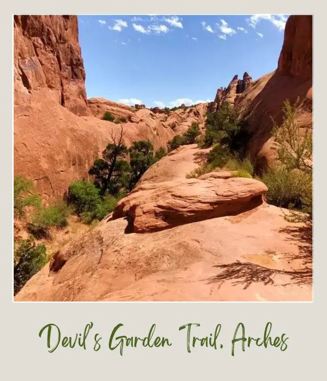
About an hour and a half along the primitive trail, the path goes through another sandy wash and then up and out.
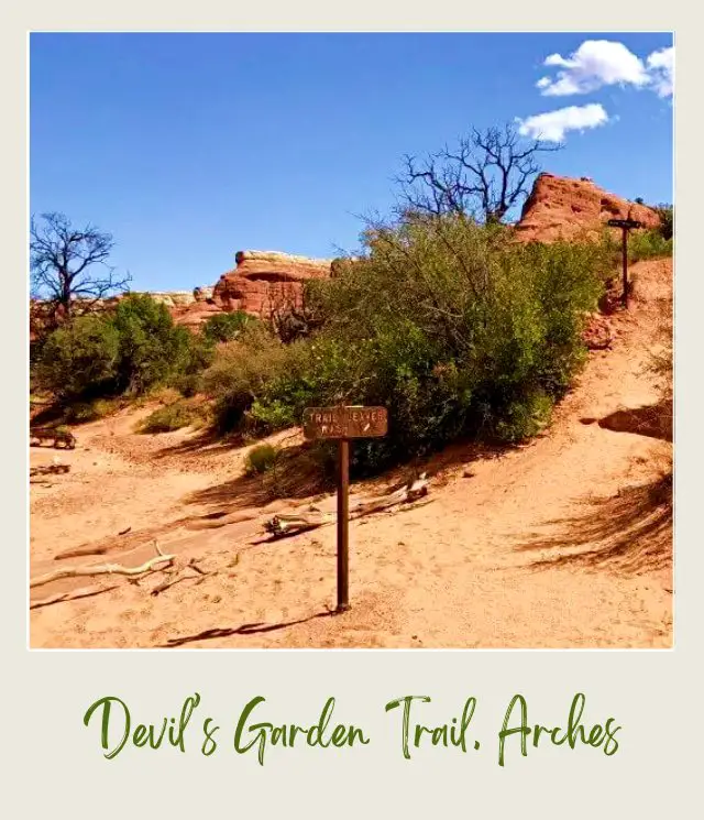
This is the end of Fin Canyon.
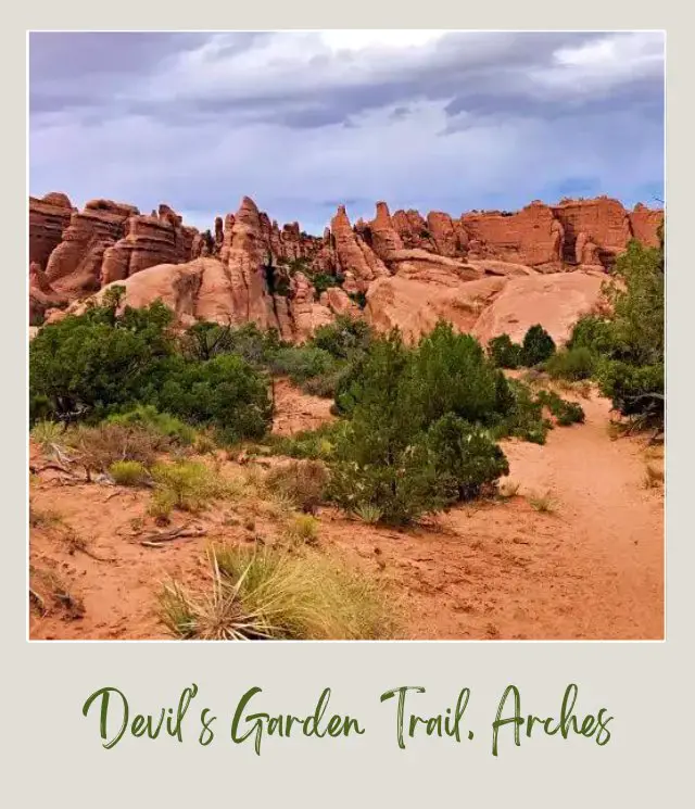
The last half an hour or so until you get back to the main trail is open and you can see the fins off to one side and in the distant.
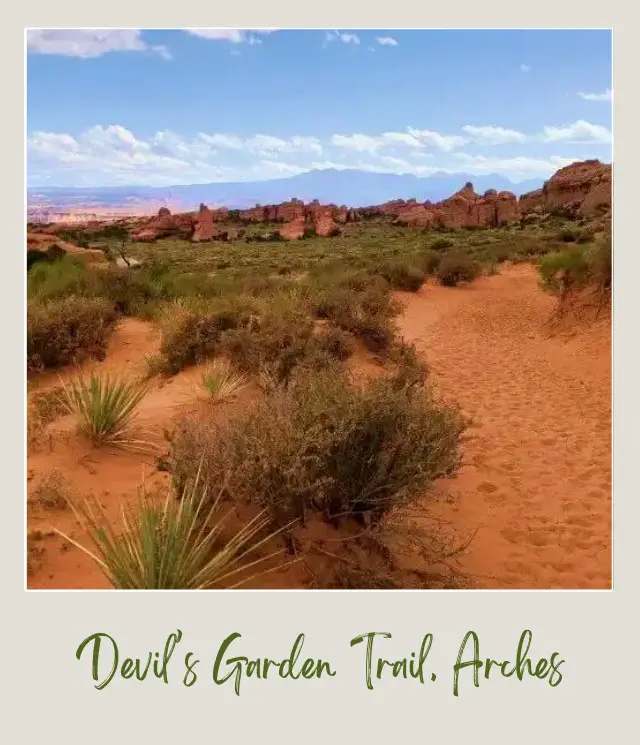
Nearing the end of the trail
The brush and open expanse are very different from the enclosed canyon. The trail, however, is mostly sand, which is hard going when you are getting tired.
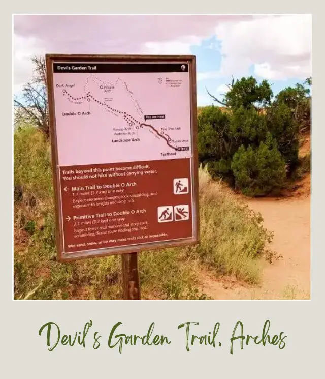
From there it is only about another twenty minutes along an easy path back to the parking lot. It is a little strange to see so many people, as many people are on the easy Landscape Arch trail.
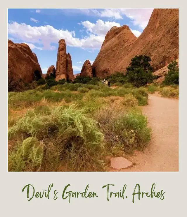
I started at 8:00am and got back at 2:00pm. So, six hours in total.
Learning all about the Devils Garden hike is a great thing to do, because it will make the hike so much easier and more enjoyable.
However, it’s just one of the many amazing hikes in Arches National Park. And it can be really difficult to know what they all are and how to put them all together for your trip.
As you can see, there’s a lot to know about this one hike alone.
It’s even harder to coordinate all the other hikes you want to do and all the other things to see and do in Arches into an itinerary that actually makes sense – so you’re doing the hikes and activities you want to do and seeing all the arches you want to see at the right time of day, joining them all together in a logical order, and managing all the logistics that makes them happen.
To help take away the overwhelm of planning a trip to Arches National Park, I’ve created several super detailed itineraries .
There are 1-day and 2-3-day options: all with detailed hour-by-hour schedules, including alternatives for different activity and fitness levels, plus trail maps and descriptions, driving instructions, important information, essential tips, and everything else you need to make the most of your time in Arches National Park.
The itineraries will help you make the most of whatever time you have available. The hike to Landscape Arch is included on the 1-day itinerary, and the 2-day itinerary gives you time to hike the entire Devils Garden. And there are options built in for you if you prefer not to do the entire hike.
Verdict: Devil’s Garden Hike, Arches National Park
Arches National Park has many great hikes, but this is my favorite. It’s a cool combination of eight arches, fantastic fins and lots of diverse interactive hiking like scrambling, narrow ridges and sandy washes. If you’re fit and up for a challenge, I highly recommend this hike.
Happy hiking!
Subscribe to monthly updates with tips for planning, travel inspiration and trip ideas and get instant access to the free PDF of this
Guide to the Devil’s Garden Hike
Additional Planning Resources for Arches National Park
⭐ Planning a Trip to Arches National Park: 7 Mistakes to Avoid
⭐ How Many Days in Arches National Park Do You Need?
⭐ Guide To The Arches National Park Reservations System
⭐ The 10 Best Hikes in Arches National Park
⭐ 10 Tips For Visiting Arches National Park
⭐ Arches Scenic Drive: Complete Guide to All the Stops
⭐ How To Get To Arches National Park
⭐ What Is The Closest Airport To Arches National Park?
⭐ All the Airports near Arches National Park
⭐ When is the Best Time to Visit Arches National Park?
⭐ Visiting Arches National Park: What To Expect Throughout the Year
⭐ 12 Fun Facts About Arches National Park
⭐ Arches Itinerary
⭐ The Best Airbnb Moab
⭐ The Best Books About Arches National Park
Do you have any stories of Arches National Park or additional tips for the Devil’s Garden Trail that should be included? I’d love to hear them. Join my private Facebook group National Parks Collectors and comment and let me know.
💡 Are you just starting to think about taking a national parks trip? Get Inspiration
‼️ Are you looking for helpful tips for visiting US national parks? Read articles that share useful tips on a range of national-park related issues
💻 Are you starting to plan a trip to Arches National Park? Read my Guide to Arches National Park
📋 Do you want a ready-made super detailed plan for your trip to Arches? Get a detailed 1 – 3-day Arches National Park Itinerary
🛏️ Are you looking for a place to stay near Arches National Park? Find a vacation rental near Arches National Park
💲 Are you ready to book your trip? Use these Planning and Booking Resources
📖 Do you want to read a book about Arches National Park? Check out my Recommended Reading List for Arches National Park
If you liked this trail guide, Pin it to your Hikes and National Parks boards!
About the Author
James Ian is a national park, camping and hiking expert.
He has dedicated his life to travel, visiting more than 80 countries, all 7 continents and most of the national parks in the United States. With over 35 years experience in the travel industry, James has worked on cruise ships, at resorts and hotels, and as a travel planner who’s helped hundreds of people plan successful trips to US national parks.
Based on his experience visiting our national parks multiple times, in-depth research and expertise as a travel planner, James has published detailed itineraries for many of the major national parks in the US. These itineraries, as well as in-depth park guides, and other resources will help you have your own incredible trip to US national parks without stress and hassle.
As a national park expert, James has contributed to many publications, including USA Today, Newsweek, Time Business News, Savoteur, Best Trip, and Wired.
I’m a member of the Amazon Services LLC Associates Program. As an Amazon Associate I earn from qualifying purchases.
