There are several distinct sections to Yellowstone National Park, each with their own attractions. They are connected by roads that form a Figure ‘8’ – the Grand Loop Drive.
You’ll certainly want to get out and do some hikes, visit waterfalls, see famous sites like Old Faithful and Grand Prismatic Spring, but the time spent in your vehicle is not wasted. There are several scenic drives in Yellowstone Park that will be a highlight of your visit there.
Read on to discover all the best scenic drives in Yellowstone National Park.
If you’re planning to visit Yellowstone National Park by yourself, make your planning easy and stress free with a detailed itinerary. I have 1-, 2-, 3- and 4-day itineraries for Yellowstone National Park that include all the park highlights, give you choices based on your preferred activity level, and take all the stress out of planning your trip.
Watch the best Yellowstone scenic drives on video:
🔔 You can also watch this video on YouTube directly (opens in new tab).
🎙️ Or listen as a podcast:
🛏️TOP HOTEL PICK: Check availability now
🚘FIND THE CHEAPEST CAR RENTAL: Search Discover Cars for the best deals
✈️FIND THE CHEAPEST FLIGHTS: Search Skyscanner for the best deals
🧳GET TRAVEL INSURANCE: Get insured with Travelex before you go
📱TAKE AN AUDIO TOUR: Buy an audio tour now
Table of Contents
The 10 Top Yellowstone Scenic Drives
Subscribe to daily national parks planning tips, travel inspiration and trip ideas and get instant access to the free PDF of the Yellowstone Scenic Drives
1. Lamar Valley
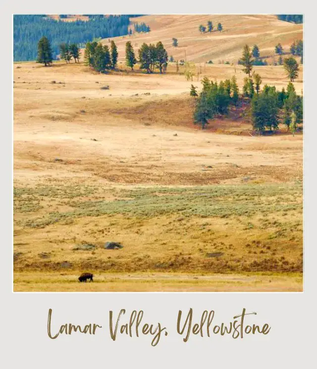
Yellowstone National Park is often nicknamed “America’s Serengeti”. The national park is home to more than 200 species of animals and the most common place to see them is Lamar Valley.
The valley is not that big – it’s about 28 miles from the turnoff near Roosevelt Lodge to the park’s Northeast Entrance – but it’s widely considered the best place in Yellowstone to see wildlife. Not only is it home to wolf packs and herds of bison, but if there is one place in the entire national park where you may see all the park’s “Big Five” – wolves, bison, bears (grizzly or black), elk and moose – then this is it. Other animals you can see include pronghorns and bighorn sheep.
There are numerous pullouts alongside the road where you can stop and see wildlife.
Length
28 miles
How to get there
In the warmer months, you can enter Lamar Valley from the Northeast Entrance of Yellowstone National Park near Cooke City, Montana. Drive west on Northeast Entrance Road and you’ll enter Lamar Valley after 10 miles.
If you’re coming from the west, either enter Yellowstone at the North Entrance and then follow the Grand Loop Road to Tower Junction near Roosevelt, or, if you’re coming from the south, follow the Grand Loop Road in either direction to Tower Junction. The western end of Lamar Valley starts at Tower Junction.
Route 212 (Northeast Entrance Road) runs along the length of the valley.
Highlights
✳️ Wildlife
To know
‼️ The best time to see wildlife is dawn and dusk, so this is the best time to do this drive.
‼️ This road is one of the few roads in Yellowstone that remain open to regular vehicular traffic all year. however, there is no access from the east over the Beartooth Highway in winter, so you need to drive from and back to Gardiner at the park’s North Entrance in winter.
Read More:
➡️ Guide to Lamar Valley
➡️ The 21 Most Scenic Drives in The United States
2. Firehole Canyon Drive
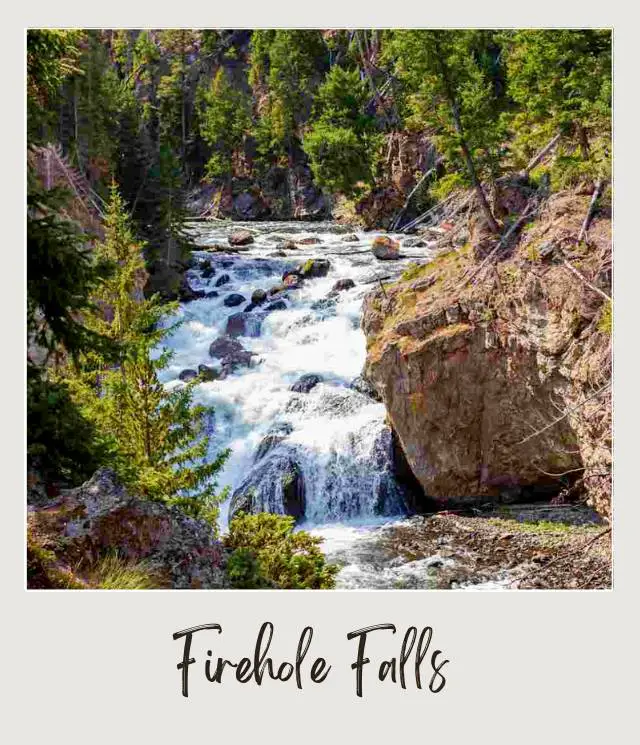
This short scenic drive is a one-way loop that runs roughly parallel to the Grand Loop Road, heading south. It’s a beautiful drive through the small Firehole Canyon beside the Firehole River, passing several geysers along the way. The canyon is formed from dark rhyolitic rock and has been carved by the Firehole River. There are several pullouts along the way to stop and take photos.
The highlight is the 40-foot Firehole Falls. There’s a small parking area near the falls where you can get out and take photos safely.
One of only two places that you can swim in Yellowstone is also along this drive past the falls. There are changing rooms near the road. Despite the name of the river, the water is not hot – in fact it is fed by snow melt that is very cold.
Length
2-mile one-way loop
How to get there
Take the main road Highway 191 heading east out of West Yellowstone for 14.5 miles to Madison Junction. Turn right heading south. After 0.6 miles, you’ll see a small sign for the Fire Canyon Drive on your right. This is the start of the drive.
Highlights
✳️ Firehole Falls
✳️ Swimming area
To know
‼️ The parking area near the falls is quite small and on the opposite side of the road from the falls, so it’s good to go here early in the morning before it gets too crowded.
‼️ There are no lifeguards at the swimming area. The swimming area may be closed if the water level is too high, typically in spring. Check the NPS website for closures and for additional rules.
‼️ Large vehicles and RVs are restricted because of limited parking and a narrow road, so if you have an RV, you may need to skip this drive.
➡️ Read More: Best waterfalls in Yellowstone
3. Firehole Lake Drive
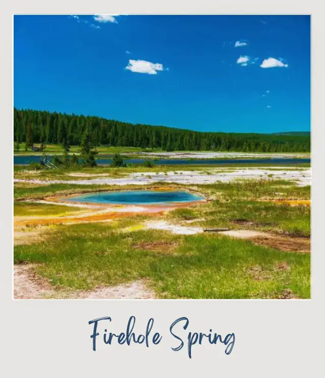
This drive is also a loop off the main Grand Loop Road. It passes several hot springs and geysers.
At the first pullout on the left, you can stop and see Firehole Spring, a blue pool rimmed with orange. At the next pullout, also on the left, is the deep blue Surprise Pool.
Next up is Great Fountain Geyser, which erupts every 8-12 hours. Eruptions average over 100 feet and can last 45-60 minutes.
Further along is White Dome Geyser. Its white dome is obvious and it erupts every 10 minutes to 3 hours (typically every 15-30 minutes), so this is a reliable – and picturesque – geyser to see.
A little further along is Pink Cone geyser. It erupts every 6-48 hours and typically lasts between 30 minutes and three hours.
Then you’ll come to the drive’s namesake, Firehole Lake. This is a good place to get out and explore. There is a boardwalk around Firestone Lake and is worth the short walk. In the same area, you can also visit Black Warrior Lake, which is across the road, and the nearby Steady Geyser and the tiny Hot Cascades.
Length
3 miles, one way
How to get there
Firehole Lake Drive is a one-way road heading north off the Grand Loop Road between Old Faithful and Madison. It loops back to the main road in a counter-clockwise direction. The turnoff is 6.8 miles north of the Old Faithful Interchange and 9.3 miles south of Madison Junction. It’s south of the Fountain Paint Pots and north of the Midway Geyser Basin.
Highlights
✳️ Geysers
✳️ Boardwalk walk around Firestone Lake
To know
‼️ RVs and trailers are not permitted because the road is narrow.
➡️ Read More: How Many Days to Spend in Yellowstone
4. South Rim of the Grand Canyon of the Yellowstone
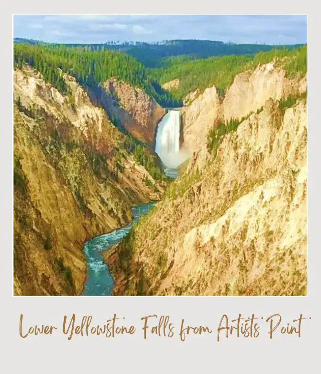
The Canyon area of Yellowstone is famous for two things – the colorful and truly spectacular Grand Canyon of the Yellowstone and the stunning Yellowstone Falls.
Yellowstone Falls are split into two tiers, the 108-foot Upper Falls and the Lower Falls, which, at 308 feet tall, are more than double the height of Niagara Falls. They are 0.25 miles apart and because of a bend on the river, can’t actually be seen together. You can see the falls from both the north and south rims of the canyon and you can drive along both rims.
The South Rim Drive goes from near Canyon Village to Artists Point, where it dead ends, so you need to drive back the way you came.
0.6 miles after leaving the Grand Loop Road, you come to a turnoff on your left to Uncle Tom’s Point. There is a large parking area here. This is the trailhead to Uncle Tom’s Trail and the viewing area for the Upper Falls, which is just across the parking lot from where Uncle Tom’s Trail starts. The Upper Falls may be shorter than the Lower Falls, but they are still very impressive.
Continue along the South Rim Drive for another mile to the end of the road. There is a large parking area here. A short walk takes you to Artists Point, the most famous – and popular – place to photograph the Lower Yellowstone Falls with the canyon in the foreground.
Length
1.5 miles each way
How to get there
From the Canyon Village parking lot, turn left. Soon after, you’ll get to Canyon Junction. Turn left towards Yellowstone Lake. 2.3 miles down the road is the turnoff to the South Rim Drive.
Highlights
✳️ Upper Yellowstone Falls
✳️ Artists Point
To know
‼️ Uncle Tom’s Trail is currently closed (and has been for ages)
‼️ Artist’s Point is extremely popular. Get here early if you can.
➡️ Read More: 1-4-Day Itineraries for Yellowstone
5. North Rim of the Grand Canyon of the Yellowstone
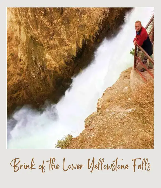
The North Rim is longer than the South Rim, forming a long one-way loop off the Grand Loop Road.
There are several viewpoints along the north rim. There are also a couple of hikes that take you down below the canyon rim to truly amazing views of Lower Yellowstone Falls, but they are steep, with lots of steps and/ or switchbacks, so you need a reasonable level of fitness.
0.2 miles after you enter the drive, there is a parking lot for the Brink of the Lower Falls on both sides of the road. The Brink of Lower Falls Trail takes you to a viewing platform that is perched right at the very top of the Lower Falls, so you see the true power of the water as it plunges over the edge. There are also great views down the canyon. The trail is steep – it descends more than 300 feet in 0.4 miles down a series of switchbacks.
Another 0.4 miles along is another smaller parking area on the right, this one for Lookout Point, where there are views of the Lower Yellowstone Falls. This is also the trailhead for the Red Rock Point Trail, which descends 260 feet in 0.3 miles to a point next to a red rock inside the canyon with breathtaking views of the Lower Falls.
Continue along the North Rim Drive for more canyon/ waterfall views at Grand View (0.9 miles from the start) and Inspiration Point, which is along a short spur road off to the right (1.3 miles from the start). 2 miles from the start, you’ll get to the Canyon Village parking area on your left. There is a large Visitor Center here, as well as restaurants and a shop.
Length
2.2 miles
How to get there
The North Rim Drive is a one-way loop off the Grand Loop Road at the most northern section of the east side of the southern loop. If you’re coming from Norris, turn right at Canyon Junction. If you’re coming from Roosevelt, continue straight at Canyon Junction.
The start of the loop is 1.2 miles south. If you’re coming from the south, the turn off is 1.2 miles before you get to the main Canyon Junction intersection. The loop road ends at the four-way Canyon Junction.
Highlights
✳️ Views of the Lower Falls
✳️ Views of Grand Canyon of The Yellowstone
To know
‼️ The parking area at Lookout Point is small and this area is popular. You may need to wait until someone leaves. An alternative is to stay parked at the Brink of the Lower Falls and walk along the north rim trail to Lookout Point (15 minutes each way).
‼️ The Brink of the Lower Falls and Red Rock Point Trails are both steep and strenuous. If you have mobility or fitness difficulties, it is probably better to stick to the viewpoints along the rim of the canyon.
➡️ Read More: 1-4-Day Itineraries for Yellowstone
6. Dunraven Pass
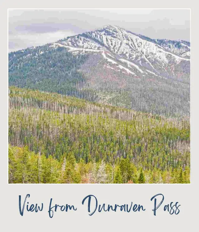
At 8,859 feet, Dunraven Pass is the highest mountain pass in Yellowstone National Park. It’s on the Grand Loop Road near Mount Washburn, the highest peak in the park. The pass is named after Earl Dunraven (well, technically it is named after nearby Dunraven Peak, which was named after Earl Dunraven).
The road proceeds up (and down) a series of switchbacks until it gets to the top of the mountain pass. There is a pullout where you can stop safely to take photos of expansive panoramic views over the surrounding mountains.
Length
The section of the Grand Loop Road between Tower Junction and Canyon Junction is 18.3 miles
How to get there
Dunraven Pass is on the Grand Loop Road between Tower Junction to the north and Canyon Junction to the south.
Highlights
✳️ Panoramic views
✳️ Mount Washburn Trail
To know
‼️ The NPS will often close the pass temporarily if there is any snow, which can happen as early as the beginning of September.
➡️ Read More: Best Hikes in Yellowstone
7. Mammoth Hot Springs Upper Terraces
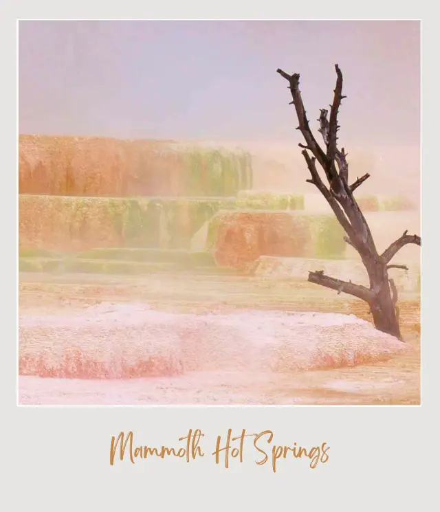
The Mammoth Hot Springs area of Yellowstone National Park is different from the rest of the park. Here you’ll find incredible terraces and other formations made from travertine limestone deposited by mineral springs and colored with thermophiles (heat-loving bacteria).
Most of the terraces can be best seen on a series of boardwalks from the Lower terrace. On the Upper Terraces, you can drive (or walk, if you prefer), past some smaller terraces and several incredible travertine formations.
Soon after you start the drive, there is a small parking lot on your right. You can park here to access the boardwalks, including the gorgeous Canary Spring.
Back in your car, the first main point of interest is Cheops Pyramid, off to your right. This is a picturesque, vaguely pyramid-like series of small terraces. Soon after is the uninspiring Prospect Terrace, then New Highland Terrace on your left, which looks a bit like a frozen waterfall.
Next up is Orange Spring Mound. There is a short wheelchair-accessible boardwalk around the end of the large colored mound.
Across from the now drained Bath Lake on your left is the lovely Aphrodite Terrace on your right. These classic travertine terraces are dripping and encrusted with golden colors.
Next up is White Elephant Back Terrace which, due to the lack of thermophiles, is mostly white. The last main point of interest on the drive is Angel Terrace.
Length
1.5-mile one-way loop
How to get there
The drive is a one-way loop off the most northern part of the western section of the northern loop, between Mammoth Hot Springs and Morris.
If you’re driving from Mammoth Hot Springs, head south from the hotel and drive past the lower terraces and up the hill for two miles. The Upper Terraces Drive is on your right.
If you’re coming from Norris in the south, the terraces are on your left two miles before the Grand Loop Road turns east towards Roosevelt.
Highlights
✳️ Travertine terraces
✳️ Unusual travertine formations
To know
‼️ RVs, buses and trailers are not allowed on this road.
‼️ Parking at the formations can be tricky in peak season; it is also possible to hike this road.
➡️ Read More: Vacation rentals in Gardiner and West Yellowstone
8. Hayden Valley
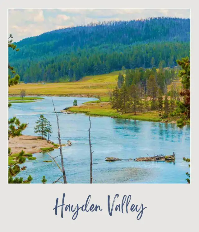
Hayden Valley is the other main area (in addition to Lamar Valley) to see wildlife such as bison, wolves, bears, and trumpeter swans. I’ve actually seen more bison here than in Lamar Valley. Not surprising, perhaps, given that Hayden Valley is home to the largest herd of free roaming bison in the world.
Heading south from Canyon Village, the road hugs close to Yellowstone River as you enter the valley. Near the Alum Creek Trailhead at the bottom of a small hill just before Hayden Valley Overlook, there is a calm bend in the river where I’ve often seen trumpeter swans.
Three miles further along, there is another well-marked pullout with views of the valley at Trout Creek. Another 0.7 miles is Yellowstone River Overlook. Both of these are good places to potentially see wolves.
A further 1.2 miles down the road is a parking lot on your right for the Mud Volcano area, near the southern end of Hayden Valley. There is a series of boardwalks, including a loop uphill to Sour Lake. This a major geothermal area and you can see the angry waters of Churning Cauldron; steam coming out of Dragon’s Mouth Spring; Grizzly Fumarole; and more.
There is also a very good chance that you’ll see bison here, especially early in the morning. I’ve encountered a herd of bison that completely surrounded the boardwalk – in fact they walked on it in part – blocking off the loop, but making a very nice addition to the geothermal features.
Length
Hayden Valley is approximately seven miles long.
How to get there
Hayden Valley lies mostly to the west of the Yellowstone River, between Yellowstone Lake to the south and Canyon to the north. The valley forms part of the lower loop of the Grand Loop Road.
To get there, if you’re coming from Yellowstone Lake, continue north along the Grand Loop Road. From Fishing Bridge, turn right on to the Grand Loop Road. From Canyon Village, turn left at Canyon Junction and head south along the Grand Loop Road.
Highlights
✳️ Wildlife
✳️ Mud Volcano geothermal area
To know
‼️ It’s worth getting to Hayden Valley early in the morning to have the best chances of seeing animals and birds.
‼️ As with Lamar Valley, the best strategy is to stop wherever you can, ask everyone you meet and keep your eyes peeled.
‼️ Binoculars or spotting scopes and a zoom lens are helpful.
➡️ Read More: The Best Spotting Scope for Wildlife Viewing
9. Beartooth Highway
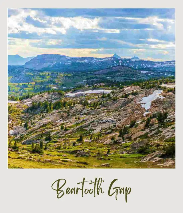
This is technically not inside Yellowstone National Park, but is widely considered one of the most beautiful scenic drives in the country and starts/ ends near the Northeast Entrance to the park. It’s also the only way to get to the park’s Northeast Entrance from the east.
The road winds its way for 56 miles from the Northeast Entrance to Beartooth Pass before starting its descent to Red Lodge, MT, a further 31 miles away. If you’re driving this as a day trip from Yellowstone, then the pass is a logical place to turn back. From the pass, you can see the famous Bear’s Tooth and breathtaking mountain views.
Beartooth Pass is at an altitude of 10,947 feet, so it is very prone to winter weather, even when it isn’t winter. In (the brief) summer, wildflowers burst into bloom in the area.
Along the way, there are incredible mountain views as the road passes through several ecosystems from Lodgepole pine forests to alpine tundra. Stop off at Beartooth Lake (23 miles from Cooke City) along the way. You could also have a picnic lunch at the Clark’s Fork Picnic Area (3 miles from Cooke City).
Length
86 miles from Yellowstone’s Northeast Entrance to Red Lodge, MT
How to get there
Coming from the west, continue through Lamar Valley along Highway 212. This goes right through Cooke City – Silver Gate and becomes the Beartooth Highway.
Highlights
✳️ Mountain views, including the famous Bear’s Tooth
✳️ Beartooth Pass
✳️ Beartooth Lake
To know
‼️ The road is officially open from Memorial Day to mid-October, but can be temporarily closed at other times of the year, especially in spring and fall. Check for current conditions. The road is closed completely for the winter season.
Read More:
➡️ Winter Guide to Yellowstone
➡️ How To get To Yellowstone National Park
10. Grand Loop Road
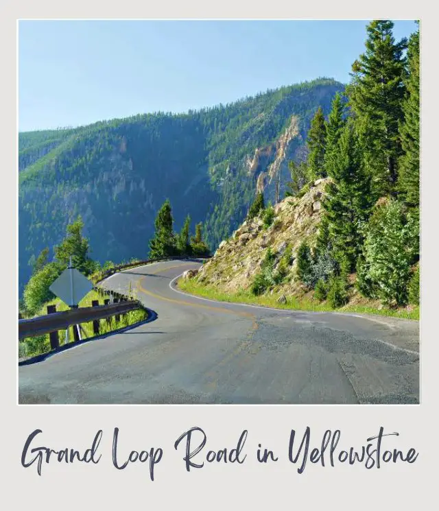
The Grand Loop Road is both the way to get around the national park and a scenic drive. Yellowstone National Park is huge and has several distinct areas – all of them are connected by the Grand Loop Drive, which is basically a large figure 8. Several of the other scenic drives on this list form part of the Grand Loop or are short loops off the side of the main Grand Loop.
Starting from West Yellowstone, you’ll hit the Grand Loop Road at Madison. Driving north, you’ll come to Norris and Norris Geyser Basin. You can cut across the middle of the figure 8 to Canyon Junction or continue up the western side of the Upper Loop to Mammoth Hot Springs and the Upper Terraces Drive.
Continue along the top of the Upper Loop to Roosevelt Lodge and Tower Junction, the start of the Lamar Valley Drive. At the far end of Lamar Valley is the beginning of the Beartooth Highway.
Turn south down the eastern side of the Upper Loop over the Dunraven Pass to Canyon Junction.
You can cut back across the middle of the figure 8 to Norris or continue south. Just south is the Grand Canyon of the Yellowstone’s North Rim and the South Rim. Further along, you’ll drive through Hayden Valley.
The Lower Loop continues along the shore of Yellowstone Lake to West Thumb where you can exit and turn south towards Grand Teton National Park.
The southern section of the Lower Loop continues to the Old Faithful area. North of this is the Firehole Lake Drive off the right. Just before you get back to Madison, you’ll find the Firehole Canyon Drive on your left.
Length
142 miles
How to get there
You can connect with the Grand Loop drive from any of the five entrances to Yellowstone National Park
Highlights
✳️ The road connects all of Yellowstone’s attractions
To know
‼️ Driving the Grand Loop always takes longer than the time given on Google maps. Allow extra time. Traffic can be slow; there is lots to see along the way – and plenty of places to stop and get out of your vehicle; and it is not uncommon for herds of bison to walk down the road, which causes all traffic to stop and build up.
‼️ Always check with the NPS for current conditions and any road closures
‼️ The only section of the Grand Loop Road that is open year-round is the section between Mammoth Hot Springs and Tower Junction (along with the road between Gardiner and Mammoth and the road from Tower Junction through Lamar Valley to Cooke City-Silver Gate). The remainder of the road is open to oversnow travel only, in the winter months.
➡️ Read More: The Best Time to Visit Yellowstone
Map of the Best Drives in Yellowstone National Park
10 Tips for Driving in Yellowstone
1. ‼️ Get an early start
The national park gets very crowded, especially in summer, and you don’t want to spend long parts of your drives at an (unintended) standstill.
2. ‼️ Allow more time than you think you’ll need
There are plenty of places to stop and take in the sights. And there may be some forced stops – herds of bison often prefer to use the roads and cause traffic jams.
3. Be aware of the season
Yellowstone is open all year, but not all of the roads are. All the drives listed here are available (temporary closures notwithstanding) from April/ May (depending on the road) to the end of October. Only the Lamar Valley Drive is open to regular vehicular traffic in winter.
➡️ Check my Guide to Winter in Yellowstone and the NPS website for more information about winter road closures.
4. ‼️ Check for temporary road closures
Current weather conditions or road works can cause delays or even closures. Check the NPS website for current information.
5. ‼️ Take binoculars and/ or a spotting scope
There is a good chance of seeing wildlife throughout the national park, but you need to keep a safe distance and the animals may be some distance from the road.
For most people, a good pair of binoculars will be enough.
➡️ If you need to get some, I’ve written a whole guide about the best binoculars for the money. My top picks are the Vortex Optics Diamondback 10×42 Roof Prism Binoculars.
➡️ Check the current price here.
However, if you really want to see the animals up close, you should invest in a good quality spotting scope and tripod. They have an amazing image quality and zoom capabilities and will generally give better quality wildlife viewing than binoculars.
➡️ For more information on spotting scopes, including what to look for and my top picks, read my Buying Guide to Spotting Scopes for Wildlife Viewing.
My pick for the best Spotting Scope for Yellowstone is the Swarovski Optik HD-STS-80 HD Spotting Scope with 20×60 Eyepiece – get it here.
6. ‼️ Invest in a good quality camera and zoom lens
If you’re serious about wildlife photography, you will want a super strong (and bulky) zoom lens. If you just want good shots but don’t want to lug around tons of camera equipment, an option is to use your spotting scope (you’ll need a tripod) as a kind of zoom lens. As long as you line the lens of your camera up carefully with the spotting spot viewing lens, you can actually take good pictures this way. For more active shots, I love the GoPro Hero 12.
7. ‼️ Have a plan
The park is big and you want to maximize your time there. You’ll need at least four days in the park to drive all ten of these scenic drives. Yellowstone National Park is big and there are plenty of other things to do as well.
➡️ I recommend getting my super detailed, hour-by-hour 4-day Yellowstone Itinerary to make sure you maximize your time and take the stress out of your planning. ➡️ Get it here.
8. ‼️ Consider taking a tour
The good thing about driving yourself is that you can go at your own pace. The bad thing is that one of you is driving and has to focus on the road. The big advantage to a tour is that everyone in your party can sit back and enjoy the views and the chances to see wildlife.
A private tour is hard to beat. It’s not cheap, but the fact that you can all sit back and enjoy the views AND go at your own pace makes it well worth it. A full-day tour of the Upper Loop takes you through Lamar and Hayden Valleys.
➡️ Book a private full-day tour of the Yellowstone Upper Loop here
A full day tour of the Lower Loop takes you through Firehole Canyon and around the lower half of the Grand Loop, with frequent stops at the geysers and colorful hot springs in this section of the park.
➡️ Book a private full-day tour of the Yellowstone Lower Loop here
9. ‼️ Get a self-guided audio tour
For a small fee, you can download an audio tour that gives key information at various places along your drives.
➡️ Get the self-guided audio driving tour of Yellowstone here
10. ‼️ Don’t stop in the middle of the road
There are multiple pullouts along the roads. These are the only safe spots to stop. (The exception is if you need to stop because animals are on the road in front of you, of course).
Enjoy these drives in Yellowstone!
More Planning Resources for Yellowstone National Park
⭐ Yellowstone National Park Guide
⭐ Yellowstone Itineraries
⭐ 7 Mistakes to Avoid
⭐ How Many Days in Yellowstone National Park?
⭐ Guide To Camping In Yellowstone National Park
⭐ How to Visit Yellowstone in Winter
⭐ Best Things To Do In Yellowstone National Park
⭐ Tips For Visiting Yellowstone National Park
⭐ Lamar Valley Scenic Drive
⭐ Best Waterfalls in Yellowstone National Park
⭐ Best Hikes in Yellowstone National Park
⭐ Grand Prismatic Spring Overlook Trail Guide
⭐ Best Time to Visit Yellowstone National Park
⭐ Visiting Yellowstone Throughout the Year
⭐ How To Get To Yellowstone National Park
⭐ All The Airports Near Yellowstone National Park
⭐ The Closest Airport to Yellowstone National Park
⭐ 10 Fun Facts about Yellowstone National Park
⭐ Best Books about Yellowstone National Park
⭐ Vacation Rentals Near Yellowstone National Park
⭐ Yellowstone Packing List
What’s your favorite Yellowstone scenic drive? I’d love to know. Join my private Facebook group National Parks Collectors and comment and let me know (you can also pick up extra planning tips, share your photos and stories with other national park lovers and more).
Subscribe to daily national parks planning tips, travel inspiration and trip ideas and get instant access to the free PDF of this
Yellowstone Scenic Drives
If you liked this article, Pin It to your Yellowstone National Park board!
💡 Are you just starting to think about taking a national parks trip? Get Inspiration
‼️ Are you looking for helpful tips for visiting US national parks? Read articles that share useful tips on a range of national-park related issues
💻 Are you starting to plan a trip to Yellowstone National Park? Read my Guide to Yellowstone National Park
📋 Do you want a ready-made super detailed plan for your trip to Yellowstone? Get a detailed 1 – 4-day Yellowstone National Park Itinerary
🛏️ Are you looking for a place to stay in or near Yellowstone National Park? Find a vacation rental near Yellowstone National Park or ⛺ Find a campground inside Yellowstone National Park
💲 Are you ready to book your trip? Use these Planning and Booking Resources
📖 Do you want to read a book about Yellowstone National Park? Check out my Recommended Reading List for Yellowstone National Park
About the Author
James Ian is a national park, camping and hiking expert.
He has dedicated his life to travel, visiting more than 80 countries, all 7 continents and most of the national parks in the United States. With over 35 years experience in the travel industry, James has worked on cruise ships, at resorts and hotels, and as a travel planner who’s helped hundreds of people plan successful trips to US national parks.
Based on his experience visiting our national parks multiple times, in-depth research and expertise as a travel planner, James has published detailed itineraries for many of the major national parks in the US. These itineraries, as well as in-depth park guides, and other resources will help you have your own incredible trip to US national parks without stress and hassle.
As a national park expert, James has contributed to many publications, including USA Today, Newsweek, Time Business News, Savoteur, Best Trip, and Wired.
I’m a member of the Amazon Services LLC Associates Program. As an Amazon Associate I earn from qualifying purchases.
