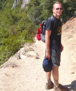
Arizona is a great place for winter hiking.
Parts of the state are at a high altitude and get snow in winter. Seeing these areas covered in snow is magical, and most areas don’t get so much snow that hiking is impossible, so you can really enjoy the winter wonderland scenery.
The southern and lower regions in Arizona may not get snow, but are nonetheless at their best in winter. Hikes that are intolerable in the summer heat are super fun in the cooler winter months.
This all makes Arizona a really great winter vacation destination.
With the help of some fellow travel experts, I’ve compiled all the best hikes in Arizona in winter.
No time right now to read about the best winter hikes in Arizona? Pin It and save it for later:


Subscribe to regular updates with tips for planning, travel inspiration and trip ideas and get instant access to the free PDF of this
Best Winter Hikes in Arizona
Before we look at all these amazing hikes, a quick word about what to take with you when hiking in winter.
First up, be sure to check my Winter Hiking Gear Essentials to make sure you have everything you need.
To hike in the snow, you need to have good winter hiking boots and Microspikes or crampons. If you are looking for hiking boots, read my Guide to the Best Hiking Shoes/ Boots. You can find the Best Winter Hiking Boots for Men here and the Best Winter Hiking Boots for Women here.
Microspikes are a web of sharp spikes that you put over the bottom of your hiking boots. Crampons are similar, but have a firm spiked surface that attaches to the bottom of your hiking boots. Both of them grip into the ice or packed snow and give you the traction you need to safely walk on otherwise slippery surfaces.
I used to hate winter hiking because I was always afraid of slipping over. As soon as I bought some Microspikes, that changed completely. Now I love hiking in winter – and feel safe doing so.
Read my Guide to the Best Hiking Microspikes.
Buy my favorite Microspikes (the Kahtoola MICROspikes) here
Table of Contents
1. Grand Canyon Rim Trail, Grand Canyon National Park
Length: 13 miles
Difficulty: Easy
Trailhead: The Rim Trail stretches from the South Kaibab Trailhead in the east through Grand Canyon Village to Hermits Rest in the west. You can join it anywhere along the way.
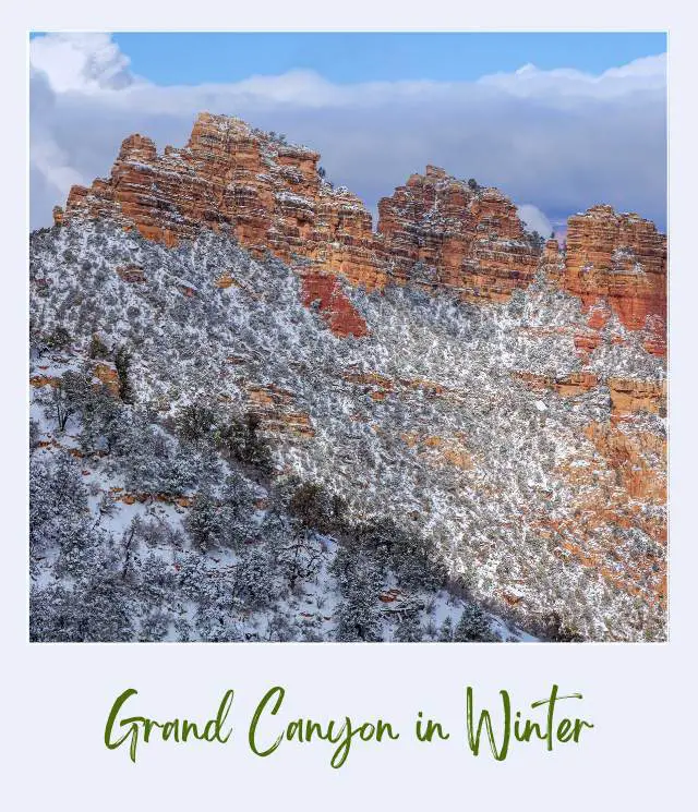
The hike along the south rim of Grand Canyon is one of the most scenic hikes in Arizona. It’s long, but fairly flat and easy and mostly paved, and you can drive part of the way in winter.
Starting in the east, the first viewpoint after the South Kaibab Trailhead is Pipe Creek Vista, then Mather Point and Yavapai Point. A small geological museum there provides plenty of fascinating information about the canyon. If you have good binoculars, you can see Phantom Ranch from here. Read my Guide to The Best Binoculars for The Money if you need to get a pair (recommended!)
To the west of Grand Canyon Village, Trailview Overlook offers good views of the Bright Angel Trail snaking its way down into the canyon. Then there’s Maricopa Point and soon after Powell Point, where the paved section ends until Monument Creek Vista.
Next up is Hopi Point, then Mohave Point which is a great sunset spot, then The Abyss. Further along the rim trail is Monument Creek Vista where the pavement starts again. At Pima Point, you can see (and hear) the Colorado River. The trail ends at Hermit’s Rest, where there is a small gift shop.
Why Winter?
There are a lot fewer visitors in the winter. Although it’s cold, the canyon is especially beautiful when the upper reaches are dusted with snow.
Insider Tips:
‼️ You can drive all or part of the way (there is a shuttle in the warmer months) if you don’t want to hike the full length, but still want to see the views.
Highlights:
✳️ Multiple viewpoints of the canyon
➡️ READ MORE: Guide to the Grand Canyon
2.Bright Angel Trail, Grand Canyon National Park
Length: 19.8 miles round trip
Difficulty: Strenuous
Trailhead: Bright Angel Lodge, south rim
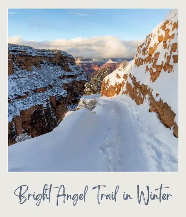
The Bright Angel Trail is one of the most famous hikes in Arizona. The hike takes you from the south rim all the way down to the Colorado River at the bottom of the canyon.
Grand Canyon’s north rim, which is higher than the south rim and therefore gets a lot more snow, is closed in winter, but the south rim is open year round. The rim can get a dusting of snow, so the upper section of the trail may be snowy or icy, but as you descend, you will leave the snow and ice behind.
The trail descends through four sets of switchbacks, with stops along the way at the aptly named 1.5-Mile Resthouse and 3-Mile Resthouse, as well as Havasupai Gardens (formerly called Indian Garden). This is the half-way point, and the last place to turn around if you are doing the hike in just one day.
If you have managed to secure a bed at Phantom Ranch, continue down the last switchbacks to the river and across a narrow suspension bridge to the ‘ranch’.
The trail is one of the best winter hikes Crand Canyon visitors can do. Being below the rim of the canyon gives you a whole other perspective of the size and grandeur of the canyon.
Why Winter?
Space at the bottom of the Grand Canyon is limited, so you need to enter a lottery to get a cabin. Winter has fewer crowds, which means that reservations for Phantom Ranch are easier to get. Plus, temperatures are lower, and the canyon is beautiful when the upper reaches are covered in a dusting of snow.
Insider Tips:
‼️ It’s too far to hike to Phantom Ranch and back up in one day. Reserve a spot at Phantom Ranch 15 months in advance! If you don’t get a spot, you can still do the hike, but you will be limited to the upper (and colder) sections of the canyon.
Highlights:
✳️ Being below the canyon rim
✳️ Phantom Ranch
➡️ READ MORE: A full description of the Bright Angel Trail and How to Make Reservations for Phantom Ranch
3. Wildcat Trail, Monument Valley Navajo Tribal Park
Length: 3.6 miles
Difficulty: Moderate
Trailhead: Wildcat Trailhead near the start of the scenic drive at the View
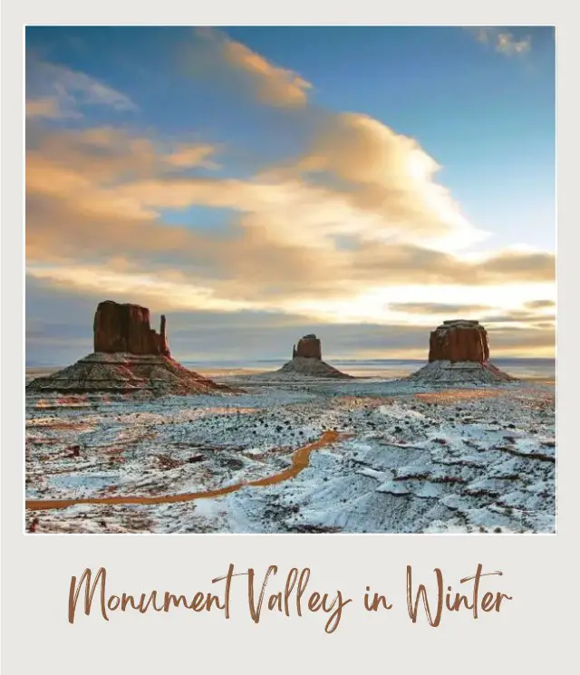
The Wildcat Trail is not only one of the best winter hikes Arizona has, it is also the only trail that you can do in Monument Valley without a Navajo guide. The trail starts near the View campground and descends down a soft sand slope before becoming a firmer trail that heads towards – and then around – West Mitten.
Along the way, there are stunning panoramic views of the Valley, but especially West Mitten and Merrick Butte.
You’ll find yourself surprised by the shifting shape of West Mitten as you walk around it and see it from angles that you can only see on this hike.
Why Winter?
Monument Valley is stunning any time of year, but there is nothing quite like seeing it blanketed in snow.
Insider Tips:
‼️ Be sure to register at the Visitor Center before you head out and then sign back in at the end, so that authorities know you have headed out into the winter desert – and are then safely back again.
Highlights:
✳️ Panoramic views of Monument Valley
✳️ Seeing West Mitten from multiple angles as you circle around it
➡️ READ MORE: A full description of the Wildcat Trail
4. The Horseshoe Bend Hike, Glen Canyon National Recreation Area
Length: 1.5 miles round trip
Difficulty: Easy
Trailhead: Where is Horseshoe Bend, Arizona? The Horseshoe Bend trailhead is a large, well-signed parking lot off Highway 89 just a few minutes south of Page.
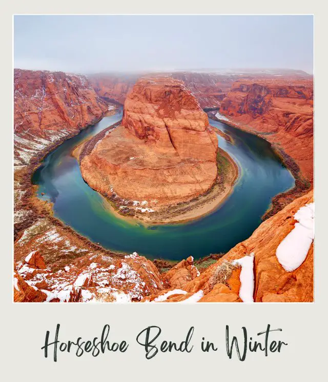
From the parking lot, the Horseshoe Bend trail heads up a small sandy hill and then (mostly) flattens out as it winds its way towards the edge of the cliff. There is a shelter along the way that is most useful to shelter from the summer heat. You won’t need it so much in winter.
The view when you get there is worth the effort. The 270° bend in the Colorado River may be a bit of a one-trick pony, but it is quite a trick! It is truly breathtaking.
Why Winter?
Horeshoe Bend, AZ has become a bit of an Instagram legend. Seeing – and photographing – the iconic image of the bend in the Colorado River is a bit of a mission for many. Which turns it into a bit of a zoo at busy times.
However, there are a lot fewer people in winter – and it is especially beautiful when there is snow around.
Insider Tips:
‼️ The trail is open year-round between sunrise and sunset. It costs $10 per vehicle to park.
‼️ It’s actually hard to get the whole bend of the river in your photo. There’s an official Horseshoe Bend Overlook that is fenced off, but you won’t see the whole bend from there. There are only a couple of places – very close to the edge – where you can get the classic shot. It’s best to use a wide-angle lens. You can sit and inch closer to the edge if standing is freaking you out. But be careful, especially in winter – it’s just a photo, after all!
Highlights:
✳️ The horseshoe-shaped bend of the Colorado River
5. Antelope Canyon, Navajo Nation, near Page
Length: 0.25 miles (Upper) | 1.1 miles (Lower)
Difficulty: Easy (Upper is easier)
Trailhead: Upper Canyon: There is a parking area where you take a tour bus to the canyon. Lower Canyon: The tour operators have visitor centers near each other, with parking. You walk a short distance to the canyon.
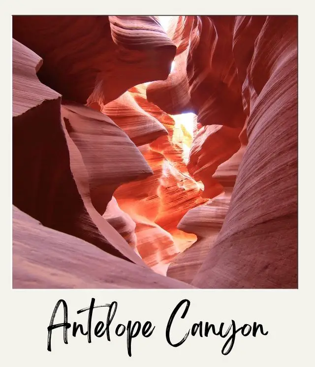
Antelope Canyon is probably the most famous slot canyon in the world. The fantastical red, orange and purple swirled rock is otherworldly and walking through the canyon is one of the most amazing hikes in Arizona. The steep, but swirling canyon walls are up to 120 feet tall in places.
There are actually two different trails/ tours. The Upper Antelope Canyon and the Lower Antelope Canyon. They are both on Navajo land and can only be visited on a tour. This is not a solitary hike, that’s for sure, but it is really is an incredible site/ sight.
The Upper Antelope Canyon (also called The Crack) is the easiest – and most popular. You walk straight into the canyon on flat ground, and it is shorter.
The Lower Antelope Canyon (also called The Corkscrew) is less popular (but still VERY popular) because you need to climb up and down ladders to get in and out. It’s also longer and narrower. There are five flights of stairs in total, of varying widths, so you should have reasonable mobility to do this hike.
Why Winter?
Although the famous beams of light shining down through the canyon only happen around noon in summer, winter is still a great time to go because there are fewer people there. In summer, it can seem a bit like being in one constant stream of humanity. In winter with fewer people, it’s a more enjoyable experience.
Insider Tips:
‼️ The guides will tell you exactly what settings to put your cameras and iphones on to get the best color in your photos, so don’t worry about that beforehand.
‼️ Lighting is typically better in the early and late morning
Highlights:
✳️ Incredible sandstone formations
6. White House Trail, Canyon de Chelly National Monument
Length: 2.7 miles round trip
Difficulty: Moderate
Trailhead: The White House Overlook
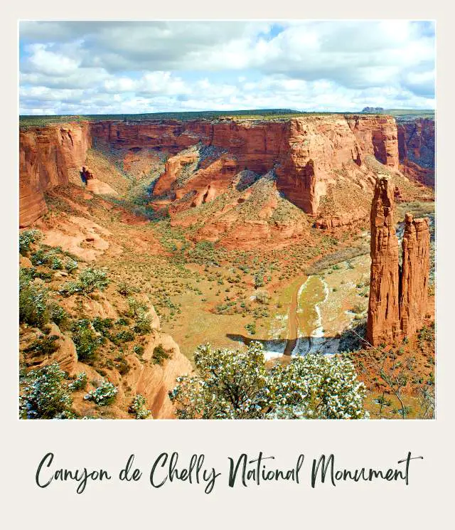
Opportunities for hiking Canyon de Chelly are limited because the entire canyon is home to the Navajo people. In fact, this is the only trail down into Canyon de Chelly that you do by yourself without being accompanied by a Navajo guide.
The trail descends from the canyon rim down about 560 feet to the canyon floor and on to the base of the White House cliff dwelling. The path climbs down a series of switchbacks and through two tunnels to the floor of the canyon.
When you get into the canyon, the trail follows a wash around the base of the cliff and crosses a narrow footbridge over a stream. It then follows near the banks until crossing over to the cliff dwelling on the other side of the narrow canyon.
Part of the White House is actually on the valley floor, while part of it is about 50 feet up in an alcove in the cliff.
Why Winter?
If you like ancient Puebloan cliff dwellings, this is one of the more adventurous winter hiking trails Arizona hikers can do. Although the path can be slippery, the White House ruins, Canyon de Chelly, and the entire area are especially beautiful when covered in snow.
Insider Tips:
‼️ The White House ruin trail can be very slippery when icy, so be sure to wear Microspikes or crampons.
Highlights:
✳️ Hiking into Canyon de Chelly
✳️ The White House cliff dwelling
7. Sandal Trail, Navajo National Monument
Length: 1.3 miles round trip
Difficulty: Easy
Trailhead: Navajo National Monument Visitor Center
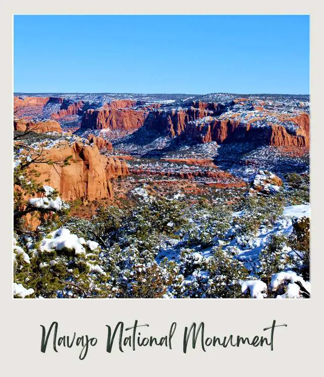
There are three well-preserved cliff dwellings in Navajo National Monument. The best one is the Betatakin Cliff Dwelling. The dwelling can be seen from the Betatakin Overlook at the end of the easy Sandal Trail.
The trail, which is the only way to see the cliff dwelling without a guided tour, leaves from just behind the Visitor Center and follows a fairly flat, paved trail through juniper bushes and ponderosa pine trees. Tt ends at an overlook with great views of the cliff dwelling on the opposite side of the canyon
Why Winter?
Winter provides a respite from the summer heat and the canyon may be covered in snow, making the area especially pretty.
Insider Tips:
‼️ The Betatakin dwelling is 0.25 miles from the overlook. The panoramic view gives a real sense of the whole canyon and how the dwelling is situated on the cliff and canyon. However, if you want to see the dwelling in more detail, I recommend taking binoculars. If you are looking to get some binoculars, be sure to read my Guide to The Best Binoculars for The Money.
‼️ If the path is covered in snow, be sure to wear Microspikes so you don’t slip.
Highlights:
✳️ Panoramic view of the well-preserved Betatakin cliff dwelling
8. Blue Mesa, Petrified Forest National Park
Length: 0.9-mile loop
Difficulty: Easy
Trailhead: The trail starts at the Blue Mesa Trailhead in the southern section of the park.
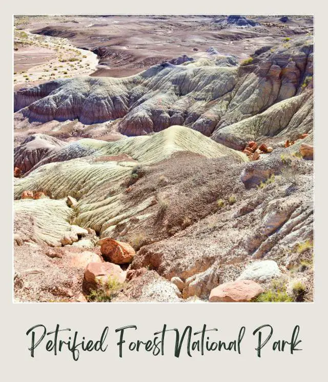
The Blue Mesa Trail is inarguably one of the best hikes in Petrified Forest National Park, descending from the rim of a mesa down to the desert floor below. It’s an easy addition to this list of the best hikes Arizona hikers can do.
Once in the basin, you’ll have panoramic views of blue-hued striated badlands, soaring overhead. These badlands are made of bentonite clay, eroded over time by water and wind to form the fascinating geological structures around you.
Why Winter?
Winter is a wonderful time to explore the Blue Mesa Trail, as well as the rest of the national park- the crowds of the summer have thinned, the relentless heat from the Arizona sun has cooled, and the weather is usually fairly dry and clear.
Insider Tips:
‼️ While Petrified Forest is still something of a hidden gem (at least, as far as national parks are concerned), hiking Petrified Forest National Park is nonetheless popular and Blue Mesa Trail is a crowd-favorite in the park. So, if you’re visiting on a weekend or a busy holiday, you should make a beeline to the trailhead first thing in the morning if you prefer to have the trail all to yourself.
‼️ While most of the trail is flat, it starts with a short but steep descent that can be very slippery if ice. I recommend taking microspikes to be safe.
‼️ Make sure to keep an eye out for petrified wood along the trail- as the bentonite clay badlands erode, pieces of petrified wood are slowly unearthed after being buried for millions of years. But please be sure to follow the leave no trace principles, including leaving the beautiful wood where you found it, so other hikers can enjoy for millennia to come!
Highlights:
✳️ Amazing striped color rock formations
Recommended by Jessica from Uprooted Traveler
➡️ READ MORE: Petrified Forest National Park Guide
9. Bell Rock Trail, Sedona
Length: 1.8 miles Roundtrip
Difficulty: Moderate
Trailhead: Bell Rock Trailhead
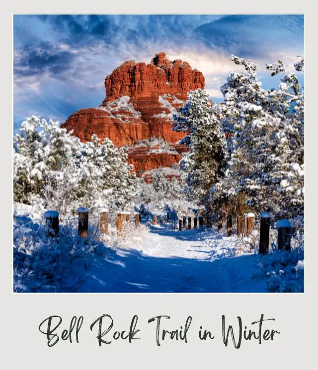
The Bell Rock Sedona hike is one of the best hikes in Sedona, Arizona and is located in the southern part of the town.
The views throughout the whole hike are pretty glorious. The loop takes you around the Bell Rock and offers many different views of this stunning butte. You can also see the beautiful Courthouse Butte on this trail in the distance.
The basic trail is one of the best easy hikes in Sedona, but if you want to make it more difficult, you can also add in Courthouse Butte Loop or Upper Bell Rock trail and get even more remarkable views.
Why Winter?
The Sedona Bell Rock hike is one of the best winter hikes in Sedona because if there is snow, the views are splendid with the bright orange rocks against the white fluffy snow. It is a photographer’s dream.
Also, you can still see the highway throughout many parts of the trail, so it is difficult to get lost.
Insider Tips:
‼️ Bring microspikes if it is snowing. Some areas can get pretty icy!
‼️ The trail isn’t very well marked, so make sure you are keeping an eye out.
‼️ You need to pay for parking at the kiosk.
‼️ For more downhill climbs, take the loop clockwise and for more uphill climbs, take the loop counterclockwise.
Highlights:
✳️ Great views of Bell Butte and Courthouse Butte.
✳️ Upper Bell Rock Trail takes you closer to Bell Butte.
✳️ The highway can be seen from the trail, so this is a great beginner hike.
Recommended by Michelle from The Wandering Queen
10. Birthing Cave Trail, Sedona
Length: 2 miles
Difficulty: Moderate
Trailhead: Long Canyon Trailhead
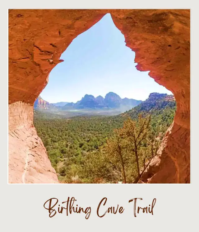
If you find yourself hiking in Sedona and are looking for a unique and less-known hike, check out the Birthing Cave.
It is a flat and easy trail until the ascent into the cave. It is suitable for beginner hikers and is one of the most beautiful hikes in Arizona, with stunning views of the Sedona area.
The Birthing Cave Sedona trail starts at the Long Canyon Trailhead. There is limited parking in a dirt area on the side of the road.
For the majority of the hike, the trail is very wide and flat. The final ascent into the cave has a steep and narrow trail.
Once you make it to the cave, be sure to take in the views outside the cave. The Sedona view from the cave is beautiful.
Why Winter?
Escape the summer heat and crowds
Insider Tips:
‼️ There is a seat at the back of the cave that is a great place to take pictures from. You will need a wide-angle lens if you want to take a picture of the entire cave.
‼️ The best time of day to photograph the Birthing Cave is midday.
‼️ There is limited cell coverage in the area and you do have to wind through a few different trails to get to the Birthing Cave in Sedona, so it is a good idea to download the map and GPS coordinate of the cave ahead of time.
Highlights:
✳️ Beautiful views of the Sedona area
✳️ Cool cave
Recommended by Candice from CS Ginger
11. Wind Cave Trail, Phoenix | Mesa
Length: 2.9 miles
Difficulty: Moderate
Trailhead: Wind Cave Trailhead, Usery Mountain Regional Park

The Wind Cave Trail is one of the most popular hiking trails near Mesa, AZ and is one of the best things to do near Phoenix. The trail has beautiful views of the surrounding valley and has a high density of Saguaro cacti.
The first half of the trail is pretty easy with the steeper parts of the trails at the end when you ascend into the cave.
The cave at the top is more like a piece cut out of the side of the mountain rather than a cave. It is about 12 feet high and is long, giving hikers a chance to spread out to enjoy the beautiful views from the top. It is a great place to take a rest and hydrate before the descent back to the trailhead.
Why Winter?
Hiking in Mesa AZ in summer is unbearably hot, but this hike is very pleasant in the cooler winter months.
Insider Tips:
‼️ Usery Mountain Regional Park is one of the best places to hike in Phoenix, but you will need to hike during the park hours:
- Sun-Thu: 6 AM – 8 PM
- Fri-Sat: 6 AM – 10 PM
‼️ There is a $7.00 park entrance fee. At the trailhead, you will find restrooms and vending machines.
‼️ This trail is dog-friendly as long as they are on leashes.
‼️ Even in winter, you want to start this trail early in the morning to beat the hot Phoenix sun as you climb up into the cave. Also, in the early mornings, the trail is shaded. Be sure to bring plenty of water because there is little shade until you reach the cave.
Highlights:
✳️ Saguaro cacti
✳️ Cave
✳️ Views
Recommended by Candice from CS Ginger
12. Seven Falls Trail, Sabino Canyon Recreation Area, Tucson
Length: 8.2 miles
Difficulty: Moderate
Trailhead: Bear Canyon Trailhead
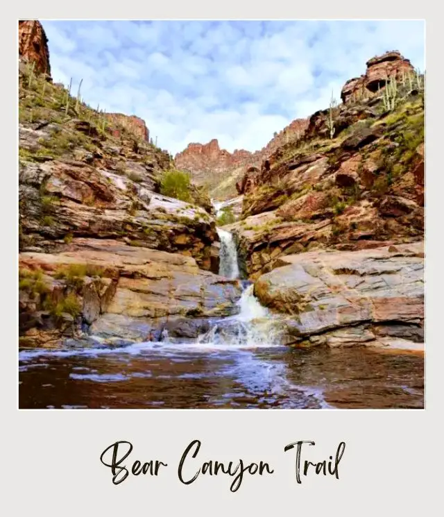
The trail, also called the Bear Canyon Trail, is one of the prettiest hikes in Arizona.
It takes off through deciduous forests of saguaros, sycamore and cottonwood trees. A small stream flows beside the trail almost throughout the year. Many rivers also cut off at specific points. In most places, the river is narrow enough to jump over it. You can find similar trails in Sedona too.
Typical desert vegetation like cactus, buckhorn cholla, and barrel cactus line the path.
After walking a bit, you will come across a crossing from where the trail switches back and ascends to Bear Canyon. Turn left from the seventh crossing to find the falls.
When you get to the falls, a marvelous view welcomes you. Hikers mostly relax by the side or go for a dip in the clear natural pool.
Why Winter?
During the rainy season (June – September), parts of the trail get submerged in water and thus become inaccessible. Flash floods are also quite common during this time.
Summers are also not ideal due to the excessive heat. Since it’s a desert area and direct sunlight falls on most of the trail, it can be physically exhausting to hike the entire distance.
Due to these reasons, winter is the most suitable time to hike on the Seven Falls trail. During this time, the rivers are also snow-fed, so the falls tend to look extra beautiful.
Insider Tips:
‼️ A tram service is available to take you to the trailhead. The ticket costs $4 a person.
‼️ Dogs are not allowed.
‼️ Bathroom facilities are available at the trailhead.
Highlights:
✳️ Deciduous trees and desert shrubs can be seen on the way
✳️ Small streams and rivers flow across the way
✳️ The hike is not only of the nicest waterfall hikes in Arizona, the main waterfall site is ideal for recreational purposes
Recommended by Ruma from The Holiday Story
13. Valley View Overlook Trail, Saguaro National Park
Length: 0.8 miles round trip
Difficulty: This is one of the best easy hikes in Arizona
Trailhead: Bajada Loop Drive, Hohokam Road The trail starts at a parking lot about 3.5 miles north of the Visitor Center. There’s a small that says ‘View Trail’ next to the parking area.
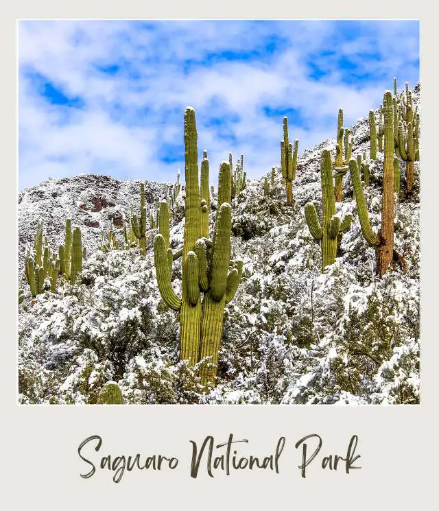
Saguaro National Park is named after the iconic saguaro cactus and is often referred to as the Saguaro Cactus National Park. This is the classic American cactus that appears in cartoons. It is also the largest cactus in the United States.
The park is divided into two separate sections, with Tucson in between. The eastern section (also called the Rincon Mountain District) has fewer cacti, but the beautiful Rincon mountains as a picturesque backdrop. The western section (also called the Tucson Mountain District) has more cacti (and people). The Valley View Overlook Trail is one of the easy Saguaro National Park west trails.
From the parking lot, the trail starts through a couple of washes before ascending slowly up some wide steps built into the dirt path. It ends at a lookout over the Avra valley and Picacho Peak, with thousands of cacti on view.
Another reason that this is one of the best hikes in Saguaro National Park is that there are signs along the way identifying various native plants.
Why Winter?
Summer’s get very hot in Saguaro National Park. Winter, on the other hand, is much cooler. It can snow in the park, though this is not that common.
Insider Tips:
‼️ This is an easy walk suitable for all ages and most fitness levels.
Highlights:
✳️ Thousands of Saguaro cacti
✳️ Easy trail with nature signs making this a great winter hike for kids
➡️ READ MORE: Saguaro National Park Guide
14. The Wave Hike, Vermilion Cliffs National Monument
Length: 6.4-mile round-trip
Difficulty: Strenuous
Trailhead: The Wave trailhead is the Wire Pass Trailhead (this is in Utah, but The Wave at the end of the trail is just across the border in northern Arizona)
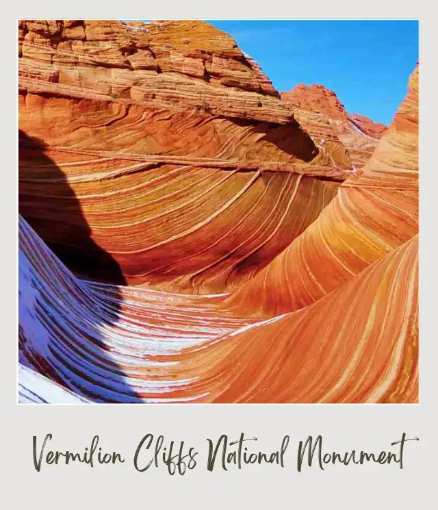
One of the really great hikes in Arizona and best hikes in northern Arizona, The Wave trail is justifiably famous. It’s also one of the hardest to do because there is a very limited daily number of permits issued for the hike.
The incredible rock formations of North Coyote Buttes (The Wave), with curved walls of layered rock was made famous back in 2009 when it became a Microsoft Windows 7 desktop wallpaper image.
The area is fragile so a permit system exists, with only 64 spaces being issued each day. If you are lucky enough to get a space, you will be given a map that indicates natural formations to look for. Unlike most hikes, there is actually no clear trail, so you need to follow the map carefully.
At the end is an incredible area of layered sandstone carved by water into smooth ‘waves’.’
There are two ways to get a permit. Spaces for 48 people (or 12 groups) are released four months in advance through an online lottery. The remaining 16 spaces (or 4 groups) are released through an in-person lottery a day in advance. If you manage to nab a spot, it then costs $7 per person for the permit.
Why Winter?
In winter, it’s possible that the wave will be covered in snow. A dusting of snow makes the area especially beautiful. Obviously, you don’t want everything completely covered in snow because then you can’t see the layered sandstone at the bottom (though the curved walls won’t all be covered in snow), which is a risk you will take when doing this hike in winter.
However, this is offset by the fact that the hike is less popular in winter, which makes your chances of winning the Wave lottery much better. Given that winning the permit lottery is the hardest thing about this hike, and hiking the wave without a permit is not an option (there is a very hefty fine for trying), this increased chance helps propel this hike into the Best Winter Hikes list.
Insider Tips:
‼️ The Wave hike permit spaces are available all year round, but from mid-November to mid-March, the in-person permits are issued Monday through Friday (except for federal holidays). The in-person lottery for Saturday, Sunday, and Monday permits happens on the Friday before the weekend.
‼️ The road to get to the Coyote Buttes Wave trailhead is unpaved. The road may be unpassable if there is lots of snow, so this is a risk you’ll take in winter. To minimize the chances of not being able to get there, have a high clearance 4WD or AWD vehicle!
Highlights:
✳️ Incredible wave-like rock formations
15. Montezuma Castle Hike, Montezuma Castle National Monument
Length: 0.3 miles
Difficulty: Easy
Trailhead: The Montezuma’s Castle Visitor Center
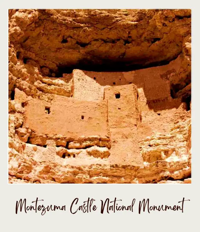
This is more of a short walk than a hike. The trail is flat and paved and passes under some shady sycamore trees. At the end are close up views of Montezuma’s Castle, which is one of the best-preserved cliff dwellings in Arizona, if not the entire country.
Why Winter?
Like much of Arizona, it’s hot in summer. Although the trail is short and flat and mostly in the shade, it’s definitely more comfortable in winter.
Insider Tips:
‼️ Be sure to stop at the small museum nearby to learn all about this incredible cliff dwelling
Highlights:
✳️ Montezuma’s Castle cliff dwelling
Map of the best winter hikes in Arizona
To make your planning easier, here is an overview map of where all these hikes are located:

