One of the unique things about Shenandoah National Park is the Skyline Drive. The national park was created with the intention of building a road running the length of the mountain ridge, so that people could enjoy the park by driving through it. And so the Skyline Drive was born.
There are 75 overlooks spread along the drive. If you were to stop at each and every one of them, chances are you would soon start to get bored and somewhat jaded. So the best way to enjoy the drive is to stop at the best views and skip the less interesting ones.
That means you need to know which overlooks are worth stopping at. Which is where this guide comes in. Here you will find the 25 best overlooks in Shenandoah National Park, with photos. Let’s go!
Subscribe to daily national parks planning tips, travel inspiration and trip ideas and get instant access to the free PDF of this
Best Overlooks on Skyline Drive
No time right now to discover the best overlooks on Skyline Drive? Pin It and save it for later:


🛏️TOP HOTEL NEAR FRONT ROYAL: Check availability now
🛏️TOP HOTEL NEAR LURAY: Check availability now
🛏️TOP HOTEL IN CHARLOTTESVILLE: Check availability now
🚘FIND THE CHEAPEST CAR RENTAL: Search Discover Cars for the best deals
✈️FIND THE CHEAPEST FLIGHTS: Search Skyscanner for the best deals
🧳GET TRAVEL INSURANCE: Get insured with Travelex before you go
📱TAKE AN AUDIO TOUR: Buy an audio tour now
Table of Contents
The 25 Best Views in Shenandoah National Park
Here are my picks for the best Skyline Drive highlights:
North District Overlooks, Shenandoah National Park
The North District extends for 31.5 miles from the Front Royal Entrance Station (Mile 0.6) to the Thornton Gap Entrance Station (Mile 31.5). The western views in this section mostly offer lovely views of Shenandoah Valley.
Today Shenandoah Valley is mostly agricultural, with small farms and townships dotting the area on either side of the Shenandoah River between the Blue Ridge Mountains/ Shenandoah National Park and the Massanutten Mountain range.
The area has been cultivated for centuries – before Europeans moved in, Native Americans grew beans, squash and corn in the river valley. The mountains were also used for livestock and small homesteads before the creation of the national park displaced the homesteaders and forced them down into the valley.
Skyline Drive Overlooks Map (North District)
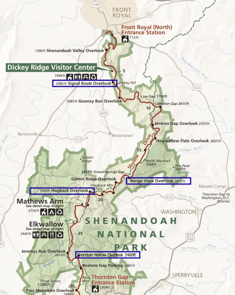
1. Signal Knob Overlook (Mile 5.5 | West facing | Elev. 2,090 feet)
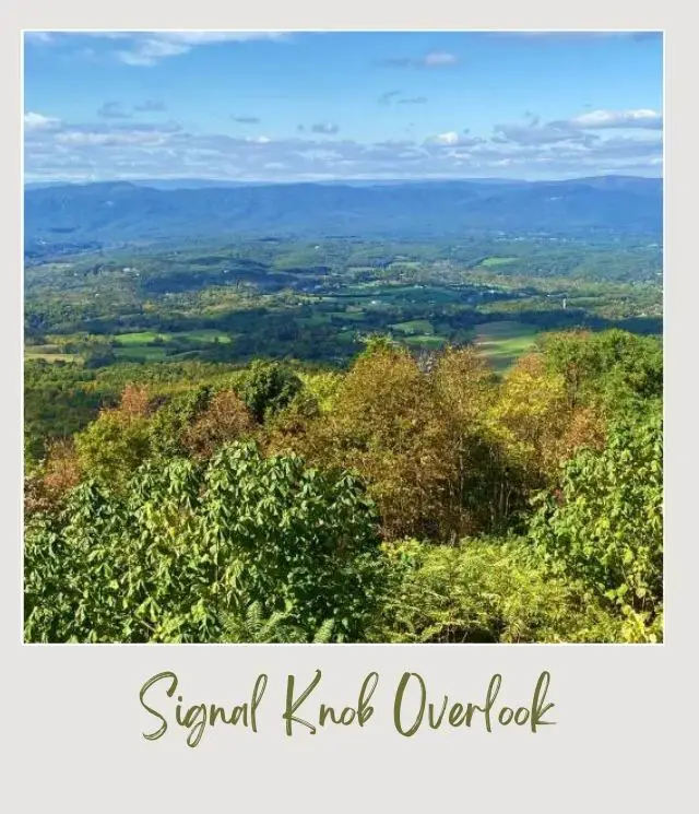
If you’re driving south, this is the second overlook in the park, but the first I recommend stopping at. There’s a great view of the Shenandoah Valley with the Shenandoah River clearly visible.
The mountain range you can see on the other side of the valley is the Massanutten Mountain Range, which is part of the George Washington National Forest. You can see Signal Knob, the northernmost peak of the Massanutten Mountains, from the overlook. Like much of the area, Signal Knob played a pivotal role in the Civil War. Today, it’s a great place for a hike.
There are interpretive signs at many of the overlooks. The one here has photos of the same view taken in 1940, 1965 and 1997 so you can easily see the changes in the valley over the years.
2. Range View Overlook (Mile 17.2 | East facing | Elev. 2,810 feet)
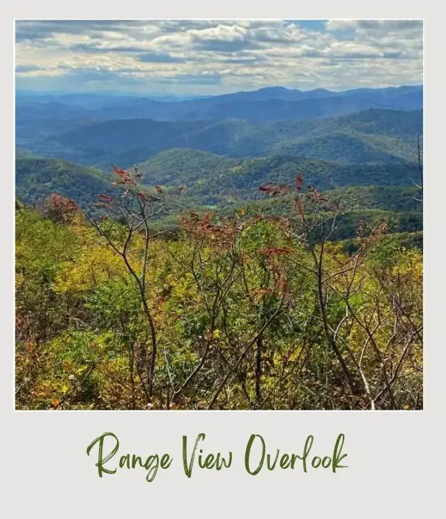
This overlook has an amazing panoramic view down the length of the Blueridge Mountains, so you can see of the lot of the national park stretching before you.
Starting from the left is Jenkins Mountain, Pickerel Ridge, Old Rag, Stony Man Mountain and Pass Mountain. Then, the nearest mountain to the right is Mount Marshall Overlook and to the right of that is Hogback Mountain.
3. Hogback Overlook (Mile 21.0 | West facing | Elev. 3,385 feet)

This is the longest viewpoint in the park and my personal favorite. I recommend getting out and walking the length of the overlook, as the view changes along its length.
In the foreground is Gimlet Ridge, Matthews Arm and Overall Run Valley. Beyond is a really lovely view of Shenandoah Valley with the Blue Ridge foothills hills around it. In the background are the Massanutten Mountain and the Allegheny Mountain ridges.
4. Thornton Hollow (Mile 27.5 | East facing | Elev. 2,460 feet)
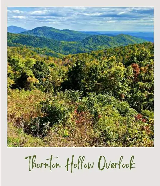
The view looks down into Thornton Hollow with endless views of the mountains beyond. The mountain to the left is North Marshall and then The Peak. To the right of the hollow is Fork Mountain and then Oventop Mountain.
This is a popular place to see the sunrise.
Central District Overlooks, Shenandoah National Park
The Central District extends for 34.2 miles from the Thornton Gap Entrance Station (Mile 31.5) to the Swift Run Gap Entrance Station (Mile 65.7). This is generally considered the most scenic / best part of Skyline Drive.
Shenandoah National Park Skyline Drive Map (Central District Overlooks)
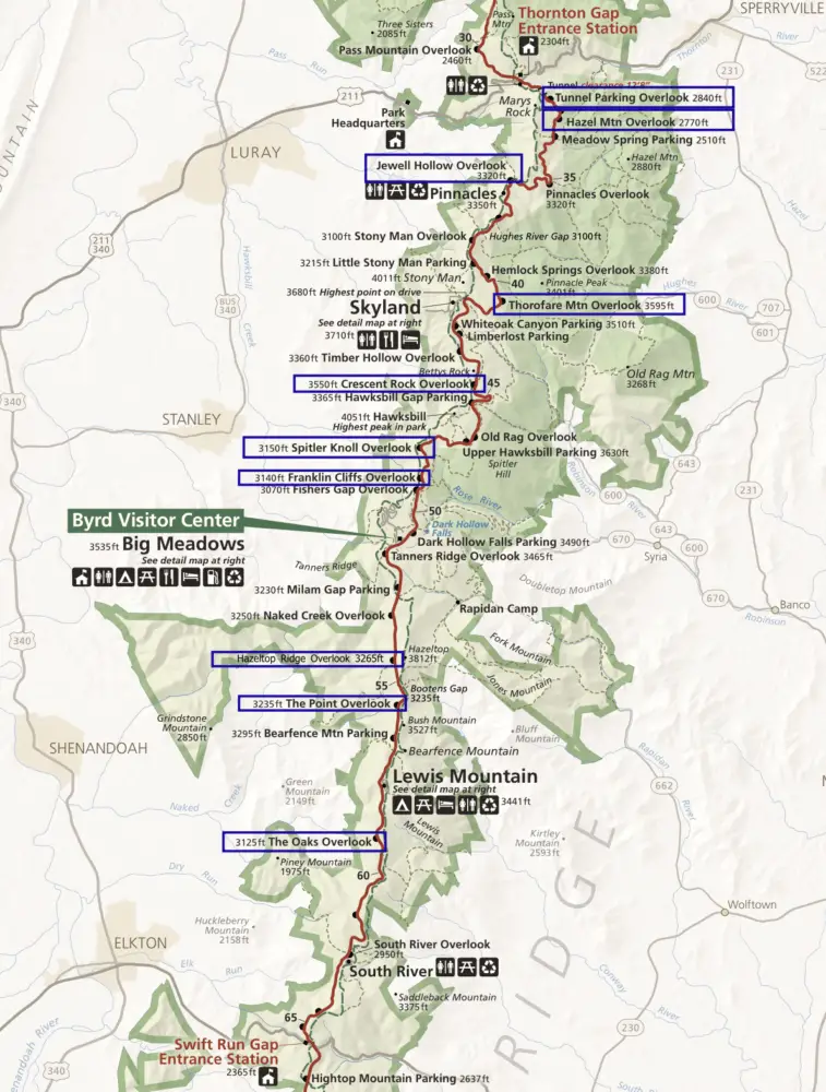
5. Tunnel Parking Overlook (Mile 32.2 | East facing | Elev. 2,840 feet)
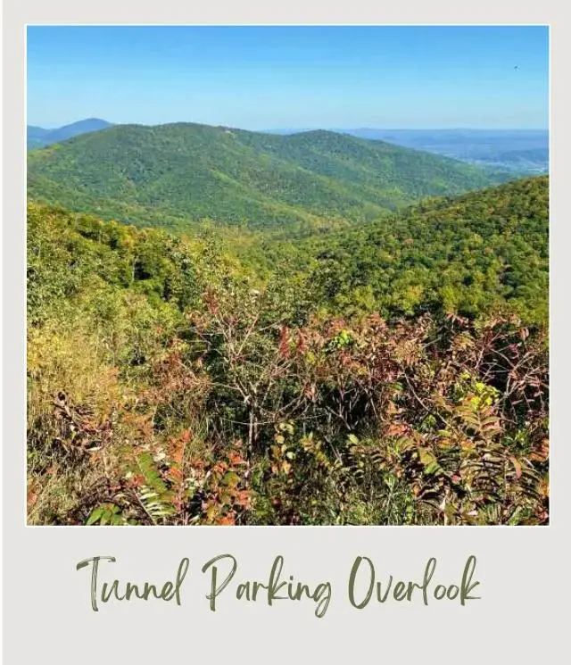
This is the first overlook after the Thornton Gap Entrance. The view of the eastern hills is lovely. You can see Oventop Mountain and Skinner Ridge, with the historic town of Sperryville in between.
However, the main point of interest here is Mary’s Rock Tunnel.
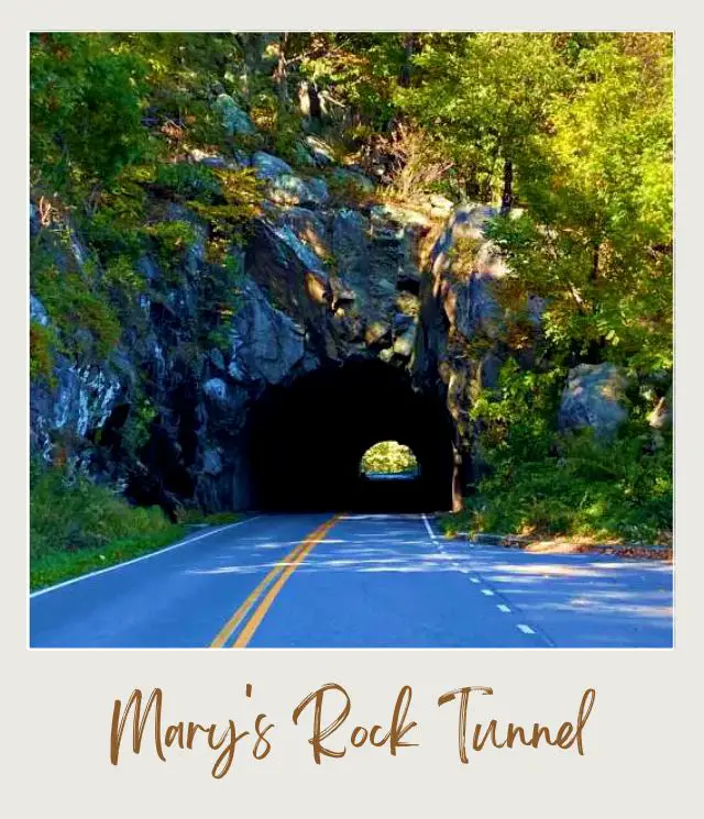
The tunnel was built in 1932 because the engineers who were building Skyline Drive decided that taking the Skyline Drive around Mary’s Rock would be too unsightly. So, they built the 600-foot tunnel in three months, and it remains a highlight of the drive. There is an interpretive sign explaining more about the tunnel.
6. Buck Hollow Overlook (Mile 32.8 | East facing | Elev. 2,710 feet)
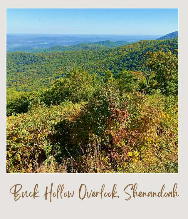
The views from this overlook are more stunning forest-covered foothills. The view here is a little expansive than the nearby overlooks. You can see Skinner Ridge, Buck Ridge and Hazel Mountain. In the far distance you can see the small town of Sperryville on a clear day.
This overlook is another popular place to see the sunrise.
7. Hazel Mountain Overlook (Mile 33.0 | East facing | Elev. 2,770 feet)
There is a cluster of large granodiorite rocks in the center of the overlook that make a great vantage point to see the view.
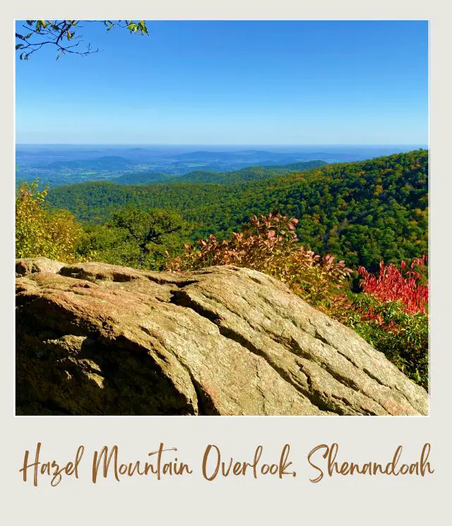
Feel free to climb up on top of the rocks, which provide a nice foreground for photos. There are more sensational views, which include Buck Ridge and, no surprise given the overlook’s name, Hazel Mountain
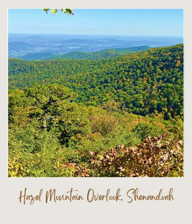
This is yet another popular place to see the sunrise.
8. Jewell Hollow Overlook (Mile 36.4 | West facing | Elev. 3,320 feet)
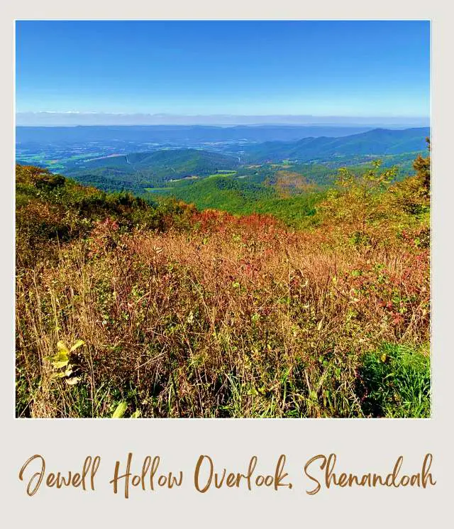
This is a large overlook with two parking areas, so you should have no problems finding a space to park. The best views are from the higher area, but you can easily walk between the two.
There are lovely views over Shenandoah Valley. You can take a short path down from the parking lot for even better views. You can see Morning Star Lake, Jewell Hollow (of course) and Leading Ridge. Neighbor Mountain is the peak behind and just to the left of Jewell Hollow.
9. Thorofare Mountain Overlook (Mile 40.4 | East facing | Elev. 3,595 feet)
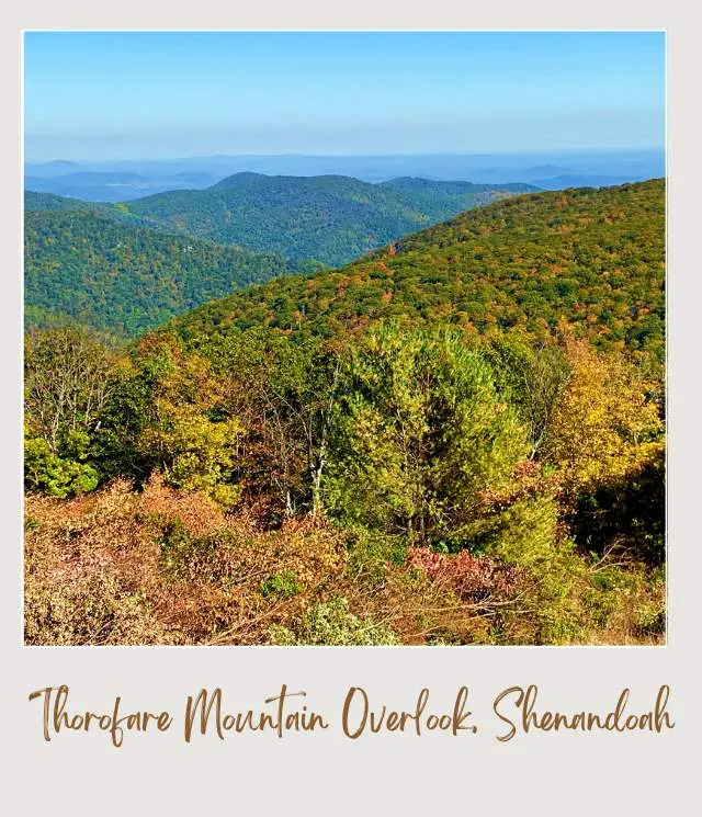
This is the closest east-facing overlook to Skyland Resort, so is a great sunrise option if you’re staying there. It’s also the highest overlook on Skyline Drive.
Thorofare Mountain is straight ahead. To its left is Hazel Mountain in the distance and Pinnacle Ridge. Old Rag Mountain and Roberston Mountain are to the right.
10. Crescent Rock Overlook (Mike 44.0 | West facing | Elev. 3,550 feet)
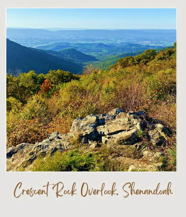
There’s a lovely view of Shenandoah Valley through a gap in the mountains from this overlook. You can also see Hawksbill Mountain, the highest peak in the national park, to the left. In between are Nakedtop and Hershberger Ridge.
There’s a short, easy-to-miss trail with a great view. Look for the rocks and you should see a trail behind it. There’s a clearance a short way along that frames the view perfectly. Crescent Rock, which gives the overlook its name, is a cliff which, to be honest, I didn’t really notice.
11. Spitler Knoll Overlook (Mile 48.0 | West facing | Elev. 3,285 feet)
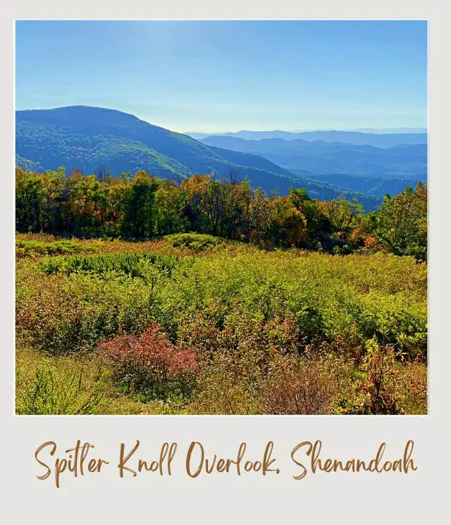
This a long, curved overlook with plenty of space to park. Be sure to get out and walk the length of the curve, as the view does change. The curve provides one of the widest, most panoramic views on Skyline Drive.
There are sensational views of Page Valley, part of the Shenandoah Valley. You can see the small town Stanley, Dovel Mountain, the not-so-nicely-named Dog Slaughter Ridge, and Roundhead Ridge to the left. Massanutten Mountain Ridge is in the distance.
This is another popular place to see the sunset.
12. Franklin Cliffs Overlook (Mile 49.0 | West facing | Elev. 3,285 feet)
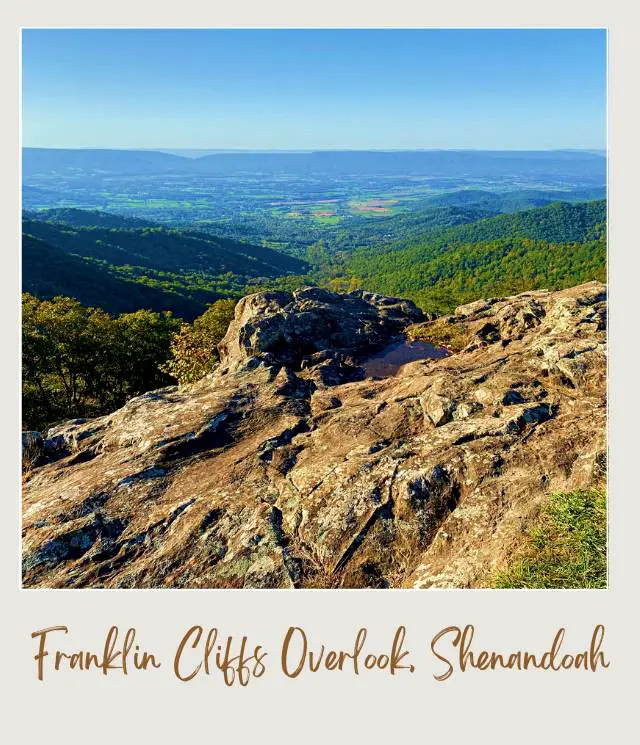
This is another overlook with a rocky outcrop that makes a great foreground for your photos. The view is of the Shenandoah Valley. In the distance on a clear day you can see the towns of Stanley and Luray. Left of the valley are Blackrock and Roundhead Ridge.
13. Hazeltop Ridge Overlook (Mile 54.5 | West facing | Elev. 3,265 feet)
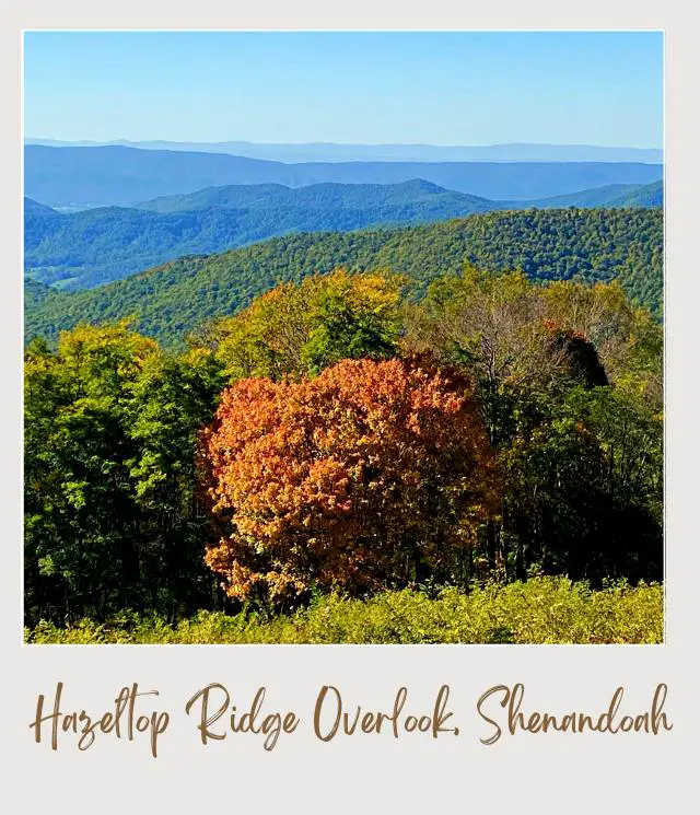
This a rare west-facing view that doesn’t focus on the Shenandoah Valley. The expansive view includes (from left to right) Hanse Mountain, Powell Mountain, Grindstone Mountain, Smith Mountain, Devils Tanyard and Long Ridge.
14. The Point Overlook (Mile 55.3 | West facing | Elev. 3,235 feet)
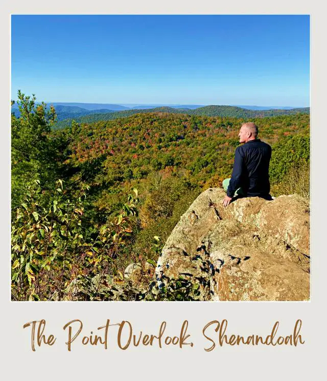
The view from the walled parking area is nice, but the thing that makes this overlook extra special is the short – but steep and narrow – hike you can do to “The Point”. Look for a break in the stone wall and follow the trail down for about five minutes to a rocky outcrop.
Few people make it down it’s a steep hike back up), so you can often have this to yourself. The views are sensational.
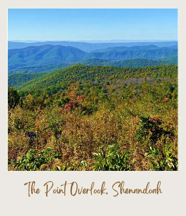
On a clear day you can see the small town of Elkton to the left. Near it is Green Mountain and then further to the right is Grindstone Mountain. The central closer peak is Powell Mountain.
This is also a popular place to see the sunset.
15. The Oaks Overlook (Mile 58.8 | West facing | Elev. 3,125 feet)
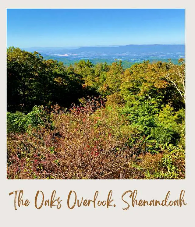
There are a lot of trees in the foreground at this overlook, but above the tree tops you can the Shenandoah Valley. It’s a nice contrast to many of the more open panoramic views, while not being blocked all together as some of the viewpoints are.
South District Overlooks, Shenandoah National Park
The South District extends for 39.3 miles from the Swift Run Gap Entrance Station (Mile 65.7) to the Rockfish Gap Entrance Station (Mile 105). It’s the longest stretch of the Skyline Drive.
In contrast with the northern sections of the park, the western views in the southern section mostly offer closer up views of mountain peaks rather than Shenandoah Valley.
Skyline Drive Map Shenandoah National Park (South District)
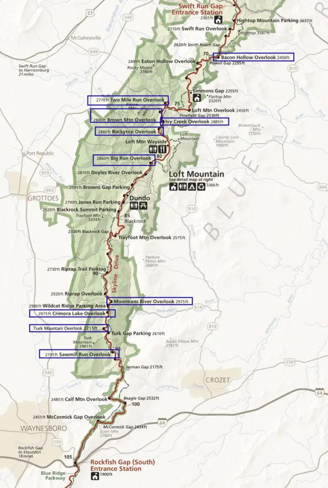
16. Bacon Hollow Overlook (Mile 68.9 | East facing | Elev. 2,450 feet)

The view here looks down into Bacon Hollow, a beautiful wooded valley with hills on both sides. The hills of Virginia Piedmont roll into the background, creating a truly breathtaking scene. To the right of Bacon Hollow in the distance you can see Brokenback Mountain and Flattop much closer.
It’s a long bend with views that change as you move along the bend, so it’s definitely worth getting out of your car and walking along this one. There’s also a dead tree that creates a great centerpiece for photos.
17. Two Mile Run Overlook (Mile 76.4 | West facing | Elev. 2,770 feet)
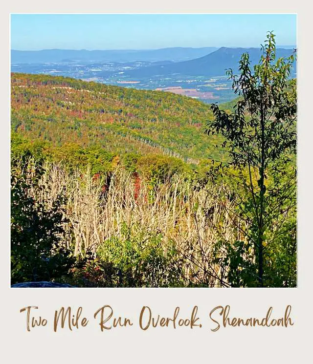
This is a small overlook with hills in the foreground, Shenandoah Valley in the mid-distance, and the southern tip of Massanutten Mountain ridge behind. From left to right is Brown Mountain, Two Mile Ridge and Rocky Mount. Two Mile Run is a valley in front of Rocky Mount.
You’ll notice swathes of dead trees. These are Eastern Hemlocks, killed by hemlock woolly adelgid, an invasive sap sucking insect from Asia.
18. Brown Mountain Overlook (Mile 76.9 | West facing | Elev. 2,840 feet)
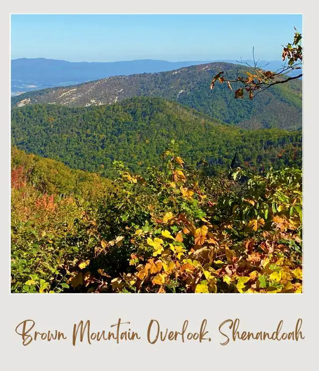
The main view here is nearby mountains, with Brown Mountain just behind and parts of Shenandoah Valley just peaking behind them. Other peaks you can see are Trayfoot Mountain, Rockytop, and Rocky Mountain.
This is also the trailhead for the Brown Mountain Trail.
19. Ivy Creek Overlook (Mile 77.6 | East facing | Elev. 2,885 feet)
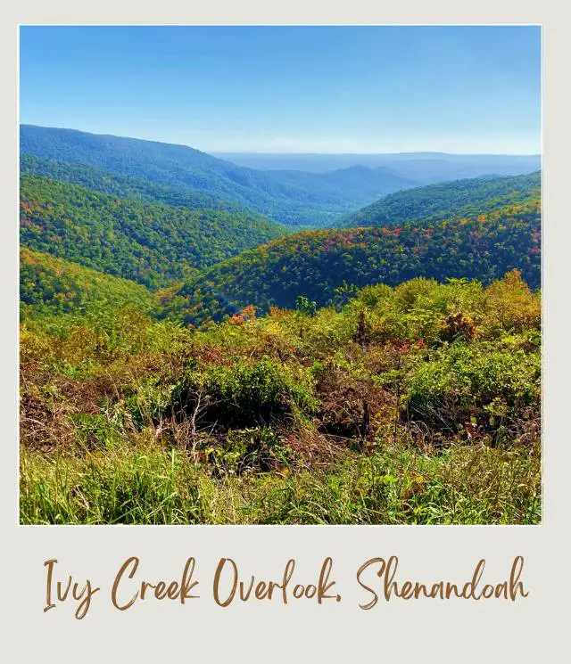
There are layers of peaks crossing a valley with Ivy Creek running through the middle in this view. Weaver Mountain is on the left and Loft Mountain on the right, with Flattop and Brokenback Mountain further afield.
20. Rockytop Overlook (Mile 78.2 | West facing | Elev. 2,860 feet)
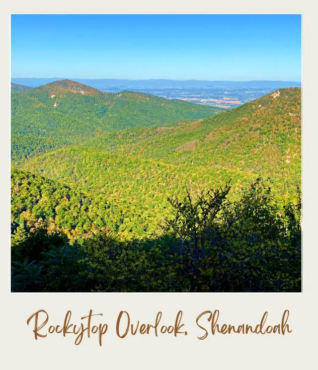
The views here change depending on which direction you look. To the left are beautiful views of mountains peaks, valleys and ridges including the flat Patterson Ridge nearby and Lewis Mountain peaking through at the back.
Further to the right is the eponymous Rockytop and then glimpses of Shenandoah Valley. Nearby on the right is Loft Mountain.
21. Big Run Overlook (Mile 80.8 | West facing | Elev. 2,860 feet)
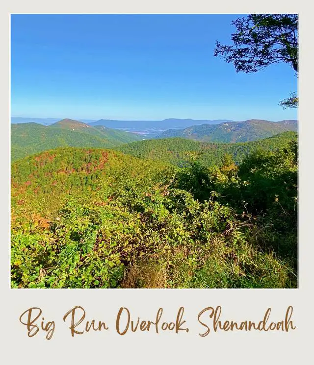
The view here looks down the valley that features the largest stream in the park, Big Run. You can see Rockytop on one side and Rocky Mountain and Brown Mountain on the other. The view here is sometimes obstructed by trees growing, but if you are here before they grow in or after they’ve been cleared, it’s a lovely vista.
The overlook is also the trailhead for the Big Run Loop Trail.
22. Moormans River Overlook (Mile 92.0 | East facing | Elev. 2,975 feet)
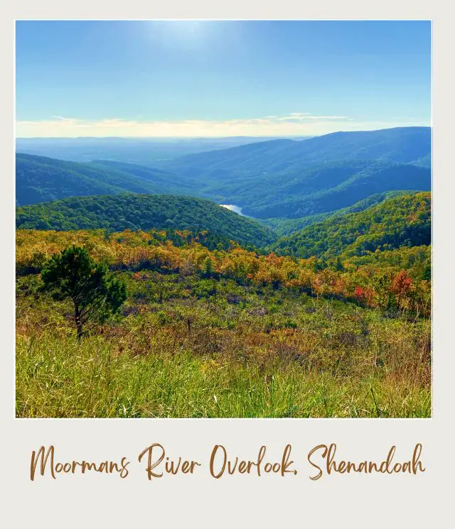
The overlook looks down an open valley with wooded hills on both sides. The water you can see is actually the Charlottesville Reservoir.
It’s a lovely view that a little different from those at the other overlooks. Peaks you can see include Pasture Fence Mountain, Sawlog Ridge and, further back, Bucks Elbow Mountain.
23. Crimora Lake Overlook (Mile 92.6 | West facing | Elev. 2,975 feet)
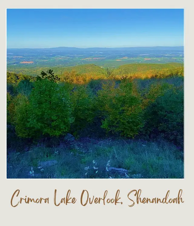
Crimora Lake is in the center, though it’s hidden behind the hills. Nonetheless, it’s an expansive view of the valley beyond. That’s Turk Mountain and Thorofare Ridge on the left and Rocks Mountain and Wildcat Ridge on the right.
Crimora Lake is actually the site of a former manganese mine. The mine, which operated between 1867 and 1948, had a small lake created to help process the ore.
24. Turk Mountain Overlook (Mile 93.7 | West facing | Elev. 2,715 feet)
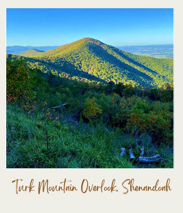
There’s a great view of the cone-shaped Turk Mountain and a vista of Shenandoah Valley to the right. Scott Mountain and Sawmill Ridge are to the left.
25. Sawmill Run Overlook (Mile 95.3 | West facing | Elev. 2,210)
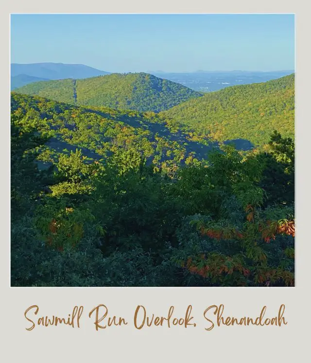
This is a lovely leafy overlook with views of the Shenandoah hills beyond the trees. Sawmill Run is in the center and Sawmill Ridge to the right.
Skyline Drive, Shenandoah National Park Overview
Now we’ve looked at all the best spots in Shenandoah National Park, a quick overview of the park and the Shenandoah scenic drive, the Skyline Drive, in particular.
Shenandoah National Park is a narrow strip spilling down the sides of a stretch of the Blue Ridge Mountains from Front Royal in the north (Mile 0) to the Rock Fish Gap Entrance in the south (Mile 105).
How long is Skyline Drive in Virginia?
How many miles is Skyline Drive? The entire drive is 105 miles.
Where does Skyline Drive start and end?
The Shenandoah scenic drive starts and ends at Front Royal and Rockfish Gap.
Entrances to Shenandoah National Park
There are four Shenandoah National Park entrance stations: one at each end and two in the middle. They are roughly equidistant and effectively divide the park into three sections – the northern, central and southern sections.
The Skyline Drive entrances are:
Front Royal Entrance Station
🔹Mile 0
🔹Getting there: Routes 66 and 340
🔹Shenandoah National Park north entrance
Thornton Gap Entrance Station
🔹Mile 31.5
🔹Getting there: Route 211
Swift Run Gap Entrance Station
🔹Mile 65.7
🔹Getting there: Route 33
Rockfish Gap Entrance Station
🔹Mile 105
🔹Getting there: Routes 64 and 250
🔹Shenandoah National Park south entrance / southern entrance to Skyline Drive
🔹This is the divider between Blue Ridge Parkway and Skyline. It’s the start of the northern end of the Blue Ridge Parkway, which is a continuation of the Skyline Drive
What’s the Best Skyline Drive Entrance?
Most people enter at the Front Royal Entrance. This does mean that the route heading south tends to be busier than the one heading north. So, if you’re visiting at peak periods (especially fall weekends), it’s better to start at the southern Rockfish Gap Entrance and head north.
When is the Skyline Drive open?
The national park and Skyline Drive are open year-round, weather permitting. If the weather is iffy, you can check the status of the Skyline Drive by calling (540) 999-3500 (option 1, then option 1).
What are the Skyline Drive hours?
The Skyline Drive is open 24 hours a day. If the entrance station is closed when you enter, you can drive right through and pay as you exit.
How much does the Skyline Drive cost?
How much does the Skyline Drive cost?
The Skyline Drive price (Shenandoah National Park entrance fee) is $30 per vehicle/ $25 per motorcycle or $15 per person for other means of transport. Entrance is valid for 7 consecutive days. You can pay at the entrance station or online.
However, if you plan to visit more than a couple of parks in a year (or the same park more than twice), then I recommend getting the America the Beautiful Pass. It gives you unlimited access for a year from the date of purchase to over 2,000 federal recreation sites including all U.S. national parks plus national forests and BLM lands. It includes admission for one vehicle or four people (for places that charge per person).
Visitor Centers on the Shenandoah Skyline Drive, VA
There are two Visitor Centers in the park:
Dickey Ridge Visitor Center: Near the northern entrance of the park at Mile 4.6
Harry F. Byrd Visitor Center: In the middle of the park at Big Meadows at Mile 51
Mile Markers on the Skyline Drive
There are mile markers every mile along the scenic Skyline Drive, starting from 0 in the north and ending at 105 at the southern entrance. The markers are small posts and somewhat easy to miss. They’re on the right side of the road if you’re driving south and on the left if you’re driving north.
➡️ See a complete list of all the mile markers in the park here.
How long does it take to drive Skyline Drive?
The Skyline Drive speed limit is 35 miles per hour. So, driving Skyline Drive straight through without stopping would take you three hours. However, if you stop at all or some of these 25 overlooks, it will take you much longer to drive through Shenandoah National Park.
Rather than doing the entire drive all at once, I recommend breaking it up with hikes and stops at the visitor center, restaurants, etc.
Can a large motor home, RV, or tour bus drive on Skyline Drive?
RVs, buses and trailers are permitted on the Skyline Drive. The main thing to be aware of is that Mary’s Rock Tunnel (Mile 32.2) has a maximum clearance of 12′ 8″. If your vehicle is taller, you can still drive the southern and northern sections of the Skyline Drive, but would need to turn back when you get to the tunnel.
When is the best time to drive the Skyline Drive?
You will beat the crowds by going early. However, the viewpoints are best after 10:00 am. Before 10:00, the east-facing overlooks have the sun right in your eyes, which is terrible for photos. And the hills on the west side of the mountain are in shadow / shade until about 10:00am.
So, it’s better to do a hike early in the morning and then do the drive and the overlooks later in the day.
The same thing is true in reverse for late afternoon.
Which overlooks on the Skyline Drive are best for sunrise? Which overlooks are best for sunset?
In general, the eastern-facing overlook are best for the sunrise and the west-facing overlooks are best for the sunset. I’ve indicated some of the more popular sunrise and sunset overlooks below.
When is the best time of year to do the Skyline Drive?
The park gets 25% of its annual visitors in the month of October. Shenandoah National Park is famous for its stunning fall color and this is when the fall foliage is at its peak. The fall color typically peaks around October 18-25, but this can vary from year to year.
Something to be aware of is that the color can be at its peak along the Skyline Drive but not yet at its best on the hillsides. Which means that the trees you pass on the road may be golden, but then the hills you see in panoramic views from the overlooks are still green. Or the hills may be stunning swathes of gold while the trees along the drive are past their prime.
That being said, the park is also beautiful in spring and summer. Most of the park’s stunning waterfalls are seasonal and best in spring.
The road is open throughout the winter, weather-permitting, and seeing it covered in snow has its own beauty.
What is the highest point on Skyline Drive?
The highest point on Skyline Drive is at the northern entrance to Skyland, at Mile 41.7. It’s 3,680 feet.
The highest overlook on Skyline Drive, at 3,595 feet, is Thorofare Mountain Overlook at Mile 40.4.
The Skyline Drive Overlooks
There are 75 lookouts on Skyline Drive, facing either east or west. There are more overlooks on the west side, which looks over the Shenandoah Valley and the Massanutten Mountain Range beyond, than on the east.
The area to the east is called the Virginia Piedmont (literally “foothills”), and the views have more woods and less agricultural and developed areas.
It’s probably a matter of taste, but I think that the views to the east are generally more interesting.
What’s the best view Shenandoah National Park?
Not all of the views are equal. So, what’s the best overlook on Skyline Drive?
My personal favorite Skyline Drive overlook is Hogback Overlook (Mile 21), followed by The Point Overlook (mile 55.3) as a close second. However, you may well have your own favorite.
In addition to the overlooks in this guide, I have several other favorite views that can only be seen on hikes.
➡️ Read More: Best hikes in Shenandoah National Park
Travel Insurance for Shenandoah National Park
When you drive the Skyline Drive, I strongly recommend having travel insurance for your trip. Whether it is for unexpected trip cancelation, emergency repatriation or medial help, or to replace something lost or stolen, having travel insurance will give you piece of mind and help you when you need it.
➡️ A great insurance option is Travelex. It has coverage for all you’ll need. You can choose the best travel insurance plan for your trip here or get a quote right now:
Enjoy the incredible views in Shenandoah!
Best Views in Grand Teton National Park
Best Views in Grand Canyon National Park
Best Views in Bryce Canyon National Park
Best Views in Olympic National Park
Best Views in Zion National Park
More Planning Resources for Shenandoah National Park
⭐ Shenandoah National Park Guide
⭐ Planning A Trip to Shenandoah National Park: 7 Mistakes to Avoid
⭐ 10 Tips For Visiting Shenandoah National Park
⭐ Skyline Drive Mile Markers
⭐ Best Things To Do in Shenandoah National Park
⭐ The Best Waterfalls in Shenandoah National Park
⭐ Best Hikes in Shenandoah National Park
⭐ How To Get to Shenandoah National Park
⭐ All The Airports Near Shenandoah National Park
⭐ The Closest Airport to Shenandoah National Park
⭐ Best Time to Visit Shenandoah National Park
⭐ Visiting Shenandoah National Park: What To Expect Throughout the Year
⭐ 10 Fun Facts About Shenandoah National Park
Have you done this drive? What was your favorite overlook? I’d love to hear your thoughts on the Skyline Drive best stops. Join my private Facebook group National Parks Collectors and comment and let me know (you can also pick up extra planning tips, share your photos and stories with other national park lovers and more).
Subscribe to daily national parks planning tips, travel inspiration and trip ideas and get instant access to the free PDF of this
Best Overlooks on Skyline Drive
If you liked this article about the best overlooks on the Skyline Drive in Shenandoah National Park, Pin It to your National Parks board!


💡 Are you just starting to think about taking a National Parks trip? Get Inspiration
‼️ Are you looking for helpful tips for visiting US national parks? Read articles that share useful tips on a range of national-park related issues
💻 Are you starting to plan a trip to Shenadoah National Park? Read my Guide to Shenandoah National Park
💲 Are you ready to book your trip? Use these Planning and Booking Resources
📖 Do you want to read a book about US national parks? Check out my Recommended Reading Lists
About the Author

James Ian is a national park, camping and hiking expert.
He has dedicated his life to travel, visiting more than 80 countries, all 7 continents and most of the national parks in the United States. With over 35 years experience in the travel industry, James has worked on cruise ships, at resorts and hotels, and as a travel planner who’s helped hundreds of people plan successful trips to US national parks.
Based on his experience visiting our national parks multiple times, in-depth research and expertise as a travel planner, James has published detailed itineraries for many of the major national parks in the US. These itineraries, as well as in-depth park guides, and other resources will help you have your own incredible trip to US national parks without stress and hassle.
As a national park expert, James has contributed to many publications, including USA Today, Newsweek, Time Business News, Savoteur, Best Trip, and Wired.
I’m a member of the Amazon Services LLC Associates Program. As an Amazon Associate I earn from qualifying purchases.
