Planning a trip to Bryce but not sure what hikes to do in Bryce Canyon? You’re in the right place.
With so many trails weaving through surreal rock formations, it can be hard to know where to start, especially if you want big views without exhausting climbs or crowded paths.
I’ve hiked all over Bryce Canyon in different seasons and conditions – early mornings, snow-covered trails, hot summer afternoons. Some trails totally lived up to the hype. Others? Not so much.
In this guide, I’ll walk you through the best hikes in Bryce Canyon National Park, and share what makes each one special (or skippable), depending on your time, fitness level, and interests.
This guide is for first-time visitors or anyone who wants to experience the best of Bryce on foot – whether you’re into short scenic walks or longer, more adventurous loops.
Want a quick recommendation? The Navajo Loop and Queens Garden Trail combo is hands-down one of the most iconic and rewarding Bryce Canyon National Park hikes – and totally doable in a couple of hours.
From must-do classics to underrated gems, I’ll help you sort through the options and plan your time on the trail with confidence. These aren’t just the most popular trails – they’re the ones that offer the best hiking in Bryce Canyon for every type of traveler.
Let’s check out the hikes that truly show off what makes this park so unforgettable.
Watch the 10 best hikes in Bryce Canyon National Park on video:
🔔 You can also watch this video on YouTube directly (opens in new tab).
🎙️ Or listen as a podcast:
🛏️TOP HOTEL PICK: Check availability now
🚘FIND THE CHEAPEST CAR RENTAL: Search Discover Cars for the best deals
✈️FIND THE CHEAPEST FLIGHTS: Search Skyscanner for the best deals
🧳GET TRAVEL INSURANCE: Get insured with Travelex before you go
📱TAKE AN AUDIO TOUR: Buy an audio tour now
Table of Contents
Guided Hikes – Bryce Canyon National Park
It’s certainly possible to do all of these hikes by yourself but a guide can give you even more information about the best places to hike in Bryce Canyon National Park and describe what you’re seeing along the way.
Some tours to Bryce Canyon National Park that include hikes (or the option to hike) are:
Private Half-Day Guided Hike in Bryce Canyon with Picnic
With your own naturalist guide, a private tour gives you maximum flexibility and attention. This 4-6 – hour hike includes the Queens Garden-Navajo Loop trail or the Peekaboo Loop and includes a picnic lunch. It leaves from the North Campground General Store inside the national park.
➡️ BOOK THIS PRIVATE HALF-DAY GUIDED HIKE IN BRYCE CANYON
Private Full-Day Guided Hike in Bryce Canyon with Picnic
With pickups anywhere between Springdale (outside Zion National Park) and Bryce Canyon City (outside Bryce Canyon National Park), this is a very convenient option. You’ll have your own naturalist guide to take you on the Queens Garden Trail, a large part of the Rim Trail and even the peekaboo trail if you’re looking for a longer hike.
➡️ BOOK THIS PRIVATE FULL-DAY GUIDED HIKE IN BRYCE CANYON
Subscribe to daily national parks planning tips, travel inspiration and trip ideas and get instant access to the free PDF of this
Guide to the Best Hikes in Bryce Canyon National Park
10 Best Hikes at Bryce Canyon
There are several Bryce hikes you can do, but here are my picks for the best trails in Bryce Canyon:
10. Queen’s Garden Trail, Bryce Canyon
Distance: 0.9 miles/ 1.4 km each way (1.8 miles/ 2.9 km return)
Time: 1-2 hours
Rating: Moderate
Elevation change: 357 feet/ 109 m
Trailhead: Queens Garden Trailhead at Sunrise Point
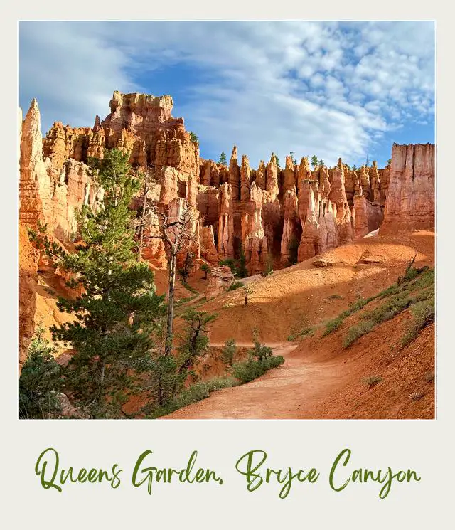
If you’re looking for easy Bryce Canyon hikes that go down into the canyon itself, then the Queen Garden trail is a great choice as it is the least strenuous hike into Bryce Amphitheater.
The Queen’s Garden trail goes from Sunrise Point to the Queen Victoria hoodoo.
The trail starts down a wide, not too steep trail with great views of the hoodoos and ridges in the canyon. After 0.5 miles, the trail heads down a series of switchback and then turns to the right, descending along a ridge. There are plenty of cool hoodoos here, and the path actually goes through three tunnels cut into sandstone fins that cross the trail.
As you near the bottom of the amphitheater, you enter a ponderosa pine forest that provides a bit of a respite from the heat.
At 0.9 miles, you’ll come to a side spur trail (0.1 miles round trip). This goes into the middle of in Queens Garden.
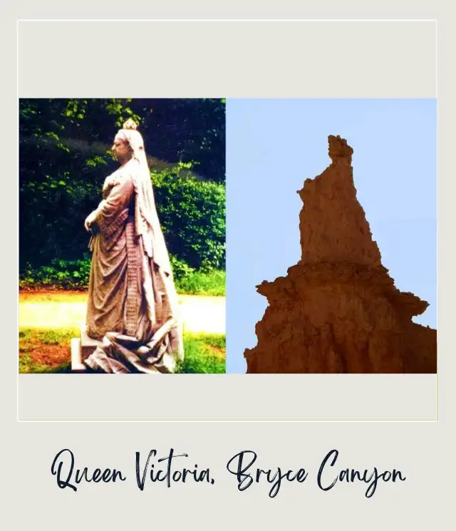
Bryce Canyon has several hoodoos named after what they supposedly look like, including the Queen Victoria hoodoo. Fortunately, there’s a small sign with a photo of Queen Victoria to help you identify the hoodoo. When you see the photo, it actually does look like Queen Victoria standing in profile on top of a pedestal.
Return the way you came, or add on the Navajo Loop (see Queens Garden-Navajo Loop Trail).
Insider Tips:
‼️ The Queens Garden Trail (Bryce Canyon) is an out and back hoodoos trail, but the views are different each way, so it will not seem like you are doing the same trail twice. However, if you are OK with some steep switchbacks, I recommend combining this with the Navajo Loop (Hike #3).
Highlights:
✳️ Queens Garden/ Queen Victoria
✳️ Hoodoos
9. Navajo Loop Trail, Bryce Canyon
Distance: 1.3 miles/ 2.2 km
Time: 1-2 hours
Rating: Moderate
Elevation change: 550 feet/ 168m
Trailhead: Navajo Loop Trailhead at Sunset Point
If you’ve heard of the iconic Wall Street hike (Bryce Canyon – The Narrows in Zion National Park also has a Wall Street section), this is the one.
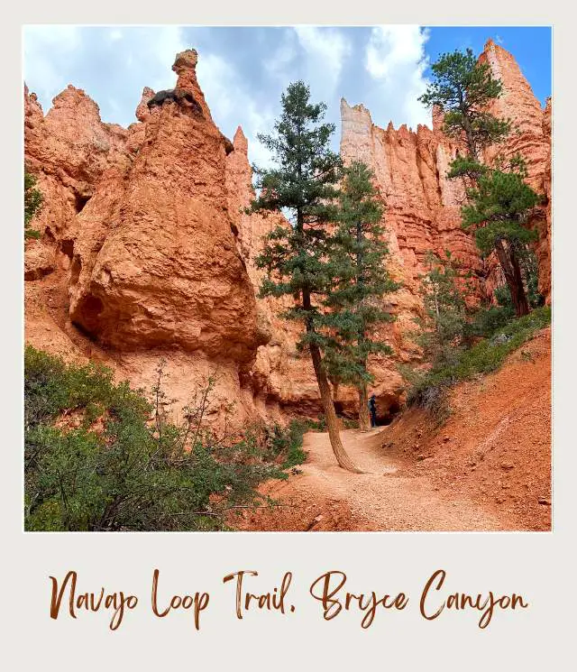
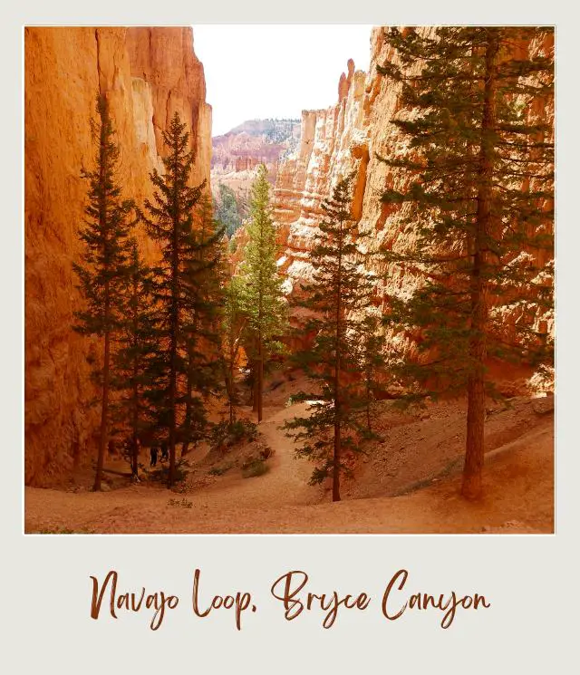
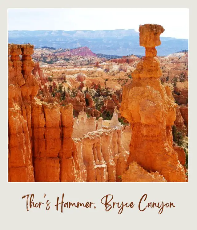
The trail is a tight loop that descends one narrow section with switchbacks between walls of colorful limestone and then ascends through another narrow section with switchbacks between walls of colorful limestone. Along the way, there are spectacular views of hoodoos, including perhaps the most famous hoodoo in the park (the world?), Thor’s Hammer.
Starting at Sunset Point and hiking clockwise, you’ll pass Thor’s Hammer before descending the switchbacks on the Two Bridges side of the loop.
There are wonderful views over towering Douglas-fir trees. Near the bottom, you’ll pass two narrow rock bridges wedged between cliff walls that give this side of the loop its name.
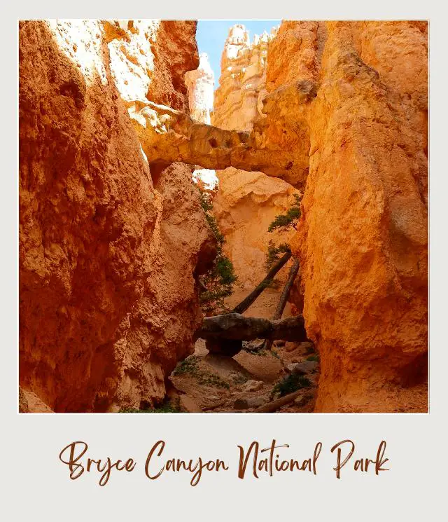
At the bottom of the canyon is a junction with the Queens Garden Trail to the left and the Wall Street side of the loop to the right.
The Wall Street switchbacks are even narrower, steeper and more dramatic than the Two Bridges ones.
Insider Tips:
‼️ The Wall Street side of Navajo Loop is closed in winter, so the whole loop is only possible in summer.
‼️ Most people tend to do the Navajo Loop in a counterclockwise direction (down Wall Street and up Two Bridges), but the national park service recommends doing it clockwise (down Two Bridges and up Wall Street) because it has better views and is safer that way.
‼️ The top section of the Two Bridges Trail (before the switchbacks) has the best view in the park of the famous Thor’s Hammer hoodoo.
Highlights:
✳️ Two Bridges
✳️ Wall Street switchbacks
✳️ Thor’s Hammer
➡️ Read my full Navajo Loop Trail Guide for more details
8. Queen’s Garden/ Navajo Loop, Trail Bryce Canyon
Distance: 2.9 miles/ 4.6 km
Time: 2-3 hours
Rating: Moderate – Strenuous
Elevation change: 550 feet/ 168m
Trailhead: Queens Garden Trailhead at Sunrise Point
The trail has a great combination of the open views and cool hoodoos on the Queen’s Garden Trail and the dramatic switchbacks on the Navajo Trail.
Start at Sunrise Point and take the Queen’s Garden Trail. See the Queens Garden Trail above for description.
After seeing Queen Victoria, head back to main trail then continue another 0.8 miles/ 1.3 km to a 4-way junction. If you hear horses, it’s because the horse trail passes near here. From here, one of the trails goes off the Peekaboo Trail (about 3 miles), another of Bryce National Park best hikes.
For this hike, you’ll hike back up one of the two sides of the Navajo Loop, which run roughly parallel to each other.
A hard right is the Two Bridges trail (0.6 miles/ 1 km) and the next right is the Wall Street section (0.7 miles/ 1.1 km). Most people choose to go up the Wall Street section when it’s open. This has the most dramatic switchbacks, although the Two Bridges trail has some steep and narrows switchbacks too.
The Wall Street section is a very narrow section between two sandstone walls that almost seem to touch each other. This is the more famous of the two sides of the Navajo Loop, but is only open in summer.
If you take the Two Bridges Trail, you’ll soon see sandstone twin bridges. Bryce Canyon is famous for hoodoos, but also has large sandstone fins that the hoodoos start from; cliff walls; and windows. So, it’s cool to see some of these other features.
The trail climbs some steep switchbacks and then there’s the best view in the park of Thor’s Hammer, the most famous hoodoo in the park.
You’ll arrive at the rim at Sunset Point. You can then take the Rim Trail from Sunset Point to Sunrise Point to complete the loop and get back to where you started.
Insider Tips:
‼️ Many people do this loop in a counterclockwise direction, because the steepest section is a descent, but the National Park Service recommends doing it in a clockwise direction (down Queens Garden and up Navajo Loop Trail) because it’s safer and the views are better. I did it this way, and I recommend it.
‼️ The Wall Street section is closed in winter, so Two Bridges is the only option then. If Wall Street is open, I recommend going up that.
‼️ If you climbed up Wall Street, when you get to the top of the rim at Sunset Point it’s worth going down the Two Bridges Trail just for a bit. This top section (before the Two Bridges switchbacks) has the best view of the famous Thor’s Hammer hoodoo.
‼️ The switchbacks are very steep, but if you stop to take lots of photos, you’ll have a chance to constantly catch your breath.
Highlights:
✳️ Queens Garden/ Queen Victoria
✳️ Two Bridges or Wall Street switchbacks
✳️ Thor’s Hammer
7. Rim Trail, Bryce Canyon
Distance: 5.5 miles each way from Fairyland Point to Bryce Point
Time: 3-5 hours
Rating: Moderate
Elevation change: 1,587 ft
Trailhead: Bryce Point and Fairyland Point (but you can hike part of the trail easily)
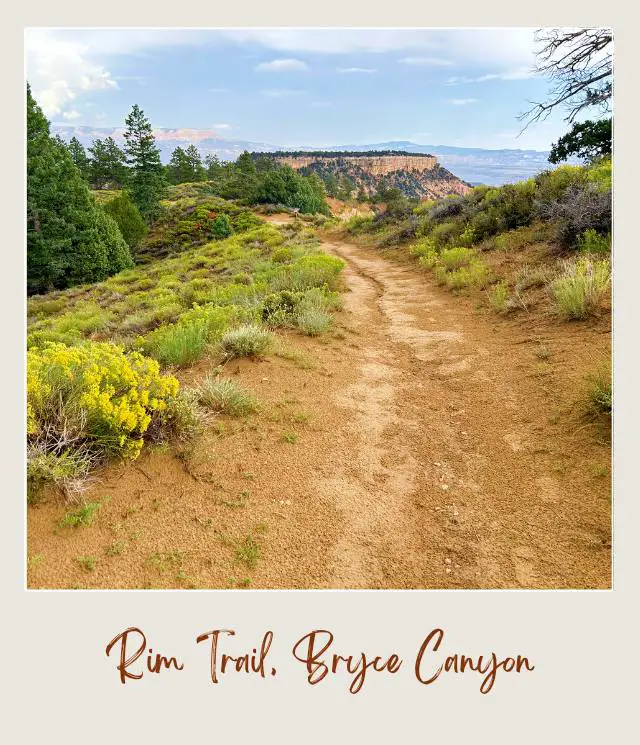
The Bryce Canyon Rim Trail is another Bryce Canyon must do hike. The most stunning views of Bryce Canyon are found here.
The Rim Trail extends along the rim of Bryce Amphitheater for 5.5 miles from Fairyland Point to Bryce Point. There are some sections with (fairly significant) elevation change.
It can be broken into sections connecting the best view points of the hoodoos from above.
📷 Bryce Point – Inspiration Point: 1.5 miles/ 2.4 km; closed in winter. Bryce Point has arguably the best views of the “Silent City”, as the main amphitheater of hoodoos is called. In addition to the hoodoos, you can see landscape features such as the Aquarius Plateau and the Sinking Ship.
📷 Inspiration Point – Sunset Point: 0.7 miles/ 1.2 km. The view from Inspiration Point is similar to Bryce Point, but the hoodoos are closer, so you can see more details.
📷 Sunset Point – Sunrise Point: 0.5 miles/ 0.8 km. This section is paved.
📷 Sunrise Point – Fairyland Point: 2.4 miles/ 4 km. There is significant elevation change on this section, but there are a lot fewer people around.
Insider Tips:
‼️ The section between Sunset Point and Sunrise Point is paved and mostly flat, so this is a good section to walk if you prefer easy hikes. Bryce Canyon National Park allows pets in this section (only).
‼️ If you don’t want to hike this trail both ways, if you have two vehicles, park one vehicle at each end and split your group in half, with half of your group hiking each way.
‼️ Alternatively, if the shuttle is running, you can start at Bryce Point and hike to Fairyland Point, then walk a mile or so down the paved Fairyland Road to the main road where you can flag down the shuttle. There is no shuttle stop, but shuttle buses will usually stop for you when you flag them down.
‼️ You could do this in reverse (ask the shuttle driver to drop you off at the Fairyland Road spur, walk along the paved road to Fairyland Point and then hike the Rim Trail from there to Bryce Point), but then you’ll hike the Rim Trail uphill rather than downhill.
Highlights:
✳️ Bryce Point
✳️ Inspiration Point
✳️ Sunset Point
✳️ Sunrise Point
✳️ Fairyland Point
6. Sunset Point to Sunrise Trail, Bryce Canyon
Distance: 0.55 miles/ 0.8 km each way (1.1. miles return)
Time: 30 minutes each way
Rating: Easy
Elevation change: 82 feet
Trailhead: Sunset Point | Sunrise Point (can be hiked in either direction)
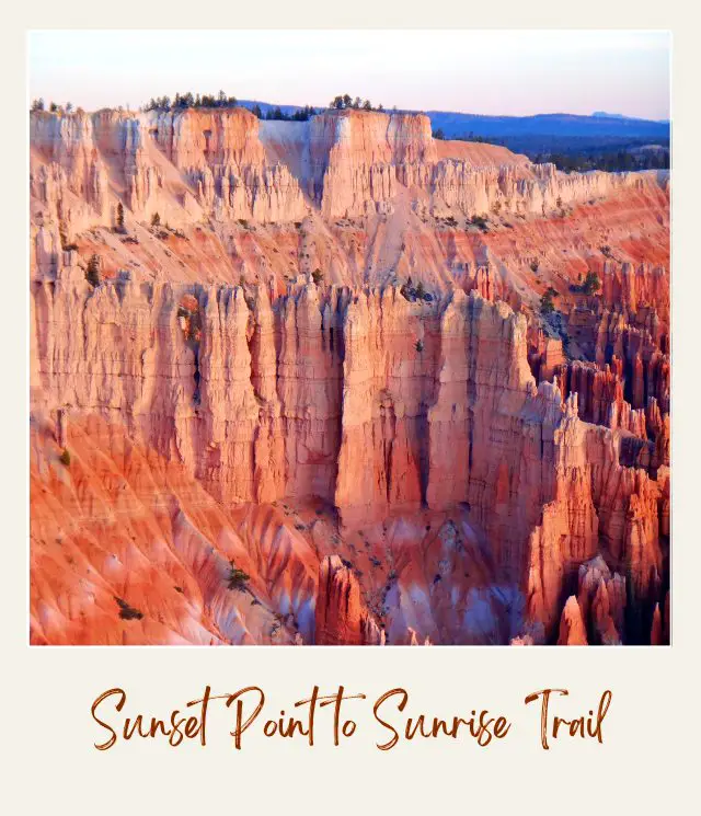
This is the easiest trail and is one of the best hikes in Bryce Canyon, because it connects two of the most iconic viewpoints in the park.
The trail is beautiful and there are spectacular views of the hoodoos that crowd Bryce Amphitheater at the two viewpoints. It’s a great trail if you have pets and/ or mobility concerns.
Insider Tips:
‼️ The trail is wheelchair accessible.
‼️ Try to visit at sunrise or sunset to see the best light on the hoodoos (and avoid the crowds).
‼️ Check the weather as hail and lightning storms are not uncommon in Bryce Canyon and walking on the rims can increase your risk.
Highlights:
✳️ Sunset Point
✳️ Sunrise Point
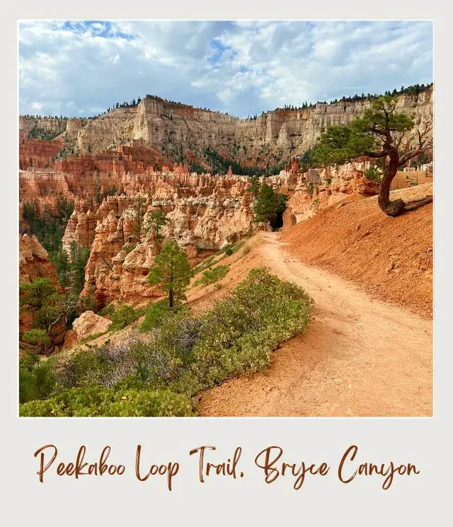
5. Peekaboo Loop, Trail Bryce Canyon
Distance: 5.2 miles
Time: 3-4 hours
Rating: Moderate–strenuous
Elevation change: 670 feet
Trailhead: Bryce Point
Another of the top Bryce Canyon hikes that goes down into the valley and through the hoodoos.
The trail descends from Bryce Point through some switchbacks into the canyon. There are expansive views of the canyon and loads of hoodoos in the early stages of the hike.
After a steep descent, the trail wanders along the canyon floor before climbing over a ridge to get to the start of the loop.
Hiking the loop through Peekaboo Canyon in a clockwise direction, you’ll soon pass a horse corral, watering trough and pit toilets (summer only). The trail passes directly beneath the Wall of Windows before climbing through a labyrinth of hoodoos and passing through a tunnel to the top of a ridge. The Cathedral will be on your right.
The trail then descends down some more switchbacks to the far end of the Peekaboo Loop and the junction with the Navajo Trail.
Continuing around the loop, the trail climbs out of Bryce Canyon to the top of ridge. You’ll see Boat Mesa and Fairy Castle Rock and have expansive views at the top of the ridge of hoodoos and fins in Peek-a-boo Canyon. The trail zig-zags down the ridge, goes through another tunnel and then crosses Peek-a-boo Canyon’s wash. You’ll then climb up Peek-a-boo Canyon for great views of the Wall of Windows and more hoodoos before connecting back to the trail up to Bryce Point.
Insider Tips:
‼️ The Peekaboo Loop is shared with horses, so be prepared for the sight and smell of horse manure.
‼️ This can be added to the Navajo Loop Trail from Sunset Point to form a mini-Figure Eight or Queens Garden from Sunrise Point to form the Figure Eight Trail (see below).
‼️ I recommend hiking this trail in a clockwise direction.
‼️ Take plenty of water, have sun protection, and wear bug spray in summer to fend off the gnats.
Highlights:
✳️ Bryce Point
✳️ Boat Mesa
✳️ Fairy Castle Rock
✳️ Wall of Windows
✳️ Peekaboo Canyon
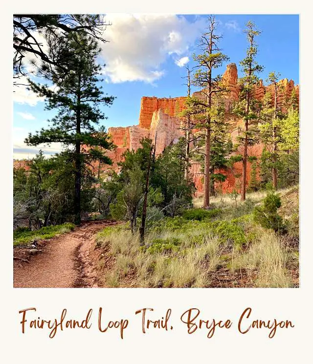
4. Fairyland Loop Trail, Bryce Canyon
Distance: 8.4 miles (5.7 miles in the canyon and 2.7 miles along the Rim Trail)
Time: 4-6 hours
Rating: Strenuous
Elevation change:1,558 feet
Trailhead: Sunrise Point or Fairyland Point
This hike takes you into Fairyland. The hoodoos here are younger and less fully formed than those in nearby Bryce Amphitheater, but they are no less spectacular. In fact, the hoodoos here have been described as “Queen’s Garden on steroids”.
The trail will let you see hoodoos up close from many different vantage points, and take you from twisted gray bristlecone trees to pinion pine forests.
The trail goes down into Fairyland Canyon and then loops back along the Rim Trail, so you can start at Fairyland Point (described here) or Sunrise Point.
From Fairyland Point, the trail descends into Fairyland Canyon. It circles wide around the base of Boat Mesa before leaving Fairyland Canyon. There are more beautiful views from the top of the ridge that separates Fairyland and Campbell Canyons.
After the trail descends into Campbell Canyon, a 200-yard side spur trail takes you to Tower Bridge, a large hoodoo flanked by two natural arches, set within the eroding fin of rock.
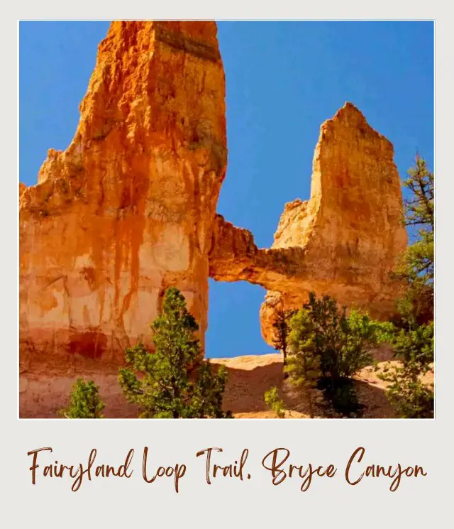
The next 0.5 miles is the steepest part of the trail, as it climbs back up to the rim. You’ll pass Chinese Wall, a tall line of hoodoos that sit in a row atop a small ridge, looking like they were built there intentionally. The trail continues to climb until you reach the rim near Sunrise Point.
Continue along the Rim Trail until you get back to Fairyland Point.
Insider Tips:
‼️ The short road to Fairyland Point is closed in winter, so you’ll need to start at Sunrise Point if you’re hiking in winter.
‼️ Doing the hike in the afternoon means it will be hot in summer, but the light will be behind you for most of the way, which is better for photos. The trail is well maintained and not used by horses.
‼️ If you don’t want to do the Rim Trail portion, (in summer) you could ask the shuttle driver to let you off at the Fairyland Road and walk about a mile along this paved spur road to Fairyland Point, then take the shuttle back when you get to Sunrise Point.
‼️ If you don’t want to drive but want to hike the full loop, you can take the shuttle to Sunrise Point and start from there. The disadvantage to this is that you start with the easier Rim Trail and end with the steepest section.
‼️ The parking lot at Fairyland Point is small, so if you plan to start there and want to drive, especially in the busy summer months, it’s best to get there early.
Highlights:
✳️ Beautiful hoodoos
✳️ Tower Bridge
✳️ Chinese Wall
✳️ Boat Mesa
✳️ Pinion pine forest
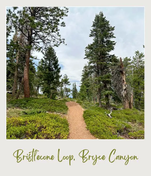
3. Bristlecone Loop, Bryce Canyon
Distance: 0.8-mile loop
Time:
Rating: Easy
Elevation change: Less than 200 feet / 60m elevation change
Trailhead: Rainbow Point
The last of my must do hikes in Bryce Canyon is this very easy hike from the end of the road at Rainbow Point or Yovimpa Point, which is on the other side of the parking lot. You’ll see a trailhead for this trail near the parking area.
It’s basically an easy, mostly flat stroll through bristlecone pines, blue spruce and fir trees, with occasional views of the canyon below. You’ll pass by Bristlecone Pines up to 1,800-years-old.
The forest is home to plenty of birds including cheeky ravens and Steller’s Jays, as well as squirrels and chipmunks. There’s a chance to see pronghorn antelope here too.
Insider Tips:
‼️ This is the highest part of the park (9,100 feet/ 2,775 m), so it can be cooler than the rest of the park and is often closed in winter and early spring because of the snow.
Highlights:
✳️ Bristlecone pine forest
✳️ Wildlife
2. Mossy Cave Trail, Bryce Canyon

Distance: 0.8 miles round trip (out and back)
Time: 30 – 60 minutes
Rating: Easy
Elevation change: 121 feet
Trailhead: Mossy Cave Trailhead, just off of SR-12
Mossy Cave is a quiet area of the park that most visitors don’t discover. It’s an easy 0.4-mile each way trail, suitable for most levels of fitness that’s one of the only hikes in Bryce Canyon National Park that begins with a climb and ends with a descent.
The trail goes past a few hoodoos and windows, so it gives you a chance to see some hoodoos up close without needing to hike below the rim of the main canyon.
Near the end, the trail it splits in two. To the right, a short trail goes into Water Canyon to a small but lovely waterfall. This ‘canyon’ is actually an irrigation ditch carved by Mormon pioneers in the early 1890’s. It is called the Tropic Ditch because it still feeds water to the town of Tropic.
The short trail to the left at the fork goes to Mossy Cave, a sheltered overhang with water often dripping from the top. The area is filled with mosses in the summer and icicles in the winter.
Insider Tips:
‼️ This area has become more popular in recent years and the parking lot is often full between 10:00 AM and 6:00 PM, so try to do this hike outside those hours.
‼️ Don’t park along the side of the road. It’s dangerous to walk along this road, and vehicles that park along the shoulder are often ticketed.
Highlights:
✳️ Water Canyon waterfall
✳️ Mossy cave
You may be thinking: “These hikes look fun, and I’d love to do them, but I’m not sure how to put them all together.” I hear this all the time.
Getting an idea of what to do is just a start. The tricky part is coordinating them all into an itinerary that actually makes sense – so you’re doing these hikes at the right time of day, joining them together with other activities in a logical order, and know how to get to the trailheads and where to go when you’re there.
To help take away the overwhelm of planning a trip to Bryce Canyon National Park, I’ve created super detailed itineraries.
There are 1-day and 2-day options: all with detailed hour-by-hour schedules, including alternatives for different activity and fitness levels, plus trail maps and descriptions, driving instructions, important information, essential tips, and everything else you need to make the most of your time in Bryce Canyon National Park.
Obviously, the more days you spend in Bryce Canyon, the more of these hikes you can do. If you follow the 2-day itinerary and you like to hike, you can do them all (though there are also options to just do some of them if you want to sample some of the hikes but not be TOO active.)
And if you have less time, the itineraries will help you make the most of the time you have available.
1. Figure Eight Trail, Bryce Canyon
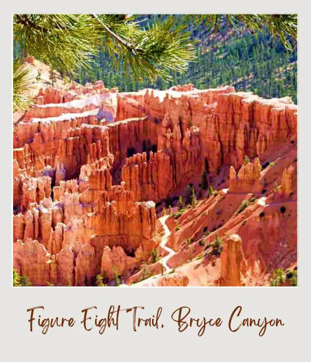
Distance: 6.4 miles
Time: 4-5 Hours
Rating: Strenuous
Elevation change: 670 feet
Trailhead: Sunrise Point
The Figure 8 hike combines the Queen’s Garden Trail, the Navajo Loop Trail, and the Peekaboo Trail all into one epic hike.
If you like to hike and have the energy, I highly recommend it, as it gives you a lot of time among the hoodoos.
The trail starts with the Queen’s Garden section. From Sunrise Point, you’ll head down a wide, not too steep trail with great views of the hoodoos and ridges in the canyon. The trail soon heads down a series of switchback, passing through three tunnels cut into sandstone fins that cross the trail.
The Queen’s Garden lies at the bottom of the canyon, home to the eponymous Queen Victoria hoodoo. After finding the hoodoo that (kind of) looks like Queen Victoria standing in profile on top of a pedestal, take the main trail along the floor of the canyon, through some pine tree and past more hoodoos.
Before long, you’ll come to the junction with the Peekaboo Trail in your left.
Hiking this loop in a clockwise direction, the trail climbs out of Bryce Canyon to the top of ridge where you can see Boat Mesa and Fairy Castle Rock and enjoy expansive views of hoodoos and fins in Peekaboo Canyon.
The trail then zig-zags down the ridge, goes through a tunnel and then crosses Peek-a-boo Canyon’s wash before climbing up Peekaboo Canyon for great views of the Wall of Windows and more hoodoos.
The trail passes directly beneath the Wall of Windows before climbing through a labyrinth of hoodoos and passing through another tunnel to the top of a ridge. You’ll soon see The Cathedral on your right.
The trail then descends some switchbacks to the end of the Peekaboo Loop. Turn left towards the Navajo Trail.
There are two different ways to do the Navajo Trail that run roughly parallel to each other. The first left is the Wall Street section. The next right is the Two Bridges trail.
Most people choose to go up the Wall Street section when it’s open, as this has the most dramatic switchbacks. However, the Two Bridges trail also has some steep and narrows switchbacks – and has the best view in the park of Thor’s Hammer.
You’ll arrive back at the rim at Sunset Point, where you can complete the loop along the Rim Trail to Sunrise Point or hop on a shuttle.
Insider Tips:
‼️ The Wall Street section is closed in winter, so Two Bridges is the only option then. If Wall Street is open, I recommend going up that.
‼️ The Peekaboo Loop is shared with horses.
‼️ When you get to the top of the rim at Sunset Point, if you climbed up Wall Street, it’s worth going down the Two Bridges Trail just for a bit. This top section (before the Two Bridges switchbacks) has the best view of the famous Thor’s Hammer hoodoo.
Highlights:
✳️ Queens Garden/ Queen Victoria
✳️ Wall of Windows
✳️ The Cathedral
✳️ Two Bridges or Wall Street switchbacks
✳️ Thor’s Hammer
Now that we’ve seen at the best hiking trails in Bryce Canyon, let’s take a quick look at some essential information about hiking in Bryce Canyon.
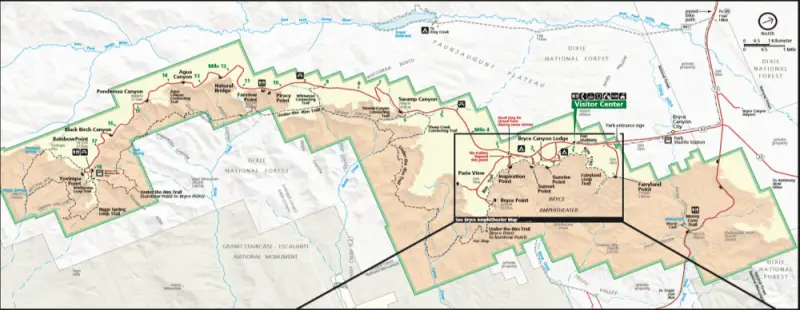
Map of Best Bryce Canyon National Park Hikes
This Bryce Canyon National Park map shows you where the best Bryce Canyon hikes are, but it’s not a detailed trail map.
For a proper Bryce Canyon map for hiking, it’s worth getting a National Geographic topographic Bryce Canyon trail map before you go.
What to Take/ Wear When Hiking Bryce Canyon National Park
In addition to finding the best hiking trail in Bryce Canyon, you may be wondering what to wear hiking in Bryce Canyon. Here are my top recommendations:
1. Hiking poles
Most of the best hikes in Bryce National Park are down into the canyon and therefore have some elevation change. Hiking poles can help stabilize you and make going up and downhill easier.
I used to think they weren’t necessary until I actually tried them and now I seldom hike without them. My favorite hiking poles are these Leki Jannu trekking poles. They’re lightweight, have shock absorbers, and have comfortable natural cork grips. You can read my detailed review here.
➡️ Check prices on Amazon here or on REI here
2. Sturdy hiking shoes or boots or sandals
You’ll want to wear good hiking boots or shoes for the best hiking. Bryce Canyon National Park has great trails, but most of them are down into the canyon. Good footwear is essential.
➡️ If you need to get some boots, take a look at my Guide to Buying the Best Hiking Shoes/ Boots to help you know what to look for and get some recommendations. My top pick is this pair of Salomon Gore-Tex boots.
3. Water
Always take more water than you think you’ll need. I love this hydroflask. It’s easy to carry, keeps temperatures well, and comes in multiple colors.
4. Binoculars
These aren’t essential, but there are often birds soaring overhead or wildlife in the distance. So, I like to take binoculars with me when I hike so I can see them up close.
➡️ If you’re looking for some, read my guide to The Best Binoculars for the Money or get my top pick here.
5. Sun hat, sunglasses and sun screen
Many of these hikes involve some (or a lot) of exposure to the sun, so be sure to wear sunscreen, a good sun hat and sunglasses.
6. Bug Spray
Bryce Canyon isn’t as buggy as some other national parks, but there can still be bugs and mosquitoes, etc., so insect repellent is a good idea. I prefer DEET-free insect repellent because it’s better for your skin and the environment.
➡️ If you need some, you can order some DEET-free bug spray here.
7. Camera
I love the GoPro HERO 12. It is designed for travel. It’s water resistant and durable, which is especially important when you might slip and the camera could end up wet.
➡️ Check current prices on the GoPro HERO 12 here
8. Day Hike Essentials
Check my list of essential things to take and wear on a day hike to make sure you have everything you need.
9. Microspikes (in winter)
If you’re hiking in winter or early spring, you will need good microspikes so that you don’t slip on icy trails.
➡️ Read my guide to The Best Microspikes for Hiking if you need to buy some or get my favorites, the Kahtoola Microspikes.
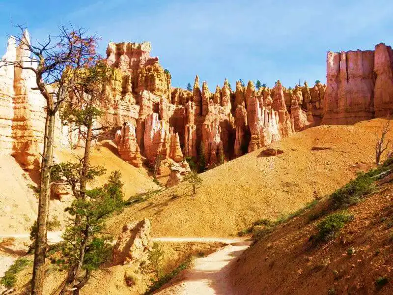
Tips for Bryce Canyon National Park Hiking
1. Get there early – or take the shuttle
July and August are the most crowded months, so try to get as early as possible to the hiking trails. Bryce Canyon National Park can get packed in summer especially and parking is limited.
If you don’t get a very early start, take the free shuttle to the Bryce Amphitheater area.
This isn’t possible for all the hikes, however, so getting an early start is essential for those trails especially.
2. Be sun sensible
There is little shade on some of the trails, so be sure to have a hat and sunglasses, and wear sunscreen.
3. Get maps
Before setting out, be sure to get maps for all the best hiking trails. Bryce Canyon trail maps can be downloaded or you can buy a detailed National Geographic topographic trail map here.
4. Take a handheld GPS
Most of these trails are well marked, but for peace of mind, especially for the longer trails, you can invest in a good quality handheld GPS for hiking (see reviews and recommendations here). Or get my top Garmin GPS right here.
5. Wear the right gear in winter
The best hiking trails Bryce Canyon has are often covered in snow and ice from November to March and possibly earlier/ later than that. Microspikes are essential at this time of year.

The Verdict: Best Bryce Canyon hiking trails
The Bryce Canyon National Park trails are all great. Seeing the hoodoos from above is breathtaking and the overall view of Bryce Canyon Amphitheater from above is spectacular.
However, hiking down into the amphitheater and being surrounded by the hoodoos is magical. I especially loved the Bryce Canyon Queens Garden – Navajo Loop Trail and walking through the hoodoos and seeing them up close.
It’s possible to do all or just one of the trails described above.
If you prefer to take it easy, the short walk between Sunset Point and Sunrise Point is not strenuous and gives incredible views of the hoodoos below.
If you like to hike, and have a moderate level of fitness, then the Queen’s Garden and/ or Navajo Loop Trails get my vote.
If you have even more time, the longer trails give more of the same experience. Leave time for a drive to rainbow Point and the easy Bristlecone Loop trail and all the lookouts on the way back to the main area.

What is a hoodoo?
So, you may have heard about Bryce Canyon hoodoos. It’s a cute word, right? But what is a hoodoo?
According to Wikipedia, a hoodoo is “a tall, thin spire of rock (with variable thickness) that protrudes from the bottom of an arid drainage basin or badland.” They are typically found in desert areas.
Overview of Bryce Canyon
You will first drive through Bryce Canyon City, then pass the turn off to Fairyland Point. A short distance further along is the main park entrance. You’ll soon get to the Visitor Center and Bryce Amphitheater. This is the main concentration of hoodoos and is where the lodge and the campgrounds are. A shuttle bus is available in this area.
A spur road off to the west goes to Bryce Point. The main road continues about 18 miles (about a 30-minute drive) to Rainbow Point, with many lookouts along the way.
Mossy Cave is reached on UT-12 in the opposite direction. There is no entrance station in this part of the national park.
That’s it. It’s a fairly small, self-contained park, but spectacular.
Read my Guide to the Bryce Canyon Scenic Drive for details about the 18-mile scenic drive.
Seeing the Bryce Canyon National Park hoodoos is an incredible sight, and your first view of the “Silent City”, as the main amphitheater is nicknamed, is truly awe-inspiring. Inspiration Point or Bryce Point are the best spots for this overview. Read my guide to the Best Viewpoints in Bryce Canyon to make sure you don’t miss any of the views.
However, hiking in Bryce National Park down among the hoodoos is the best way to experience the park and my favorite thing to do in the national park.
Bryce Canyon Best Hikes FAQs
Where is the best place to hike in Bryce Canyon National Park?
Although there are many incredible places throughout Bryce Canyon that are great for hiking, arguably the place to hike is Bryce Amphitheater. The Queens Garden and Navajo Loop Trails go into this section of the national park.
What is the longest trail in Bryce Canyon National Park?
The Under the Rim Trail is the longest trail in Bryce Canyon National Park. It is 23 miles each way.
What is the most popular hike at Bryce Canyon?
The most popular hike in Bryce Canyon is the Queens Garden – Navajo Loop Trail.
What’s the best hike in Bryce Canyon National Park?
The best trail in Bryce Canyon National Park is the popular Queens Garden – Navajo Loop Trail. The trail has a great combination of the open views and cool hoodoos on the Queen’s Garden Trail and the dramatic switchbacks on the Navajo Trail.
Is Bryce Canyon a hard hike?
The hikes that go down into the canyon are moderate or strenuous because of the elevation change. However, there are several easy trails available.
What are the easiest hikes in Bryce Canyon National Park?
There are several easy hikes in Bryce Canyon National Park. The easiest trails are:
– Rim Trail from Sunset Point to Sunrise Point
– Mossy Cave Trail
– Bristlecone Loop Trail
What is the best month to hike Bryce Canyon?
When is the best time of year for hiking at Bryce Canyon depends to some extent on what you like most.
The best month is September when the crowds have thinned, the temperatures have cooled, but it’s not too cold.
However, hiking in winter, with the right gear, has its own charm.
Is Bryce National Park worth visiting
Yes! There is no place on the planet like Bryce Canyon!
Where is the best place to stay when visiting Bryce Canyon
Where should I stay when visiting Bryce National Park?
Bryce Canyon Lodge is located inside the national park, near the rim. The other main option is Ruby’s Inn, just outside the park’s entrance.
What are the Bryce Canyon top hikes to do in winter?
The best Bryce Canyon hike in winter is the Queens Garden – Navajo Loop Trail.
The Wall Street side of the Navajo Loop is closed in winter but the Two Bridges side is open. It’s essential, though, to have microspikes so you can hike safely on the snow and ice.
Read my guide to The Best Microspikes for Hiking if you need to buy some or get my favorites, the Kahtoola Microspikes.
What are the most scenic hikes in Bryce Canyon National Park?
The most scenic hikes in Bruce Canyon include the Queens Garden Trail, the Peekaboo Loop and the Fairytale Loop Trail.
What is the Bryce Canyon switchback trail?
There are several Bryce Canyon switchbacks, but the most famous are on the Bryce Canyon Wall Street hike on the Navajo Loop Trail.
Where can you see the Bryce Canyon Queen Victoria hoodoo?
Head down to Queens Garden to see the famous hoodoo that looks like Queen Victoria.
Bryce Canyon Queens Garden Trail starts at Sunrise Point.
If you are planning to visit Bryce Canyon National Park by yourself, make your planning easy and stress free with a detailed itinerary. I have 1- and 2-day itineraries for Bryce Canyon National Park that include all the park highlights, give you choices based on your preferred activity level, and take all the stress out of planning your trip.
Travel Insurance for Bryce Canyon National Park
You should definitely have travel insurance whenever hiking any of these Bryce Canyon trails.
Good travel insurance will cover you for trip cancellation, theft or damage if your property when traveling, medical help if you have an accident while hiking the best trails in Acadia National Park or medical repatriation if you need to get medi-vaced out.
A great insurance option is Travelex. It has coverage for all you’ll need. You can compare Travel Insurance plans here or get a quote right now:
Enjoy hiking Bryce Canyon!
Additional Planning Resources for Bryce Canyon National Park
⭐ Planning a Trip to Bryce Canyon National Park: 7 Mistakes to Avoid
⭐ Best Things To Do In Bryce Canyon National Park
⭐ 10 Tips for Visiting Bryce Canyon National Park
⭐ The Bryce Canyon Scenic Drive: A Complete Guide
⭐ The 10 Best Bryce Canyon Viewpoints
⭐ How Long Do You Need in Bryce Canyon?
⭐ How To Get To Bryce Canyon National Park
⭐ What’s the Closest Airport To Bryce Canyon National Park
⭐ The Airports Near Bryce Canyon National Park
⭐ When Is The Best Time To Visit Bryce Canyon National Park?
⭐ Visiting Bryce Canyon National Park: What To Expect Throughout the Year
⭐ 10 Fun Facts About Bryce Canyon National Park
⭐ The 5 Best Easy Hikes in Bryce Canyon National Park
⭐ Navajo Loop Trail Bryce Canyon
⭐ Bryce Canyon Itinerary
What’s your favorite hike in Bryce Canyon? Do you have any other picks for the best hikes Bryce Canyon has? I’d love to hear them. Join my private Facebook group National Parks Collectors and comment and let me know.
Subscribe to daily national parks planning tips, travel inspiration and trip ideas and get instant access to the free PDF of this
Guide to the Best Hikes in Bryce Canyon National Park
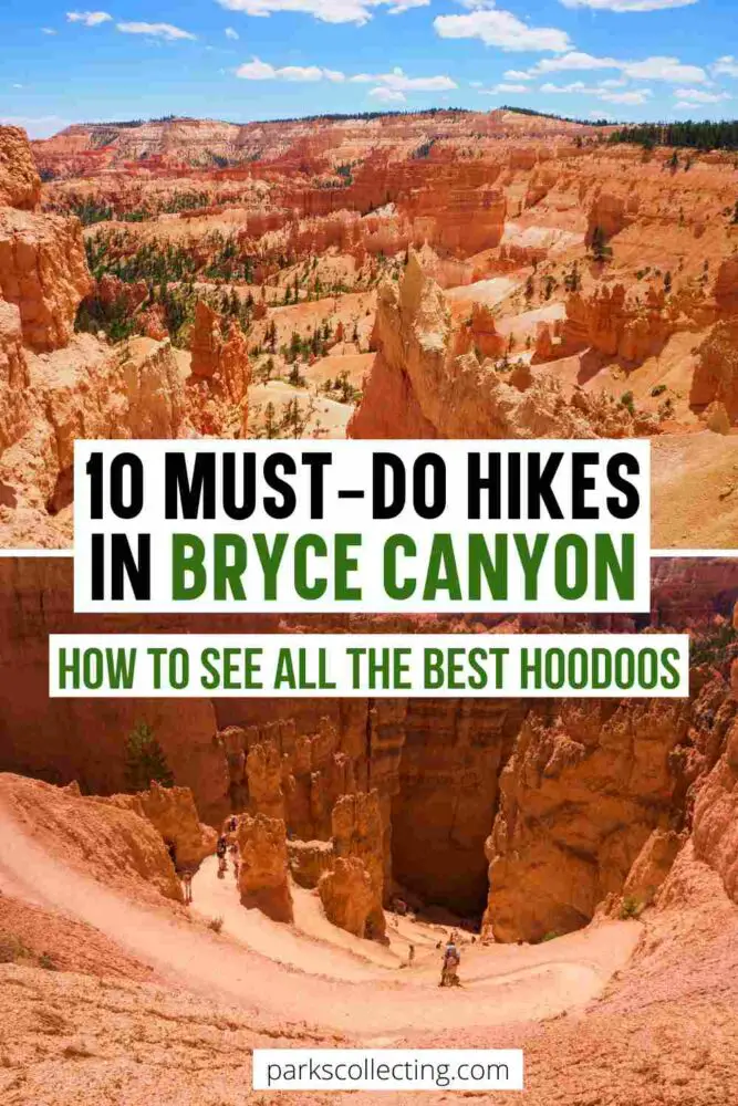
If you liked this article about the best Bryce Canyon hikes, Pin It to your Hikes or National Parks Boards!
💡 Are you just starting to think about taking a national parks trip? Get Inspiration
‼️ Are you looking for helpful tips for visiting US national parks? Read articles that share useful tips on a range of national-park related issues
💻 Are you starting to plan a trip to Bryce Canyon National Park? Read my Guide to Bryce Canyon National Park
📋 Do you want a ready-made super detailed plan for your trip to Bryce Canyon? Get a detailed 1 – 3-day Bryce Canyon National Park Itinerary
💲 Are you ready to book your trip? Use these Planning and Booking Resources
📖 Do you want to read a book about US national parks? Check out my Recommended Reading Lists
About the Author
James Ian is a national park, camping and hiking expert.
He has dedicated his life to travel, visiting more than 80 countries, all 7 continents and most of the national parks in the United States. With over 35 years experience in the travel industry, James has worked on cruise ships, at resorts and hotels, and as a travel planner who’s helped hundreds of people plan successful trips to US national parks.
Based on his experience visiting our national parks multiple times, in-depth research and expertise as a travel planner, James has published detailed itineraries for many of the major national parks in the US. These itineraries, as well as in-depth park guides, and other resources will help you have your own incredible trip to US national parks without stress and hassle.
As a national park expert, James has contributed to many publications, including USA Today, Newsweek, Time Business News, Savoteur, Best Trip, and Wired.
I’m a member of the Amazon Services LLC Associates Program. As an Amazon Associate I earn from qualifying purchases.
