
Looking for the best hikes in Mesa Verde National Park but not quite sure where to start? Mesa Verde is unlike any other park in the U.S. – here, the landscape and its history are intertwined. The trails lead you past ancient cliff dwellings, sweeping canyon views, archaeological sites, and quiet high-desert forests.
But with so many options, it can be hard to know which hikes are actually worth carving out time for.
This guide is best for first-time visitors, history lovers, and hikers who want to experience Mesa Verde’s natural beauty and its cultural significance without guessing which routes are worth the effort.
Whether you’re craving a short walk to a breathtaking overlook or a longer trek with archaeological surprises along the way, I’ve got hikes that match your style and timeframe.
One quick teaser: Petroglyph Point Trail offers one of the most exciting combinations of views, rock art, and canyon scenery in the entire park.
Let’s take a look at the hikes that will make your Mesa Verde visit unforgettable.
There are three main regions in the park, so, to make it easier, let’s break the hiking trails in Mesa Verde National Park down into each of those areas.
Table of Contents
Mesa Verde Hikes on Chapin Mesa
1. Petroglyph Point Trail
Distance: 2.4 miles | 3.9km
Difficulty: Moderate
Trailhead: Near the Chapin Mesa Archeological Museum
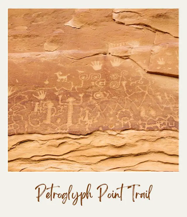
If you just have time for one hike in Mesa Verde, do the petroglyph trail. Mesa Verde is all about the history and the petroglyphs at the end of the trail are pretty amazing. Plus, it’s a fun trail to hike.
The trail starts near the museum along the same trail as the Spruce Canyon Trail, but you will soon come to a small sign indicating the Petroglyph trail. It skims along the side of a cliff, below the cliff edge, so you are often hiking under an overhang on a fairly narrow trail.
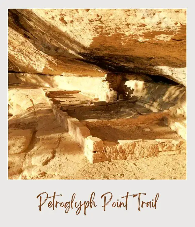
There are great views of Spruce and Navajo Canyons and you will pass the remnants of a small ancient dwelling. The petroglyphs are at the far end of the loop. They are quite extensive, well-signed posted and right next to the trail, so you can’t miss them.
In case you are wondering “What is a petroglyph?”, well, petroglyphs are rock carvings (as opposed to rock paintings, which are called pictographs). They are made by chiseling away some of a stone’s surface.
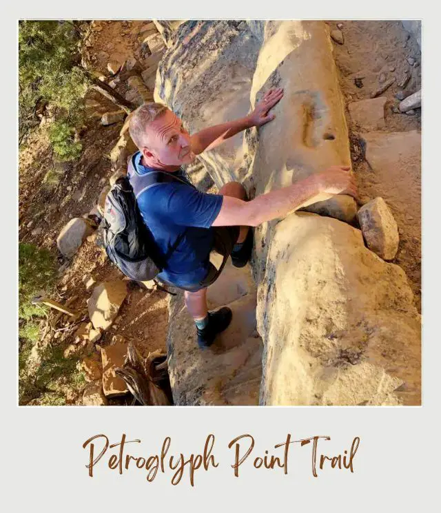
After the petroglyphs, there is a steep scramble up a large ‘staircase’ to the top of the mesa. The return loop is a fairly flat and easy walk along the mesa through the forest.
Insider Tip
‼️ In winter, the lower section of the loop is usually closed, but you can see the petroglyphs on an out-and-back route along the upper section.
Subscribe to daily national parks planning tips, travel inspiration and trip ideas and I’ll send you a free PDF of this Guide:
The 10 Best Mesa Verde Hikes Not to Miss
2. Spruce Canyon Trail
Distance: 2.4 miles | 3.9km
Difficulty: Moderate
Trailhead: Near the Chapin Mesa Archeological Museum
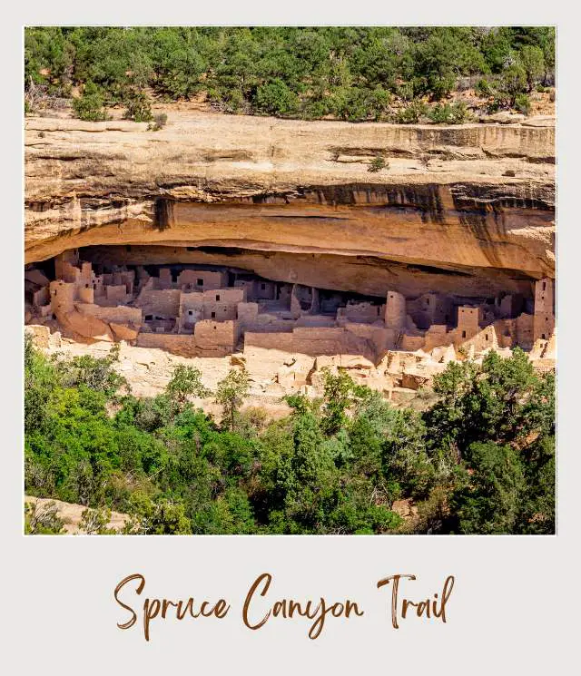
The trail begins near the Chapin Museum with wonderful views of Spruce Tree House. It soon diverges from the Petroglyph Trail and heads down a fairly steep set of switchbacks to the bottom of Spruce Canyon. From there, it follows along beside a (seasonal) stream for about 0.75 miles. It then starts back up more switchbacks for a steep climb out of the canyon, ending at the picnic area.
Insider Tip
‼️ You need to sign in with a ranger before setting out.
3. Soda Canyon Overlook Trail
Distance: 1.2 miles | 1.9km
Difficulty: Easy
Trailhead: One mile north of the Balcony House parking area along the Cliff Palace Loop Road
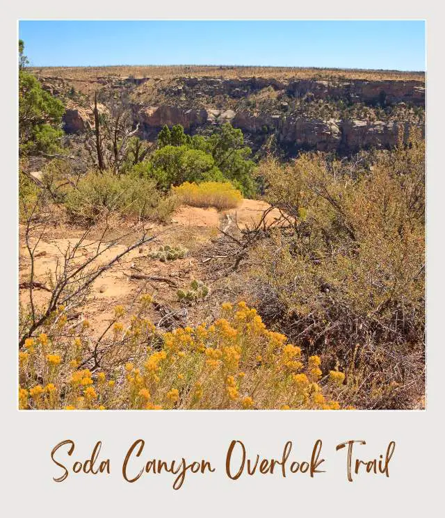
This is one of the park’s most popular hiking trails. Mesa Verde National Park has several super famous cliff dwelling and one of these, Balcony House, can be seen from the overlook. There are also views of the canyon from additional overlooks.
It’s an easy walk on a gravel path through juniper, yucca, sagebrush and gambel oak. None of which is shady, so wear a hat in summer!
Insider Tip
‼️ This is the only place to see the Balcony House (other than visiting it, when it is open).
4. Farming Terrace Trail
Distance: 0.5 mile | 0.8km
Difficulty: Easy
Trailhead: The spur road to Cedar Tree Tower
This is an easy loop on the top of the mesa around an area where the ancestral Puebloans farmed. You can see the check dams that they used to create farming terraces for their crops. You will also see the damage done to the forest from fires in the area.
Insider Tip
‼️ Did you know that check dams were a simple way to create terraces on sloping land by slowing the flow of water from melting snow so that soil built up behind each dam as the flow of water slowed down? Look out for them on the trail.
5. Park Point Overlook
Distance: 0.4 miles | 640 m
Difficulty: Easy
Trailhead: Parking area on the side of the road up to Chapin Mesa
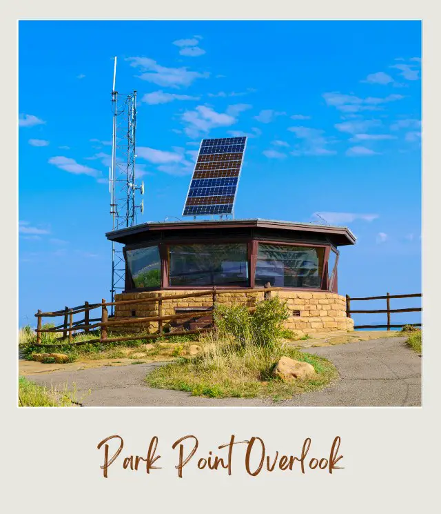
On the way up to Chapin Mesa, stop at the small parking area close to the top and walk to two amazing viewpoints and see a historic fire tower.
After a short distance, the paved path splits. To the left is Park Point North Overlook and the path to the right goes past the Park Point Fire Lookout to the south overlook. You will have 360° views of the surrounding area.
Insider Tip
‼️ Do not confuse this hike with Point Lookout (see below). They are completely different places inside the park.
Mesa Verde Hikes in the Morefield Area
6. Prater Ridge Trail
Distance: 7.8 miles | 12.6km
Difficulty: Moderate
Trailhead: The west end of Morefield Campground near the first dump station
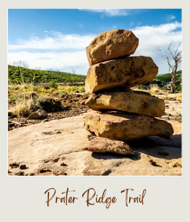
The trail starts with a steep ascent up to the top of Prater Ridge. Most of the trail circles in a big loop around the top of the ridge. There are lovely views of the surrounding canyon and the park road across the canyon heading up the mesa.
There is a trail that you can use to cut through and do just the north loop or the south loop if you want to shorten the trail. If you are there in the fall, this is a great place to appreciate the fall color.
Insider Tips
‼️ The views from the (longer) north loop are slightly better than from the south loop, though both are worthwhile.
‼️ There’s very little shade on the top of the ridge, so take lots of water and wear a hat!
7. Knife Edge Trail
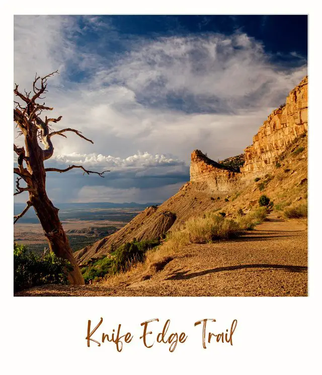
Distance: 2 miles | 3.2km
Difficulty: Easy
Trailhead: Near the facilities block on the Apache loop of Morefield Campground
This an easy trail along a section of the old Knife Edge Road, dating from 1914. Today it is an easy, mostly flat walk. To build the road on the side of the steep bluff was a whole other story. At the end are wonderful views of Montezuma Valley.
Insider Tip
‼️ This is a great place to go for the sunset.
8. Point Lookout Trail
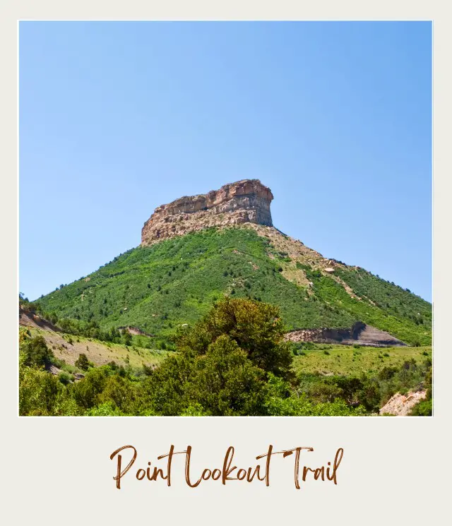
Distance: 2.2 miles | 3.5km
Difficulty: Moderate
Trailhead: The other end of the amphitheater parking area from the amphitheater/ restrooms
Not to be confused with Park Point, this trail goes up to Mesa Verde Point Lookout. The trail leaves from the Morefield campground and goes up a set of steep switchbacks for about 0.5 miles up the back side of the mesa. It then crosses along the top of the mesa to an end point with stunning views over the surrounding countryside, including both Montezuma and Mancos Valleys.
Insider Tip
‼️ In summer, wildflowers bring this area to life!
Mesa Verde Hikes on Wetherill Mesa
9. Nordenskiold Site No. 16 Trail
Distance: 2 miles | 3.2km
Difficulty: Easy
Trailhead: Wetherill Mesa information kiosk
This is a flat, easy, out-and-back trail that goes through the remnants of a badly burned forest. The gravel trail is easy to follow and ends at an overlook where you can see the Nordenskiold Site No. 16 cliff dwelling. It’s a quiet trail that is worth the walk to see the cliff dwelling.
Insider Tip:
‼️ Take lots of water and a hat; there is no shade.
10. Badger House Community Trail
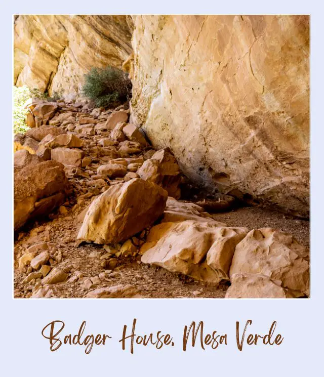
Distance: 2.25 miles | 3.6km
Difficulty: Easy
Trailhead: Wetherill Mesa information kiosk
This easy gravel and paved loop trail passes four historic sites of the Badger House Community on the mesa top. The area was occupied over a period of 600 years, so if you want to learn more about the history of this area, this is an interesting short hike.
Insider Tip:
‼️ There are signs explaining each of the site, so leave enough time to read them. The sites are much more interesting if you know what you are looking at 😉
Happy hiking!
More Planning Resources for Mesa Verde National Park
⭐ Mesa Verde National Park Guide
⭐ Planning A Trip to Mesa Verde National Park: 7 Mistakes to Avoid
⭐ How to Visit Mesa Verde National Park
⭐ How to Visit Mesa Verde Cliff Dwellings
⭐ 10 Tips For Visiting Mesa Verde National Park
⭐ The 10 Best Things to Do in & Around Mesa Verde National Park
⭐ Visiting Mesa Verde National Park: What To Expect Throughout the Year
⭐ How to Get to Mesa Verde National Park
⭐ Best Time To Visit Mesa Verde National Park
⭐ The Airports Near Mesa Verde National Park
⭐ The Closest Airport to Mesa Verde National Park
⭐ 10 Fun Facts About Mesa Verde National Park
⭐ The Best Airbnb Durango
Subscribe to daily national parks planning tips, travel inspiration and trip ideas and I’ll send you a free PDF of this Guide:
The 10 Best Mesa Verde Hikes Not to Miss
What’s your favorite hike in Mesa Verde National Park? Join my private Facebook group National Parks Collectors and comment and let me know.
If you liked this article, Pin It to your Mesa Verse National Park board!


💡 Are you just starting to think about taking a national parks trip? Get Inspiration
‼️ Are you looking for helpful tips for visiting US national parks? Read articles that share useful tips on a range of national-park related issues
💻 Are you starting to plan a trip to Mesa Verde National Park? Read my Guide to Mesa Verde National Park
🛏️ Are you looking for a place to stay near Mesa Verde National Park? Find a vacation rental near Mesa Verde National Park
💲 Are you ready to book your trip? Use these Planning and Booking Resources
📖 Do you want to read a book about US national parks? Check out my Recommended Reading Lists
About the Author
James Ian is a national park, camping and hiking expert.
He has dedicated his life to travel, visiting more than 80 countries, all 7 continents and most of the national parks in the United States. With over 35 years experience in the travel industry, James has worked on cruise ships, at resorts and hotels, and as a travel planner who’s helped hundreds of people plan successful trips to US national parks.
Based on his experience visiting our national parks multiple times, in-depth research and expertise as a travel planner, James has published detailed itineraries for many of the major national parks in the US. These itineraries, as well as in-depth park guides, and other resources will help you have your own incredible trip to US national parks without stress and hassle.
As a national park expert, James has contributed to many publications, including USA Today, Newsweek, Time Business News, Savoteur, Best Trip, and Wired.
I’m a member of the Amazon Services LLC Associates Program. As an Amazon Associate I earn from qualifying purchases.