If you are visiting Shenandoah National Park, you will become very familiar with the park’s mile markers. Whether you’re taking a Skyline Drive road trip, planning accommodations, deciding which overlooks to stop off, determining the best Skyline Drive entrances, or looking for hike trailheads, you will need to know where they are. And they way you will know this is by what mile marker they are on the Skyline Drive.
So, what are all the major locations along Skyline Drive and where are they in the park? That’s what this guide will tell you.
Subscribe to daily national parks planning tips, travel inspiration and trip ideas and get instant access to the free PDF of all the
Shenandoah Mile Markers
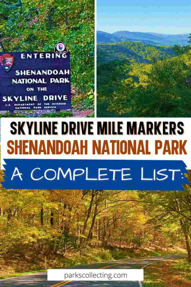
Want to save all of the main the Skyline Drive mile markers for later? Pin It!


🛏️TOP HOTEL NEAR FRONT ROYAL: Check availability now
🛏️TOP HOTEL NEAR LURAY: Check availability now
🛏️TOP HOTEL IN CHARLOTTESVILLE: Check availability now
🚘FIND THE CHEAPEST CAR RENTAL: Search Discover Cars for the best deals
✈️FIND THE CHEAPEST FLIGHTS: Search Skyscanner for the best deals
🧳GET TRAVEL INSURANCE: Get insured with Travelex before you go
📱TAKE AN AUDIO TOUR: Buy an audio tour now
Table of Contents
What is a Mile Marker?
The full Skyline Drive length is 105 miles. Every mile along the scenic road in Shenandoah National Park is marked with a small sign post. The posts are on the right as you head south or the left as you drive northwards. The numbers start at 0 the north entrance to Shenandoah and end at 105 at the south entrance.
All of the major points of interest are indicated by which mile they are along the length of the park on Skyline Drive.
➡️ READ MORE: Best Overlooks on Skyline Drive

The Mile Markers in Shenandoah National Park
Here are all the mile markers for the scenic overlooks, major trailheads, Skyline Drive restrooms, Skyline Drive parking areas, Shenandoah accommodations, park entrances, and other points of interest on Skyline Drive in Shenandoah National Park:
0.6 – Front Royal Entrance Station
2.8 – Shenandoah Valley Overlook – Elev. 1390
4.6 – Dickey Ridge Visitor Center & Picnic Grounds
5.5 – Signal Knob Overlook – Elev. 2090
6.8 – Gooney Run Overlook – Elev. 2085
7.3 – Gooney Manor Overlook – Elev. 1920
9.2 – Lands Run Parking
10.4 – Compton Gap
10.5 – Indian Run Overlook – Elev. 2400
12.4 – Jenkins Gap Overlook – Elev. 2355
13.7 – Hogwallow Flats Overlook – Elev. 2665
14.9 – Browntown Valley Overlook – Elev. 2890
15.9 – Mt. Marshall Parking
17.2 – Range View Overlook – Elev. 2810
17.6 – Gravel Springs Parking
18.4 – Gimlet Ridge Overlook – Elev. 2675
19.0 – Mount Marshall Overlook – Elev. 2850
19.4 – Keyser Run Parking
19.8 – Little Hogback Overlook – Elev. 3035
20.2 – Little Devil’s Stairs Overlook – Elev. 3120
21.0 – Hogback Overlook – Elev. 3385
21.1 – Overall Run (Tuscarora) Parking
21.6 – Rattlesnake Point Overlook – Elev. 3105
21.9 – Mathews Arm Campground
22.2 – Piney River Ranger Station
24.0 – Elkwallow Wayside & Picnic Area
26.4 – Jeremy’s Run Overlook – Elev. 2410
27.6 – Thornton Hollow Overlook – Elev. 2460
28.4 – Beahms Gap Overlook – Elev. 2485
30.1 – Pass Mountain Overlook – Elev. 2460
31.3 – Thorton Gap Entrance Station
31.4 – Panorama (Upper Parking)
32.0 – Mary’s Rock Tunnel
32.2 – Tunnel Parking and Overlook – Elev. 2840
32.8 – Buck Hollow Overlook – Elev. 2710
33.0 – Hazel Mountain Overlook – Elev. 2770
33.4 – Meadow Spring Parking
35.0 – Pinnacles Overlook – Elev. 3320
36.4 – Jewell Hollow Overlook – Elev. 3320
36.6 – Pinnacles Picnic Grounds
37.8 – Corbin Cabin Parking
38.5 – Stonyman Overlook – Elev. 3100
39.0 – Little Stonyman Trailhead
39.7 – Hemlock Springs Overlook – Elev. 3380
40.4 – Thorofare Mountain Overlook – Elev. 3595
41.7 – Skyland Resort Upper Loop (North Entrance)
42.4 – Whiteoak Canyon Parking
42.5 – Skyland Resort Lower Loop (South Entrance)
43.0 – Limberlost Parking
43.2 – Timber Hollow Overlook – Elev. 3360
44.0 – Crescent Rock Overlook – Elev. 3550
45.5 – Hawksbill Gap Trailhead
46.4 – Old Rag View Overlook – Elev. 3585
46.5 – Upper Hawksbill Trailhead
48.0 – Spitler Knoll Overlook – Elev. 3285
49.0 – Franklin Cliffs Overlook – Elev. 3285
49.3 – Fishers Gap Overlook – Elev. 3070
50.4 – Dark Hollow Falls Trailhead
51.2 – Big Meadows / Byrd Visitor Center
51.2 – Big Meadows Wayside
51.3 – Rapidan Fire Road Parking
51.4 – Parking for Lewis Falls Trail
51.5 – Tanners Ridge Overlook – Elev. 3465
52.4 – Milam Gap
52.9 – Naked Creek Overlook – Elev. 3250
54.5 – Hazeltop Ridge Overlook – Elev. 3265
54.8 – Bootens Gap Parking
55.3 – The Point Overlook – Elev. 3235
56.4 – Bearfence Trailhead
57.5 – Lewis Mountain Area (Cabins & Camping)
58.8 – The Oaks Overlook – Elev. 3125
60.9 – Baldface Mountain Overlook – Elev. 3325
62.4 – South River Overlook – Elev. 2950
63.0 – South River Picnic Area
64.1 – Hensley Hollow Overlook – Elev. 2560
64.9 – Hensley Ridge Parking
65.5 – Swift Run Gap Entrance Station
66.3 – Hightop Parking
67.2 – Swift Run Overlook – Elev. 2715
67.8 – Sandy Bottom Overlook – Elev. 2700
68.3 – Smith Roach Gap Parking
68.9 – Bacon Hollow Overlook – Elev. 2450
70.6 – Eaton Hollow Overlook – Elev. 2500
71.2 – Rocky Mount Overlook – Elev. 2450
72.2 – Beldor Hollow Overlook – Elev. 2345
72.8 – Simmons Gap Ranger Station
74.4 – Loft Mountain Overlook – Elev. 2450
75.2 – Pinefield Gap Parking
76.4 – Two Mile Run Overlook – Elev. 2770
76.9 – Brown Mountain Overlook – Elev. 2840
77.6 – Ivy Creek Overlook – Elev. 2885
78.2 – Rockytop Overlook – Elev. 2860
80.0 – Loft Mountain Wayside & Campground
80.8 – Big Run Overlook – Elev. 2860
81.1 – Doyles River Parking
81.2 – Big Run Parking
81.9 – Doyles River Overlook – Elev. 2870
82.6 – Browns Gap Parking
83.7 – Dundo Overlook – Elev. 2765
84.1 – Jones Run Parking
84.4 – Blackrock Area Parking
84.8 – Blackrock Summit
87.0 – Trayfoot Mountain Overlook – Elev. 2575
87.1 – Blackrock Gap Parking
88.2 – Horsehead Overlook – Elev. 2580
90.0 – Riprap Trail Parking
91.4 – Riprap Overlook Elev. 2920
92.0 – Moormans River Overlook – Elev. 2975
92.1 – Wildcat Ridge Parking
92.6 – Crimora Lake Overlook – Elev. 2975
93.7 – Turk Mountain Overlook – Elev. 2715
94.0 – Turk Gap Parking
95.3 – Sawmill Run Overlook – Elev. 2210
95.5 – Beagle Gap Parking
95.8 – Sawmill Ridge Overlook – Elev. 2210
96.4 – Jarman Gap Parking
98.9 – Calf Mountain Overlook – Elev. 2485
99.5 – Beagle Gap Overlook – Elev. 2490
102.5 – McCormick Gap Overlook – Elev. 2455
104.5 – Turnout/RFES Employee Parking
105.5 – Rockfish Gap Entrance Station

Skyline Drive Important Highlights
0.6 – Front Royal Entrance Station
The northern entrance to Skyline Drive and the official beginning of Skyline Drive. Access via routes 66 and 340.
4.6 Dickey Ridge Visitor Center & Picnic Grounds
Information, exhibits, store, ranger talks, restrooms, water, picnic area, access to Dickey Trail.
24.0 – Elkwallow Wayside & Picnic Area
Restrooms, picnic area, camp store and gifts, takeout food and snack bar, water, phone.
31.3 – Thorton Gap Entrance Station
Access via route 211
31.4 – Panorama
Information, restrooms, phone, access to Appalachian Trail and other hiking trails.
41.7 / 42.5 – Skyland Resort
Lodging, restaurant, bar/ taproom, giftshop, horseback riding, access to trails, restrooms, electric car charger, ranger-led programs, historic sites, conference room, phone.
51.2 – Big Meadows
Byrd Visitor Center, lodging, wayside café, restaurant, bar/ taproom, giftshop, National Park Service store, information, restrooms, ranger-led programs, access to trails, campground, phone, gas station, picnic area.
57.5 – Lewis Mountain Area
Rustic cabins, campground, picnic area, ranger-led programs, camp store, showers, phone, access to Appalachian Trail and other trails.
65.5 – Swift Run Gap Entrance Station
Access via route 33.
80.0 – Loft Mountain Wayside & Campground
Food, water, restrooms, gift store, campground, picnic area, ranger-led programs, seasonal information, laundry, showers, access to trails, trailer disposal station.
105.5 – Rockfish Gap Entrance Station
The southern entrance to Skyline Drive, the official beginning of Skyline Drive and the start of Blue Ridge Parkway. Access via routes 64 and 250.

More Planning Resources for Shenandoah National Park
⭐ Shenandoah National Park Guide
⭐ Planning A Trip to Shenandoah National Park: 7 Mistakes to Avoid
⭐ 25 Best Overlooks On Skyline Drive
⭐ 10 Tips For Visiting Shenandoah National Park
⭐ Best Things To Do in Shenandoah National Park
⭐ The Best Waterfalls in Shenandoah National Park
⭐ Best Hikes in Shenandoah National Park
⭐ How To Get to Shenandoah National Park
⭐ All The Airports Near Shenandoah National Park
⭐ The Closest Airport to Shenandoah National Park
⭐ Best Time to Visit Shenandoah National Park
⭐ Visiting Shenandoah National Park: What To Expect Throughout the Year
⭐ 10 Fun Facts About Shenandoah National Park
Have you been to Shenandoah National Park? What was your favorite stop on Skyline Drive? I’d love to hear your thoughts on the Skyline Drive best stops. Join my private Facebook group National Parks Collectors and comment and let me know (you can also pick up extra planning tips, share your photos and stories with other national park lovers and more).
Subscribe to daily national parks planning tips, travel inspiration and trip ideas and get instant access to the free PDF of all the
Shenandoah Mile Markers
If you found this list of all the main mile markers on Skyline Drive helpful, Pin It to your National Parks board!


💡 Are you just starting to think about taking a National Parks trip? Get Inspiration
‼️ Are you looking for helpful tips for visiting US national parks? Read articles that share useful tips on a range of national-park related issues
💻 Are you starting to plan a trip to Shenadoah National Park? Read my Guide to Shenandoah National Park
💲 Are you ready to book your trip? Use these Planning and Booking Resources
📖 Do you want to read a book about US national parks? Check out my Recommended Reading Lists
About the Author

James Ian is a national park, camping and hiking expert.
He has dedicated his life to travel, visiting more than 80 countries, all 7 continents and most of the national parks in the United States. With over 35 years experience in the travel industry, James has worked on cruise ships, at resorts and hotels, and as a travel planner who’s helped hundreds of people plan successful trips to US national parks.
Based on his experience visiting our national parks multiple times, in-depth research and expertise as a travel planner, James has published detailed itineraries for many of the major national parks in the US. These itineraries, as well as in-depth park guides, and other resources will help you have your own incredible trip to US national parks without stress and hassle.
As a national park expert, James has contributed to many publications, including USA Today, Newsweek, Time Business News, Savoteur, Best Trip, and Wired.
I’m a member of the Amazon Services LLC Associates Program. As an Amazon Associate I earn from qualifying purchases.
