Hiking the Bright Angel Trail, Grand Canyon. Sounds epic, right? But also a little intimidating?
A lot of people want to experience this iconic trail but aren’t sure how far to go, what to expect, or how to avoid overdoing it on the way back up.
I’ve hiked Bright Angel more than once – sometimes just to the first rest house, other times much farther down. And I’ve made a few mistakes along the way (underestimating the heat, not packing enough snacks, forgetting how tough the return climb is).
In this guide, I’ll share what I’ve learned so you can hike smarter, safer, and more confidently. This is for first-time Grand Canyon hikers who want to try one of the park’s most famous trails without overcommitting – or for anyone who’s curious about what makes this route so popular.
Want a teaser? Even just hiking to the 1.5-Mile Resthouse gives you incredible canyon views and a real sense of what it’s like to step below the rim.
Whether you’re doing a short out-and-back or heading down to Indian Garden, this guide to hiking the Bright Angel Trail will help you pick the right turnaround point, avoid common mistakes, and get the most out of this unforgettable experience.
Let’s map it out and find the hike that fits you best.
🛏️TOP HOTEL PICK: Check availability now
🚘FIND THE CHEAPEST CAR RENTAL: Search Discover Cars for the best deals
✈️FIND THE CHEAPEST FLIGHTS: Search Skyscanner for the best deals
🧳GET TRAVEL INSURANCE: Get insured with Travelex before you go
📱TAKE AN AUDIO TOUR: Buy an audio tour now
Table of Contents
Hiking the Bright Angel Trail, Grand Canyon
The Bright Angel Trail has been in use for thousands of years, first by the Havasupai people. It was given its current name by Ralph Henry Cameron in 1901. He built a hotel at the trail head, extended the trail all the way down to the Colorado River, and charged $1 (more than $26 in today’s money) to use the trail.
In 1928, the Bright Angel Trail became part of the national park. Today, it is the most popular of the Grand Canyon hikes below the rim.
Subscribe to daily national parks planning tips, travel inspiration and trip ideas and get instant access to the free PDF of this
Guide to Hiking the Bright Angel Trail
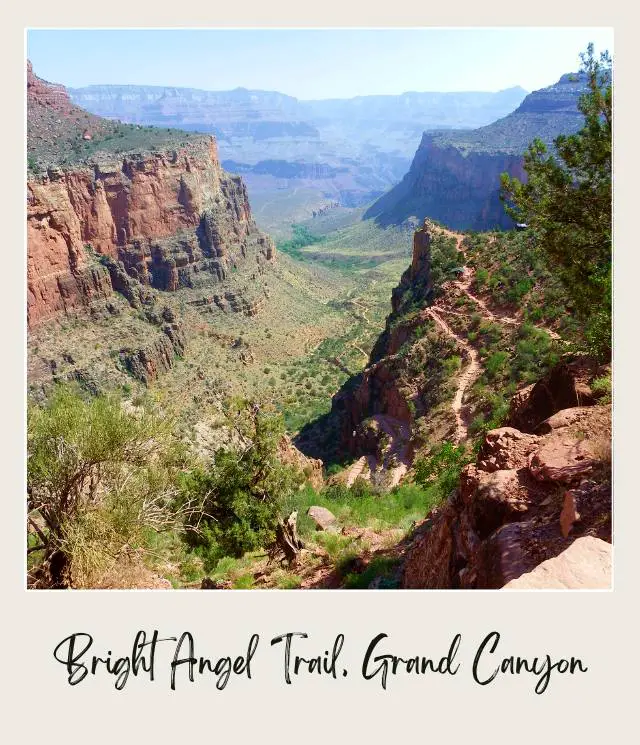
‼️ NOTE: I did the trail in reverse (from the bottom of the canyon up, because it was the end of my river rafting trip through the canyon), but I’ll describe it from its start at the Bright Angel Trail South Rim trailhead down to Phantom Ranch, since this is the way most people do it.
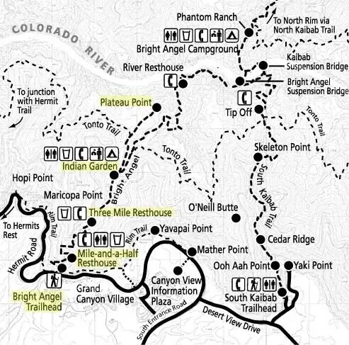
Bright Angel Trail Map
Guided Tours to Hike Bright Angel Trail
If you’d prefer to have a guide with you, there are a couple of options for hiking Bright Angel Trail with a guide:
Bright Angel Trail Guided Day Hike
Hike with a guide to any of the turnaround points, depending on your comfort and fitness level.
➡️ BOOK A GUIDED DAY HIKE ON BRIGHT ANGEL TRAIL HERE
3-Day South Kaibab – Bright Angel Trail Guided Hike
This 3-day guided trip includes the 2 main trails from the South Rim spread over three days. It starts with a transfer from Scottsdale before you head down below the rim on the South Kaibab trail to the bottom of the canyon.
The first night is spent camping at Bright Angel Campground. The second day includes a hike up the first half of the Bright Angel Trail, with a side trip to Plateau Point, camping at Indian Garden, half way up the trail. The third day is the second half of Bright Angel Trail and then a transfer ack to Scottsdale.
➡️ BOOK THIS AWESOME 3–DAY GUIDED RIM-TO-RIVER HIKE WITH CAMPING HERE
The Bright Angel Trail Description
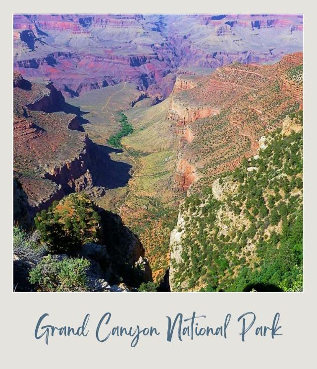
The views from the Grand Canyon’s South Rim are nothing short of spectacular. This is the only view that most people see, but experiencing the canyon from below the rim gives you a whole different perspective.
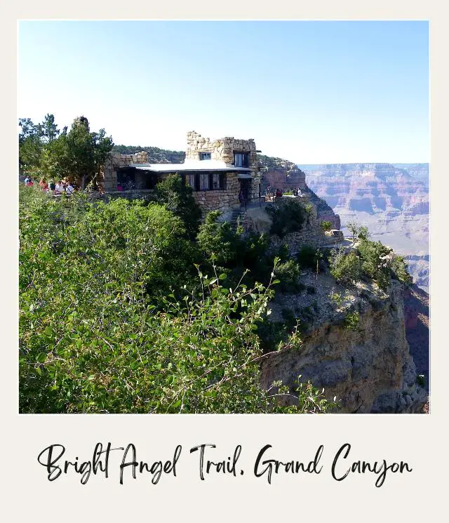
When you are at the rim, don’t miss visiting the small Kolb Studio Museum (one of the many things to do on the South Rim).
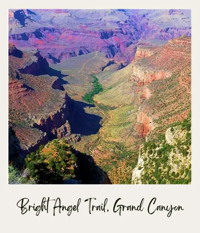
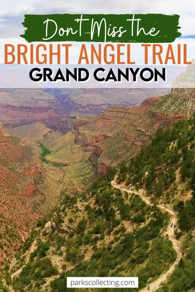
There are four major series of switchbacks on the Bright Angel Trail – three of them in the top half, above Havasupai Gardens (formerly called Indian Garden).
The Bright Angel Trailhead is just west of Bright Angel Lodge. Follow the path along rim and you’ll see the trail near the mule corral. Trailhead elevation: 6,850 feet/ 2,088 meters.
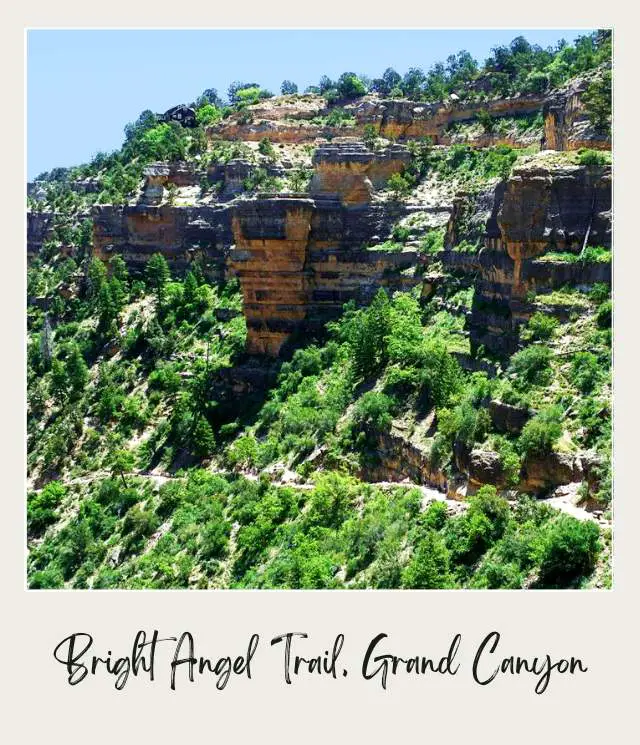
There are incredible views along the entire trail, and if you stop often to take photos, as I do, you won’t get too out of breath.
The first thing of note is a tunnel, just 0.18 miles/ 290 meters from the trail head. This part of the trail is not steep and if you just want to get feel for what it’s like to be in the canyon below the rim, then this is a good fairly easy walk. 1st Tunnel elevation: 6,708 feet/ 2,045 meters.
The path starts to get steep around 0.45 miles/ 725 meters into the hike, so if you have small children, this is a good turn-a-round point. Elevation: 6,560 feet/ 2,000 meters.
There is a second tunnel 0.75 miles/ 1.2 km into the hike. Second tunnel elevation: 6,240 feet/ 1,902 meters.
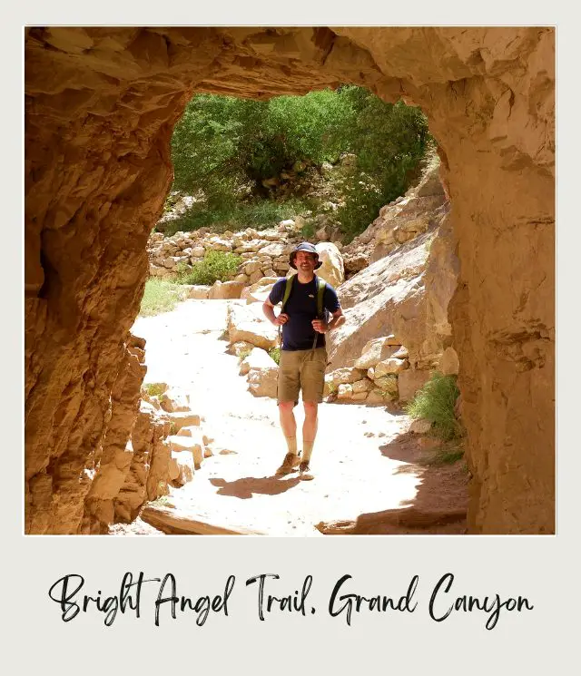
There are a four major steep switchbacks on the Bright Angel Trail. The first is after the second tunnel.
The next point of interest, 1.5 miles/ 2.4 km into the hike, is the 1.5 Mile Resthouse. There is water (seasonally; check with the national parks service before starting the hike), restrooms and an emergency phone here.
This is considered a good turn-a-round for casual hikers or if you got a late-start. 1.5 Mile Resthouse elevation: 5,729 feet/ 1,746 meters.

The switchbacks continue almost immediately – this is the second of the four major switchbacks. There is a sign at the 2-mile/ 3.2 km mark. The trail gets even steeper after that.
Then at the 3-mile/ 4.83 km mark, is the 3-Mile Resthouse. There is water (seasonally) and an emergency phone, but no restrooms. Many people turn around here. 3-Mile Resthouse elevation: 4,748 feet/ 1.447 meters.
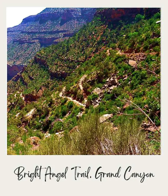
The third series of switchbacks is between 3 Mile Resthouse and Havasupai Gardens. Take it slow.
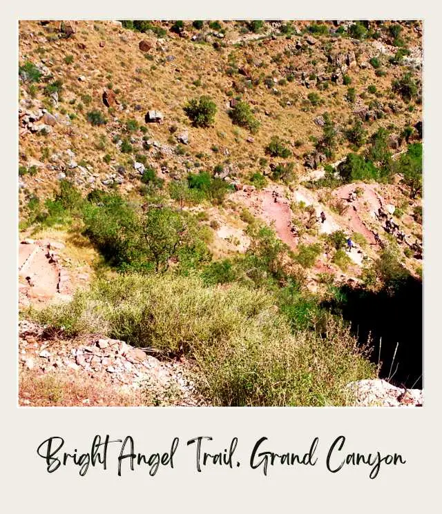
Havasupai Gardens (formerly Indian Garden) is the half-way point on the trail is. This is 4.5 miles/ 7.24 km from the start.
⚠️ This is the point that the national parks service warn day hikers not to go past, especially in summer.
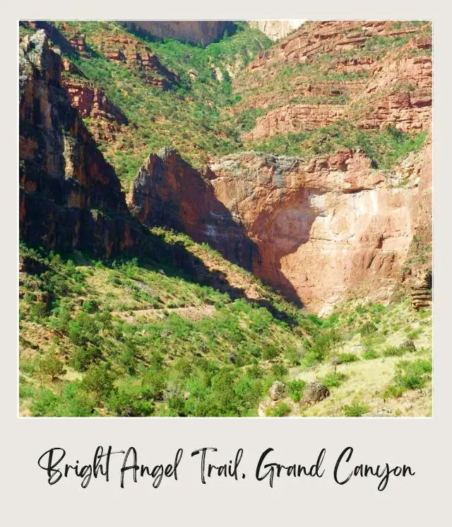
It’s a shady spot that makes a nice respite and place for a picnic lunch. There are picnic tables, water year-round from a natural spring, restrooms and an emergency phone. There is also a campsite here.
There are some remains of ancient structures built by Puebloan and Cohoninas native Americans, who had a garden (called Ha’a Gyoh) here – hence the name. To be honest, I didn’t see these. Havasupai Gardens elevation: 3,800 feet/ 1,183 meters.
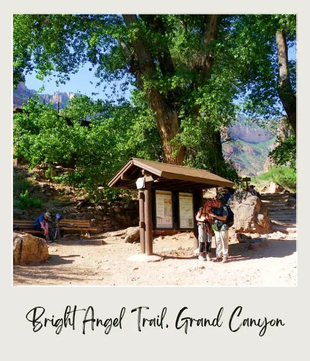
From Havasupai Gardens, a side trail (Plateau Point Trail) goes another almost 2 miles each way to Plateau Point. It is possible, though not advised, to do this as a day hike from the south rim IF you are VERY fit, have lots of water and leave very early. From the start to Plateau Point is 6.4 miles/ 10.3 km.
I didn’t do this side trail, but the region of the canyon here is Granite Gorge, which has the oldest rocks in the Grand Canyon. It is narrow, so the water is fast and the view of the Colorado River and the canyon is, by all accounts, spectacular. There is water available seasonally only and there is no shade. Plateau Point elevation: 3,740 feet/ 1,140 meters.
From Havasupai Gardens down to the Colorado River is another 3.5 miles/ 5.6 km. I was hiking up and found this stretch pretty easy. This section, the last of the four major switchbacks, is called Old Devil’s Corkscrew, but most of the trail has been rerouted and the switchbacks are not as severe as the original name would have you expect.
River Resthouse is the spot where the trail meets the river, and is the official end of the Bright Angel Trail. This is 8 miles/ 12.8 km from the start of the trail. There is an emergency phone only here. River Resthouse elevation: 2,480 feet/ 756 meters.
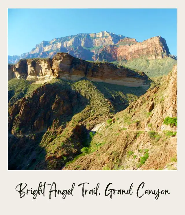
However, if you have come this far, you presumably do not plan to go back in the same day, so you will continue to the campsite or cabins. From here, it is technically the River Trail, and it is basically flat. This part of the trail is pretty sandy, which makes hiking a little harder, despite the fact that it’s flat.
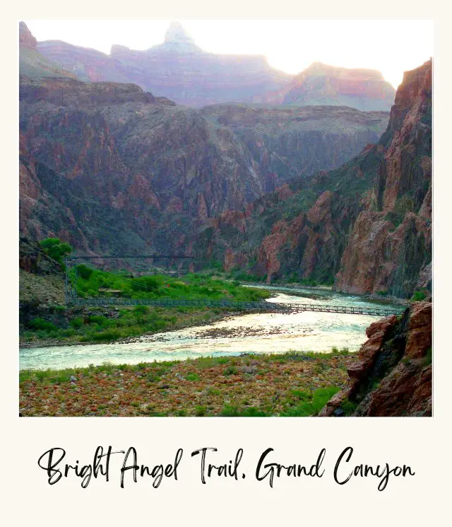
The Bright Angel Suspension Bridge (Silver Bridge) is 9.2 miles/ 14.8 km from the Bright Angel Trailhead. It’s a narrow suspension bridge that crosses the Colorado River. Bright Angel Suspension Bridge elevation: 2,460 feet/ 750 meters.
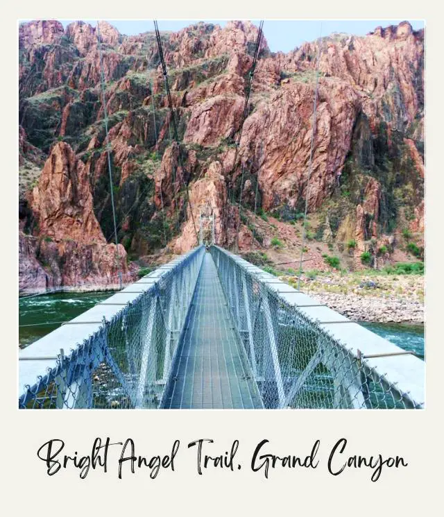
Next along the River Trail is the Bright Angel Campground, 9.5 miles/ 15.3 km from the start. Bright Angel Campground elevation: 2,480 feet/ 756 meters
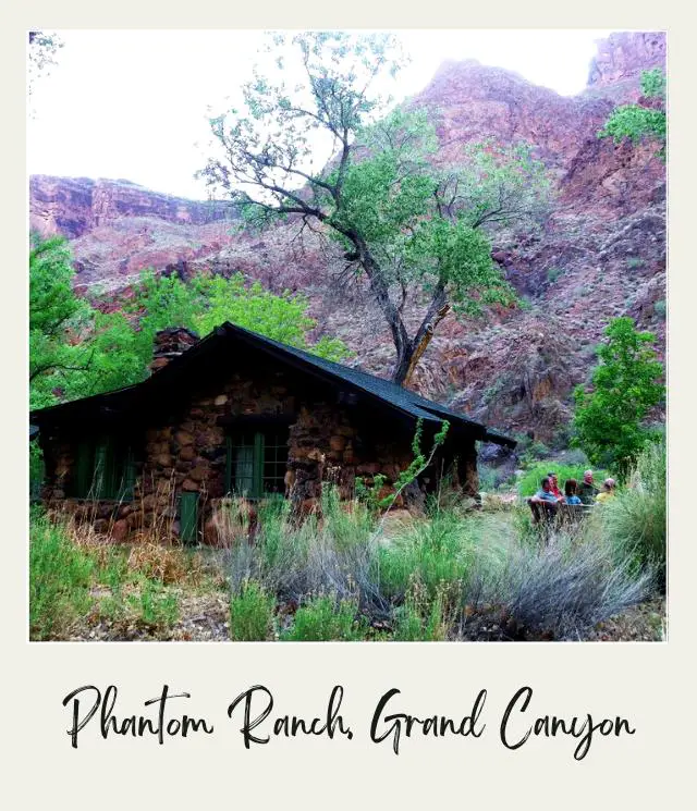
Finally, you will get to Phantom Ranch where there are cabins, a basic restaurant and shop.
Total Bright Angel Trail length
⭐ Bright Angel Trail is 9.9 miles/ 15.9 km from the start
⭐ Phantom Ranch elevation: 2,460 feet / 750 meters
⭐ Total elevation change: 4,390 feet/ 1,338 meters
Total Bright Angel Trail hiking time
We were hiking up and out, so we set off from Phantom Ranch about 5:30am, after a 5:00am breakfast.
How long does it take to hike the Bright Angel Trail? Officially, the average time is 5-6 hours. It usually takes longer going up – often as much as double the time it takes to go down. We hiked up and took our time, taking lots of photos along the way. The first half to Havasupai Gardens took us about 3 hours, where we stopped for lunch. The total hike took us just under 6.5 hours.
How Difficult is Bright Angel Trail?
This is a strenuous trail, but the good thing is that you can do part of it only and it would still be incredible. As the national park signs say – going down is optional; going up is not.
Most of the other people who had been on our Colorado River trip took less time than us, though a couple took longer. I figured there was no rush – it was a pleasure and privilege to be inside the Grand Canyon. I was moderately fit and with frequent stops, was not in bad shape at the end, though the last mile was tough and I was ready to be there.
Some who rushed a lot more than we did were in pretty bad shape at the end. Others who were fitter than us felt totally fine. So, I would recommend having at least a moderate level of fitness if you plan to do the whole hike.
The Bright Angel hike is definitely one of the world’s must do hikes. Being surrounded by the Grand Canyon is a completely different experience from seeing it from above.
Three options for hiking the Bright Angel Trail, Grand Canyon National Park
The Bright Angel Trail is the most famous of the Grand Canyon trails and the most popular route for hiking down the Grand Canyon from the South Rim to the Colorado River. The other Grand Canyon hike to the bottom from the South Rim is the South Kaibab trail. Either of these trails can then be combined with the North Kaibab Trail to from the Rim to Rim hike.
However, hiking the Bright Angel Trail to Phantom Ranch or the Bright Angel Campground at the bottom of the canyon is the most popular hike in the Grand Canyon.
As mentioned earlier, you should not attempt to hike the Bright Angel Trail in one day from the rim to the river and back, especially in the summer. There are a few different options:
1. Take a river trip down the canyon
They either start at the beginning of the canyon and end at Phantom Ranch, in which case you will end up hiking up the Bright Angel Trail as I did, or they start at Phantom Ranch, in which case you will be doing this Grand Canyon hike from the rim to the bottom.
Either option means you do the whole hike once only. This is what I did, and it meant that I got to overnight in Phantom Ranch without needing to try and get a reservation (the boat company did that for me), and I hiked up. Many people prefer hiking down, but I find that hurts my knees, so I would rather take my time and hike up. Plus, when you hike down, you don’t get to stay at Phantom Ranch, which I enjoyed.
Another bonus – our luggage was carried up by mule, so we only carried our day pack with water, lunch and sunscreen. This duffel service can be booked with your Phantom Ranch reservation and currently costs $70 each way.
Note, you can also ride a mule to Phantom Ranch instead of hiking. Unless you are used to riding horses (or mules), I do NOT recommend this. I did a mule ride at the top of the canyon only, and after an hour, I was in so much pain I would have done anything to get off. Hiking is MUCH better!
2. Hike down the Bright Angel Trail to Phantom Ranch/ the Bright Angel Campground and overnight at one of these options
Then hiking up the Bright Angel Trail the next day. Or hiking down or up the South Kaibab Trail to mix it up. You can also do it as part of the Rim to Rim trail, ending up (or starting from) the North Rim on the North Kaibab Trail.
If you go all the way down, you WILL need to overnight on the canyon. Phantom Ranch is extremely popular and there is a lottery system to get a reservation.
➡️ Read my Guide to How Make a Reservation for Phantom Ranch here.
Note that it can take twice as long to hike up as it did to hike down. If you are camping, you can also overnight at the Indian Garden campground on the way down and/ or up.
3. Hike part of the trail only
It’s not necessary to hike to the whole trail, and if you can’t or don’t want to get a reservation at the bottom of the canyon or take a river trip, this will be your only option.
Taking the Bright Angel Trail to Havasupai Gardens, which is half-way down, is the furthest recommended for a one-day hike.
If you are looking for something less intensive, but still challenging, the hike to the Three Mile Resthouse (a descent of about 2,100 feet/ 640 meters) is a good option. If you just want a more relaxing (but still a workout!) hike, then turning back at the 1.5 Mile Resthouse is the way to go.
Note that the trail is shared by mules. We only passed one mule train when we did the hike in May, but you may encounter more. Stay well away from the mules as they pass. Some people complain of the mule dung – I didn’t notice this as an issue, but don’t be surprised by it.
Learning all about the Bright Angel Trail is a great thing to do, because it will make the hike so much easier and more enjoyable.
However, it’s just one of the many amazing hikes in Grand Canyon National Park. It can be really difficult to know what they all are and how to put them all together for your trip.
As you can see, there’s a lot to know about this one hike alone. It’s even harder to coordinate all the other hikes you want to do and all the other things to see and do at the South Rim into an itinerary that actually makes sense – so you’re doing the hikes and activities you want to do and seeing all the views you want to at the right time of day, joining them all together in a logical order, and managing all the logistics that makes them happen.
To help take away the overwhelm of planning a trip to Grand Canyon National Park, I’ve created several super detailed itineraries.
There are 1-, 2-, and 3- day options for the South Rim: all with detailed hour-by-hour schedules, including alternatives for different activity and fitness levels, plus trail maps and descriptions, driving instructions, important information, essential tips, and everything else you need to make the most of your time in Grand Canyon National Park. I also offer a more basic itinerary for the North Rim.
The itineraries will help you make the most of whatever time you have available. The day hike version of the Bright Angel Trail (to various turning-around points) is included in the 2- and 3-day itineraries. And there are options built in for people you’re traveling with who prefer not to hike. If you want to hike all the way down to Phantom Ranch, then I’d recommend the 3-day itinerary but add an extra couple of days to your trip.
Packing for Grand Canyon hiking
➡️ When you are ready for your trip, check out my Essential Packing List for general ideas and my Packing List for Hiking.
Enjoy the hike!
When you’re up at the South Rim, check out 30 Top Things To Do on Grand Canyon’s South Rim for ideas on what to do.
If you are planning to visit Grand Canyon National Park by yourself, make your planning easy and stress free with a detailed itinerary. I have 1-, 2- and 3-day Deluxe Itineraries for the South Rim and a 1-2-Day Basic Itinerary for the North Rim that include all the park highlights, give you choices based on your preferred activity level, and take all the stress out of planning your trip
Additional Planning Resources for Grand Canyon National Park
⭐ Grand Canyon Guide
⭐ Grand Canyon South Rim Deluxe Itinerary
⭐ Grand Canyon North Rim Basic Itinerary
⭐ Planning A Trip to Grand Canyon National Park
⭐ How Long to Stay in Grand Canyon National Park
⭐ White Water Rafting In The Grand Canyon
⭐ Best Things To Do In Grand Canyon (South Rim)
⭐ Best Grand Canyon Viewpoints
⭐ Top Tips for Visiting Grand Canyon National Park
⭐ How To Get To Grand Canyon National Park
⭐ The Best Airports Near The Grand Canyon
⭐ Reservations For Phantom Ranch, Grand Canyon
⭐ The Airport Nearest Grand Canyon National Park
⭐ Best Time to Visit Grand Canyon National Park
⭐ Visiting Grand Canyon National Park Throughout the Year
⭐ Best Books about the Grand Canyon
⭐ Vacation Rentals In and Near Grand Canyon National Park
⭐ Vacation rentals in Flagstaff
⭐ Vacation rentals in Sedona
⭐ 12 Fun Facts About the Grand Canyon
⭐ 5 Best Easy Hikes in Grand Canyon National Park
⭐ 15 Best Things to Do in Grand Canyon for Non Hikers
Do you have any tips for hiking the Bright Angel Trail? I’d love to hear them. Join my private Facebook group National Parks Collectors and comment and let me know.
Subscribe to daily national parks planning tips, travel inspiration and trip ideas and get instant access to the free PDF of this
Guide to Hiking the Bright Angel Trail
If you liked this article, Pin It to your Grand Canyon and Hikes boards for later!
💡Are you just starting to think about taking a national parks trip? Get Inspiration
‼️ Are you looking for helpful tips for visiting US national parks? Read articles that share useful tips on a range of national-park related issues
💻 Are you starting to plan a trip to Grand Canyon National Park? Read my Guide to Grand Canyon National Park
📋 Do you want a ready-made super detailed plan for your trip to the Grand Canyon? Get a Deluxe 1 – 3-day South Rim Itinerary and Get a Basic 1-2-day North Rim Itinerary
🛏️ Are you looking for a place to stay near Grand Canyon National Park? Find a vacation rental near Grand Canyon National Park
💲 Are you ready to book your trip? Use these Planning and Booking Resources
📖 Do you want to read a book about Grand Canyon National Park? Check out my Recommended Reading List for Grand Canyon National Park
About the Author
James Ian is a national park, camping and hiking expert.
He has dedicated his life to travel, visiting more than 80 countries, all 7 continents and most of the national parks in the United States. With over 35 years experience in the travel industry, James has worked on cruise ships, at resorts and hotels, and as a travel planner who’s helped hundreds of people plan successful trips to US national parks.
Based on his experience visiting our national parks multiple times, in-depth research and expertise as a travel planner, James has published detailed itineraries for many of the major national parks in the US. These itineraries, as well as in-depth park guides, and other resources will help you have your own incredible trip to US national parks without stress and hassle.
As a national park expert, James has contributed to many publications, including USA Today, Newsweek, Time Business News, Savoteur, Best Trip, and Wired.
I’m a member of the Amazon Services LLC Associates Program. As an Amazon Associate I earn from qualifying purchases.
